Subject: Northeastern United States & Canada
Period: 1855-79 (circa)
Publication:
Color: Hand Color
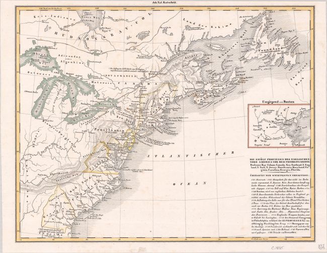
A. Die Zwolf Provinzen des Englischen Nord America vor dem Freiheits Kriege: Hudsons-Bay-Colonie, Canada, Neu-Scotland, N. England, N. York, N. Jersey, Pensilvania, Maryland, Virginia, Carolina, Georgia, Florida, by Johann V. Kutscheit, from Historisch-Geographischer Atlas..., circa 1855 (13.1 x 10.3"). This interesting German atlas map depicts colonial America as it was before the end of the Revolutionary War. The map delineates the colonies with Louisiana and various tribal lands in the west. It also extends into Canada. Battle sites are noted throughout. An inset focuses on Boston and its immediate surroundings. A historical outline appears below the title. Condition: On a bright sheet with minor scattered foxing. An alternative title in the upper margin has been trimmed away.
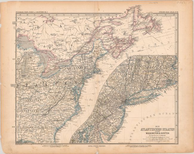
B. Die Atlantischen Staaten Zwischen Washington & Boston, by Augustus Herman Petermann, from Stieler's Hand-Atlas, dated 1879 (16.8 x 13.8"). This is the northeast sheet of Petermann's four-sheet map West-Indien, Central-Amerika bis zum Sudlichen Canada, published in Stieler's popular German atlas. It spans from Mobile north to Newfoundland. An inset, Die Atlantischen Staaten Zwischen Washington & Boston, provides rich detail of the region between D.C. and Boston. The map is dense with towns, cities, roads, rivers, and canals. Published by Justus Perthes. Reference: Rumsey #2761.088. Condition: On a lightly toned sheet with light scattered foxing and some chips and edge tears in the blank margins.
References:
Condition: B+
See description above.


