Subject: Eastern Canada
Period: 1836 (circa)
Publication: Tanner's Universal Atlas
Color: Hand Color
Size:
14.8 x 11.8 inches
37.6 x 30 cm
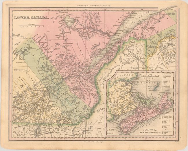
This uncommon atlas map stretches from Lake St. John south to the border with New York and Vermont, and from Montreal east to the vicinity of present-day Gaspesie National Park. There is fine detail of watershed and topography, and towns, cities, and political divisions are shown. A note on the map's western frontier states, "The Indians report this Country to be full of small Lakes and Streams." An inset map at bottom left, Nova Scotia New Brunswick &c., extends coverage east to Cape Breton. Engraved by J. Knight.
References: Rumsey #0976.008.
Condition: A
Full contemporary color with a few minor chips and edge tears in the blank margins.