Catalog Archive
Auction 173, Lot 70

"A New & Correct Map of the Isles of New Found Land, Cape Breton &c: with the Provinces of Nova Scotia", Gibson, John

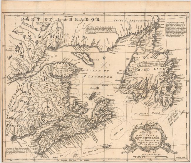
Subject: Eastern Canada

Period: 1762 (circa)

Publication: American Gazetteer

Color: Black & White

Size:
13.6 x 10.9 inches
34.5 x 27.7 cm
Download High Resolution Image
(or just click on image to launch the Zoom viewer)

This attractive and detailed map focuses on the region surrounding the Gulf of St. Lawrence. The coasts are lined with place names, and the map delineates the major fishing banks in the Atlantic. It includes some notations, including a couple describing the division of lands between the French and English according to the Treaty of Utrecht (1713). Engraved by John Gibson and published in Andrew Millar’s American Gazetteer.

References:

Condition: A

A nice impression issued folding on watermarked paper with light toning mainly along the sheet edges. The margin at lower right has been trimmed to neatline.

Estimate: $160 - $190

Sold for: $170

Closed on 6/5/2019

Archived