Subject: Fort Erie, Canada
Period: 1826 (published)
Publication: Voyage dans l'Amerique Septentrionale
Color: Black & White
Size:
9.3 x 7.8 inches
23.6 x 19.8 cm
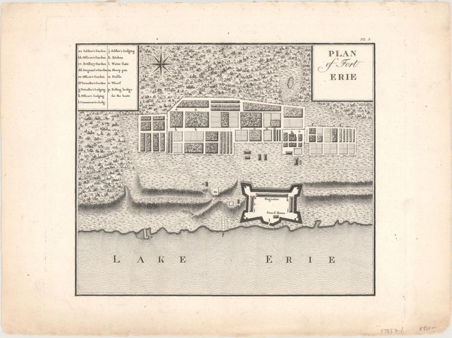
This handsome plan of Fort Erie comes from the extremely rare English edition of George Henry Victor Collot's illustrated journal, of which only 100 copies were printed. The fort was located across the Niagara River from Buffalo. Originally built in 1764 in the aftermath of the French and Indian War, Fort Erie was a port and supply depot for ships traveling to the Upper Great Lakes. In between Collot's visit in 1796 and the eventual publication of his work in 1826, the old fort was damaged by a storm and a new fort was commenced on higher ground. During the War of 1812, the fort became a grim and bloody battlefield.
In 1796, Collot was appointed by Pierre Adet to reconnoiter the interior parts of the country. Adet was concerned that the United States would join British forces in the Anglo-Spanish War and needed better intelligence on the area if they did. Collot's journey took him from Pittsburgh down the Ohio River, and then up to St. Louis on the Mississippi before finally heading downstream to New Orleans where he was promptly arrested by the Spanish. He was released shortly thereafter and returned to France in 1800 with the intention of publishing his maps and notes. Collot died in 1805 prior to printing, but his accounts were eventually published by the firm of Arthur Bertrand in 1826. A mere 300 French copies and 100 English copies were produced.
References:
Condition: A
A crisp impression with minor soiling confined to the blank margins.