Catalog Archive
Auction 116, Lot 102

"Carte de l'Isle de Montreal et de ses Environs Dressee sur les Manuscrits de Depost des Cartes Plans et Journaux de la Marine", Bellin, Jacques Nicolas

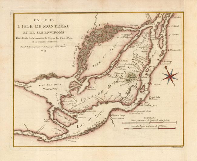
Subject: Canada, Montreal

Period: 1744 (dated)

Publication: Histoire et Description Generale de la Nouvelle France

Color: Hand Color

Size:
12.3 x 9.5 inches
31.2 x 24.1 cm
Download High Resolution Image
(or just click on image to launch the Zoom viewer)

This early map of Montreal and vicinity was drawn from manuscripts brought back to Paris by Pierre Francois Xavier de Charlevoix, a Jesuit who traveled extensively in Canada between 1705 and 1720. The map depicts the vicinity of Montreal, which was located at the navigable limits of the St. Lawrence River. Montreal (here Ville Marie) is depicted as a walled and fortified city. It is surrounded by many defensive forts that were built as protection against the Iroquois. The River St. Jean is shown as a wide channel clogged with islands, and several rapids and waterfalls are shown along the St. Laurence. A bold compass rose orients the map with north-northeast at top. Engraved by Dheulland.

References: Kershaw #1088.

Condition: A

Issued folding, now pressed. Neatly remargined at left.

Estimate: $350 - $400

Sold for: $300

Closed on 9/20/2006

Archived