Subject: Canada
Period: 1865 (circa)
Publication:
Color: Printed Color
Size:
39 x 31 inches
99.1 x 78.7 cm
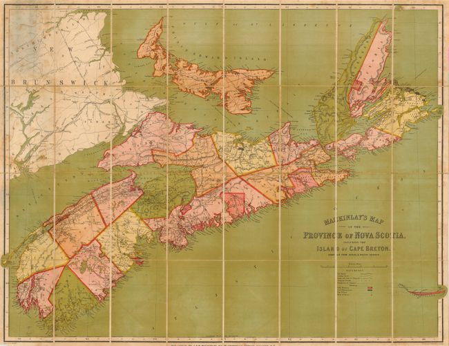
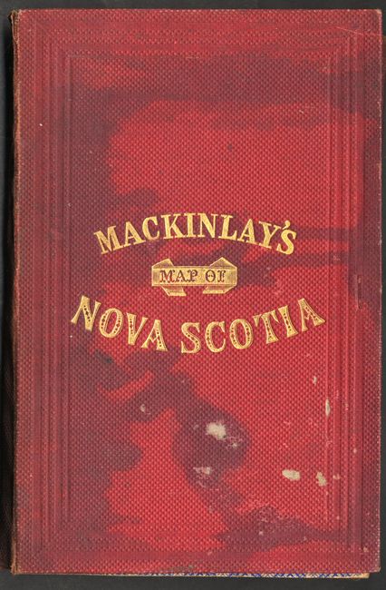
This very large folding map covers, in addition to Nova Scotia and Cape Breton Island, Prince Edward Island, Sable Island and part of New Brunswick. An attractive map that details roads, telegraph lines, railroads, boundaries, and more. The map is boldly printed in full color and is sectioned on linen in 32 parts, folding into red cloth covers (5.3 x 8") with blind-stamped gilt titling. A very uncommon issue engraved by G. Philip & Son, Liverpool and published in Halifax as noted below the map: "Published by A. & W. MacKinlay, No. 10 Granville Street, Halifax, N.S." The text booklet is missing from the covers as is often the case judging from book dealer descriptions.
References:
Condition: B
The map has some scattered foxing or toning that is diminished by the strong color. The covers are rubbed with some staining.