Subject: Canada
Period: 1744 (dated)
Publication: Histoire et Descriptoin Generale de la Nouvelle France
Color: Hand Color
Size:
14.2 x 11.3 inches
36.1 x 28.7 cm
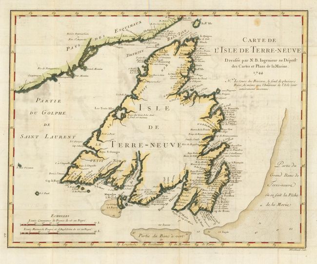
This is a finely engraved chart of Newfoundland that shows a part of the mainland at upper left and includes the Detroit de Belle Isle and part of the Gulf of St. Lawrence. Blank interior, but there is good detail along the coastlines with a remarkable number of place names. The bay and harbor of Plaisance, a former French colony, is noted on the southern coast. Several shoals and fishing banks are indicated through full stippling in the sea, with soundings noted. Two distance scales. Engraved by Dheulland.
References: Kershaw #515.
Condition: B
Early impression on a full sheet of thin hand-laid paper with wide margins and two large watermarks. Later coloring. Occasional light offsetting and some odd soiling or staining in a couple areas.