Subject: New Hampshire
Period: 1794 (dated)
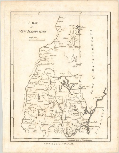
Publication: The American Geography...
Color: Black & White
Size:
6.9 x 8.9 inches
17.5 x 22.6 cm
This scarce early map of the state was published in John Stockdale's 1794 London edition of Morse’s The American Geography, the first detailed compilation of maps focusing on the individual states and territories of the United States. It shows towns and cities, rivers, and lakes, including Winnipisscoke L. (Lake Winnipesaukee) and Umbagog Lake. Present-day Nashua is here called Dunstable, and there is no sign of Concord or Portsmouth. A road extends from Salisbury to the Merrimack River. The land to the east of the state line is Part of Massachusets, since the District of Maine was still under the control of Massachusetts. Subsequent editions of Morse's work would combine New Hampshire and Vermont onto a single sheet; this edition is rarely seen on the market.
References: Cobb (NH) #67 McCorkle (18th C. Geography Books) #302-7.
Condition: B+
A crisp impression with light foxing.