Showing Unsold Lots(remove filter)
Current Auction
281 lots
Page 1 of 6
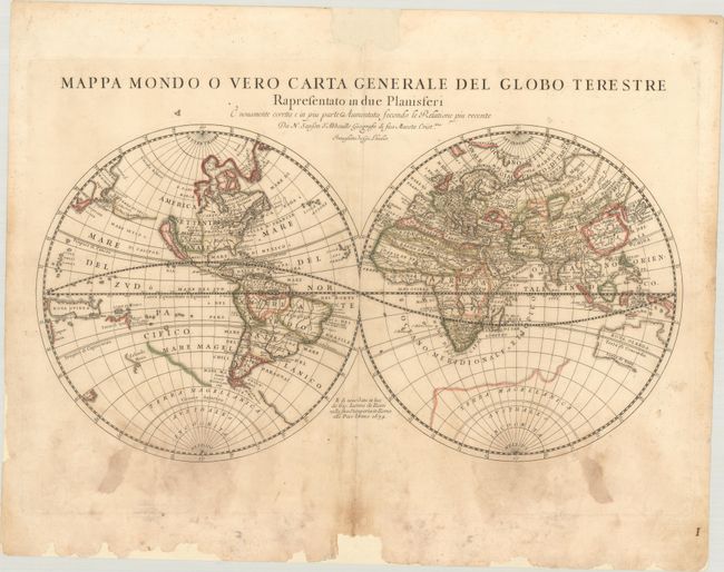
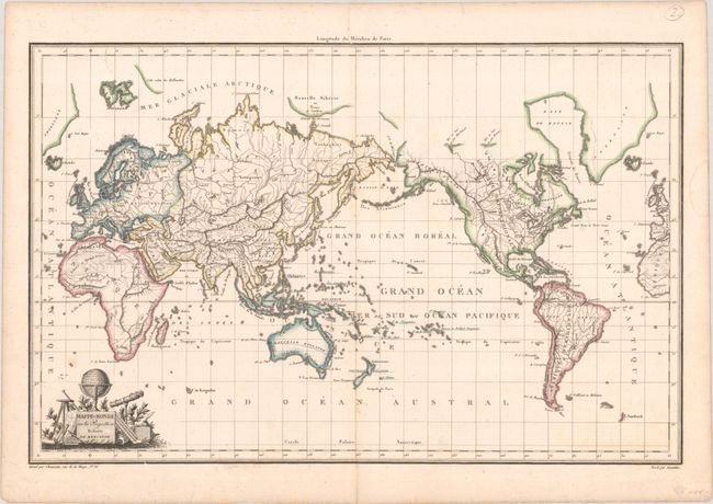
Lot 4
Subject: World
Rossi, Giamcomo Giovanni
Mappa Mondo o Vero Carta Generale del Globo Terestre Rapresentato in Due Planisferi..., 1674
Size: 21.6 x 11.3 inches (54.9 x 28.7 cm)
Estimate: $400 - $475
Price reduced by $50
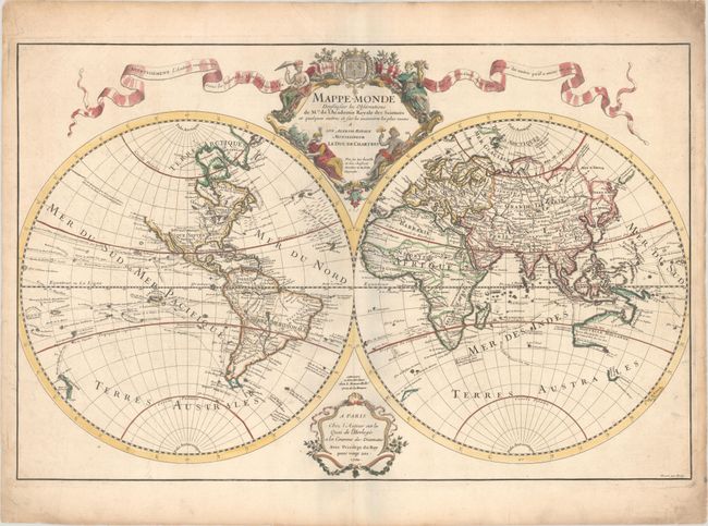
Lot 9
Subject: World
Delisle, Guillaume
Mappe-Monde Dressee sur les Observations de Mrs. de l'Academie Royale des Sciences et Quelques Autres et sur les Memoires les Plus Recens..., 1700
Size: 26 x 16.9 inches (66 x 42.9 cm)
Estimate: $1,000 - $1,300
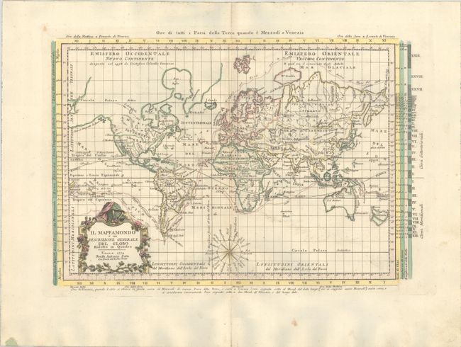
Lot 12
Subject: World
Zatta, Antonio
Il Mappamondo o sia Descrizione Generale del Globo Ridotto in Quadro, 1774
Size: 16 x 10.7 inches (40.6 x 27.2 cm)
Estimate: $475 - $600
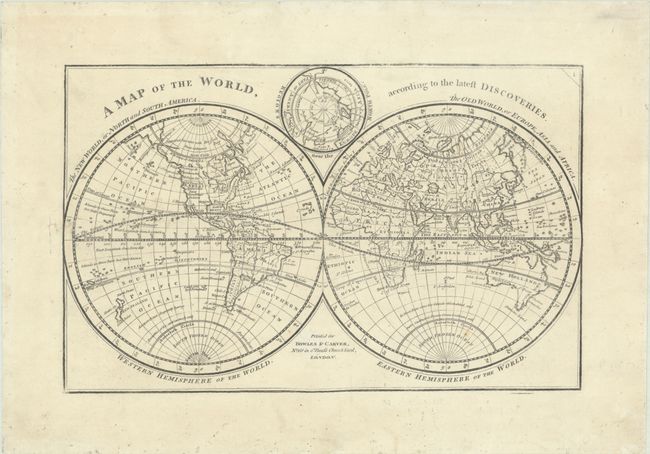
Lot 14
Subject: World
Bowles & Carver
A Map of the World, According to the Latest Discoveries, 1785
Size: 11.1 x 7 inches (28.2 x 17.8 cm)
Estimate: $325 - $400
Price reduced by $45
Lot 17
Subject: World
Chamouin, Jean Baptiste Marie
Mappe-Monde sur la Projection Reduite de Mercator, 1809
Size: 17.7 x 11.4 inches (45 x 29 cm)
Estimate: $140 - $170
Price reduced by $20
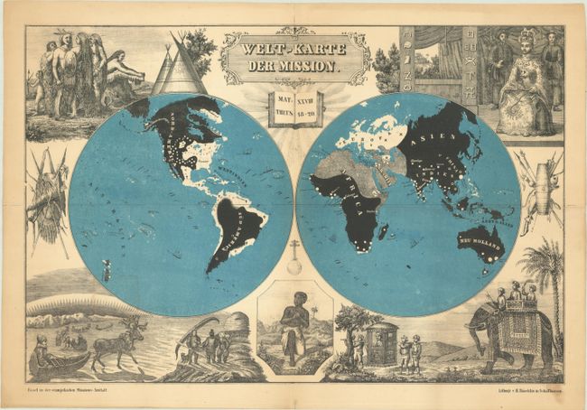
Lot 19
Subject: World
Welt-Karte der Mission, 1850
Size: 18.1 x 12 inches (46 x 30.5 cm)
Estimate: $325 - $400
Price reduced by $100
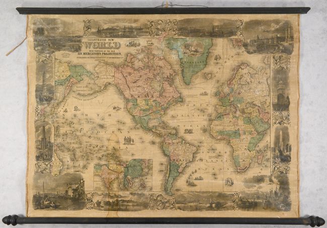
Lot 21
Subject: World
Phelps & Watson
Illustrated New World with Portions of the Old on Mercator's Projection, 1860
Size: 34.4 x 25.6 inches (87.4 x 65 cm)
Estimate: $1,400 - $1,700
Price reduced by $150
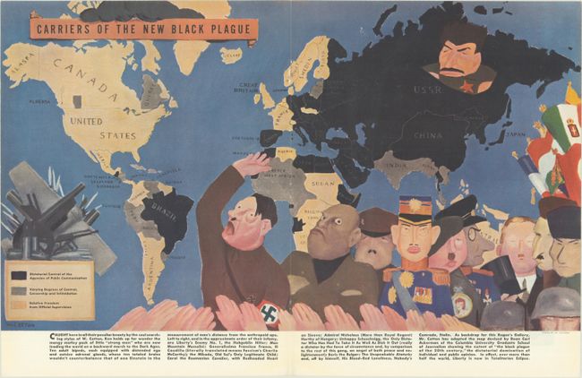
Lot 23
Subject: World, World War II
Carriers of the New Black Plague, 1938
Size: 20.7 x 11.8 inches (52.6 x 30 cm)
Estimate: $200 - $230
Price reduced by $25
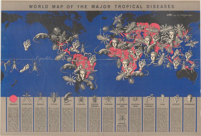
Lot 25
Subject: World
World Map of the Major Tropical Diseases, 1944
Size: 20.8 x 14 inches (52.8 x 35.6 cm)
Estimate: $200 - $230
Price reduced by $25
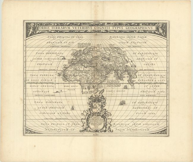
Lot 26
Subject: Ancient World
Jansson, Jan
Orbis Terrarum Veteribus Cogniti Typus Geographicus, 1680
Size: 19.9 x 15.9 inches (50.5 x 40.4 cm)
Estimate: $400 - $475
Price reduced by $50
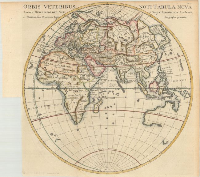
Lot 30
Subject: Eastern Hemisphere
Cluver, Philipp
Orbis Veteribus Noti Tabula Nova Auctore Guillelmo del' Isle..., 1729
Size: 15 x 15.1 inches (38.1 x 38.4 cm)
Estimate: $200 - $230
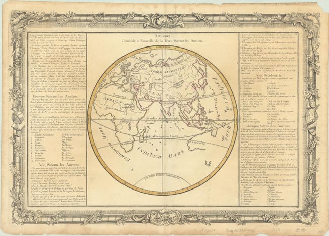
Lot 31
Subject: Eastern Hemisphere
Buy de Mornas, Claude
[Lot of 2] Division Generale et Naturelle de la Terre, Suivant les Anciens [and] Zones une Zone est un Espace de Terre, Diversement Appelle de la Differente Temperature de l'Air..., 1761
Size: 20.9 x 14.3 inches (53.1 x 36.3 cm)
Estimate: $140 - $170
Price reduced by $40
Lot 36
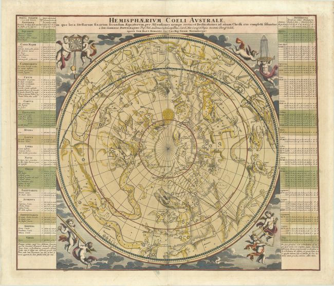
Subject: Celestial
Doppelmayr/Homann
Hemisphaerium Coeli Australe in quo Loca Stellarum Fixarum Secundum Aequatorem, per Ascensiones Nempe Rectas et Declinationes ad Anum Christi 1730..., 1742
Size: 22.6 x 19.1 inches (57.4 x 48.5 cm)
Estimate: $900 - $1,100
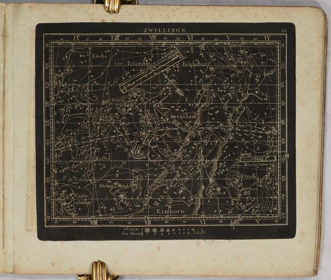
Lot 37
Subject: Celestial Atlas
Goldbach, Christian Friedrich
Neuester Himmels-Atlas zum Gebrauche sur Schul- und Akademischen Unterricht, nach Flamsteed, Bradley, Tob. Mayer, De la Caille, Le Francais de la Lande und v. Zach..., 1803
Size: 11.5 x 10 inches (29.2 x 25.4 cm)
Estimate: $2,000 - $2,400
Unique Celestial Atlas with Stars in Relief Against a Black Sky
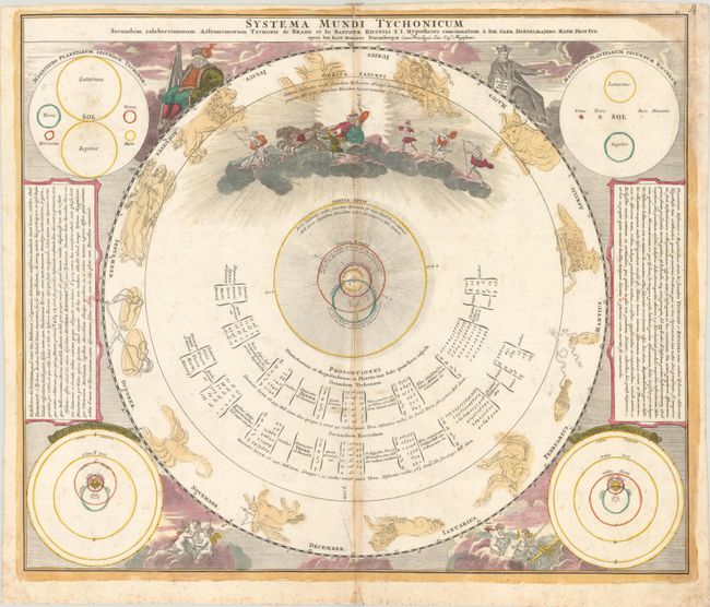
Lot 39
Subject: Solar System
Doppelmayr/Homann
Systema Mundi Tychonicum Secundum Celeberrimorum Astronomorum Tychonis de Brahe et Io. Baptistae Riccioli..., 1742
Size: 22.6 x 19.1 inches (57.4 x 48.5 cm)
Estimate: $400 - $475
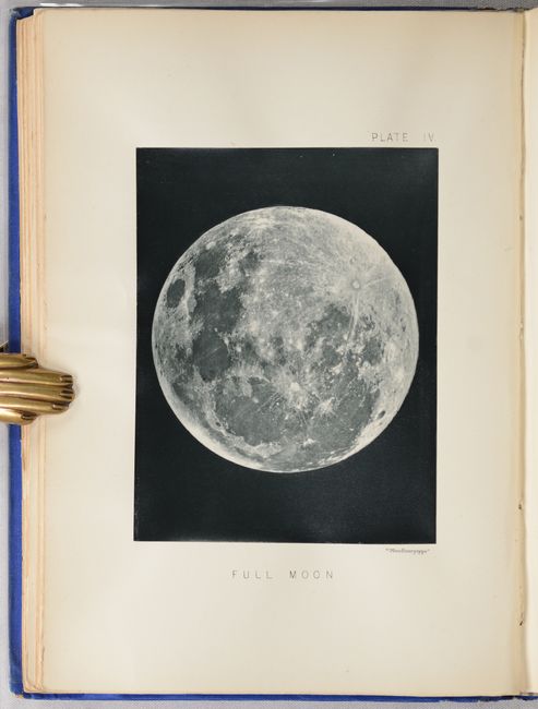
Lot 41
Subject: Moon
The Moon: Considered as a Planet, a World, and a Satellite, 1885
Size: 6.6 x 9.3 inches (16.8 x 23.6 cm)
Estimate: $1,000 - $1,300
Price reduced by $50 - Selenology with 25 Woodburytypes
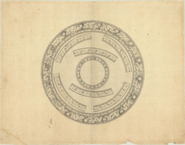
Lot 42
Subject: Cartographic Miscellany, Globe
Anon.
[Globe Horizon Ring], 1750
Size: 8.6 x 8.6 inches (21.8 x 21.8 cm)
Estimate: $325 - $400
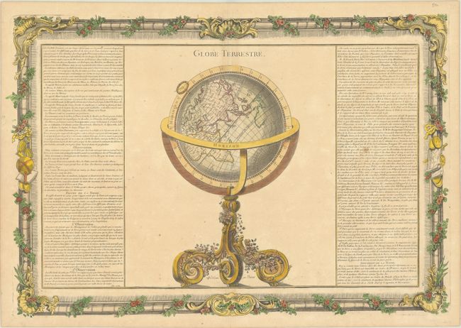
Lot 43
Subject: Cartographic Miscellany, Globe
Brion de la Tour/Martinet
Globe Terrestre, 1761
Size: 20.8 x 14.3 inches (52.8 x 36.3 cm)
Estimate: $160 - $190
Price reduced by $50
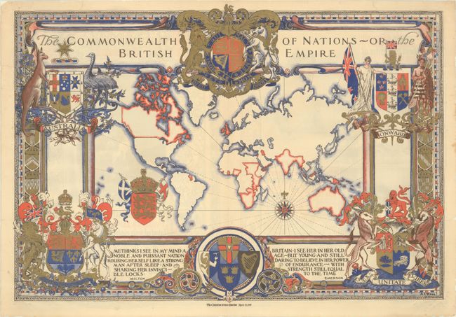
Lot 46
Subject: Cartographic Miscellany, World
The Commonwealth of Nations - or the British Empire, 1937
Size: 21.6 x 15.1 inches (54.9 x 38.4 cm)
Estimate: $180 - $220
Price reduced by $30
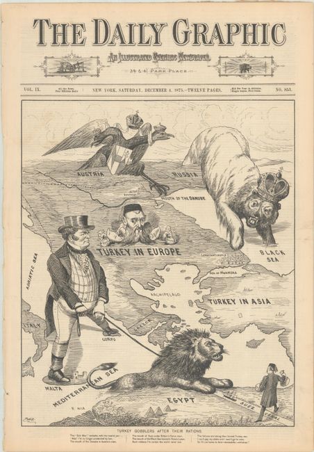
Lot 47
Subject: Cartographic Miscellany, Ottoman Empire
Daily Graphic
Turkey Gobblers After Their Rations, 1875
Size: 12.4 x 14.8 inches (31.5 x 37.6 cm)
Estimate: $500 - $700
Price reduced by $100! 12-Page Issue with Satiric Image of Great Eastern Crisis

Lot 50
Subject: Cartographic Miscellany, Literary Map
The Ian Fleming Thriller Map, 1987
Size: 27.1 x 20.6 inches (68.8 x 52.3 cm)
Estimate: $140 - $170
Price reduced by $15
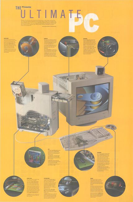
Lot 51
Subject: Cartographic Miscellany, Technology
The Ultimate PC [on verso] The Ultimate Specs, 1995
Size: 24.8 x 37.5 inches (63 x 95.3 cm)
Estimate: $1,000 - $1,300
Scarce Map of the Inner Workings of a PC
Lot 52
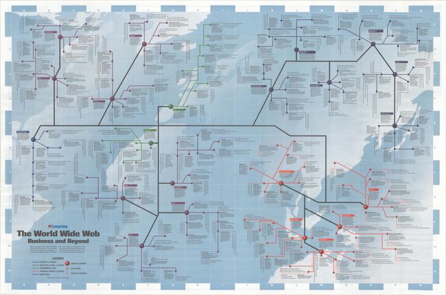
Subject: Cartographic Miscellany, Internet
Road Map to the World Wide Web - The World Wide Web Business and Beyond, 1995
Size: 36.5 x 24 inches (92.7 x 61 cm)
Estimate: $2,000 - $2,300
Scarce Map of the Early World Wide Web
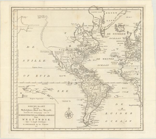
Lot 58
Subject: Western Hemisphere - America
Tirion, Isaac
Nieuwe Kaart van het Wesetlykste Deel der Weereld, Dienende tot Aanwyzing van de Scheepstogten der Nederlanderen naar Westindie…, 1754
Size: 14.2 x 13.5 inches (36.1 x 34.3 cm)
Estimate: $180 - $220
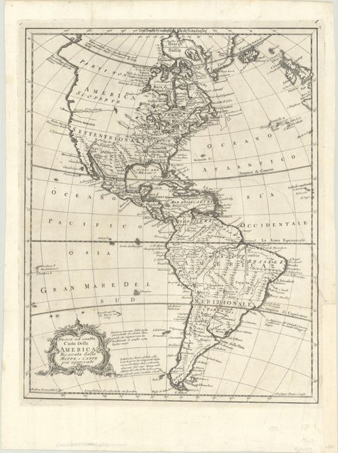
Lot 59
Subject: Western Hemisphere - America
Pazzi, Giuseppe
Nuova ed Esatta Carta della America Ricavata dalle Mappe, e Carte Piu Approvate, 1763
Size: 10.9 x 13.7 inches (27.7 x 34.8 cm)
Estimate: $190 - $220
Price reduced by $40
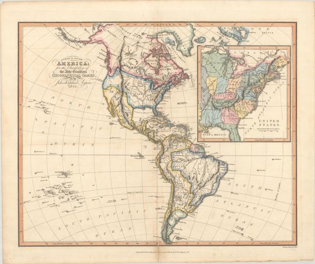
Lot 64
Subject: Western Hemisphere - America, Franklin
Aspin, Jehoshaphat
North & South America; for the Elucidation of the Abbe Gaultier's Geographical Games, 1823
Size: 16.8 x 13.4 inches (42.7 x 34 cm)
Estimate: $475 - $600
Price reduced by $50 - Map Depicting "State of Franklin"
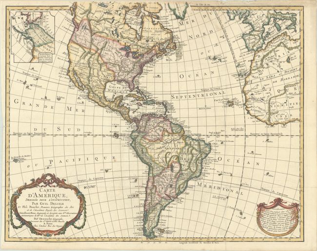
Lot 65
Subject: Western Hemisphere - America
Delisle/Dezauche
Carte d'Amerique, Dressee pour l'Instruction, part Guil. Delisle et Phil. Buache, Premiers Geographes du Roi..., 1826
Size: 23.9 x 19.3 inches (60.7 x 49 cm)
Estimate: $475 - $600
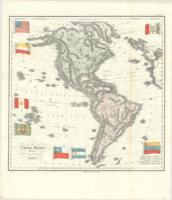
Lot 66
Subject: Western Hemisphere - America
Marmocchi, Francesco
Il Nuovo Mondo Diviso Nelle sue Principali Contrade, 1838
Size: 20.1 x 19.8 inches (51.1 x 50.3 cm)
Estimate: $400 - $475
Price reduced by $50
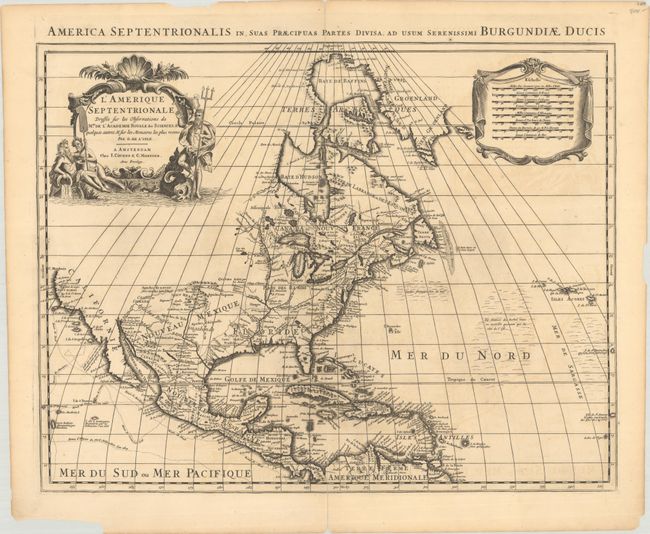
Lot 70
Subject: Colonial North America
Delisle/Covens & Mortier
L'Amerique Septentrionale Dressee sur les Observations de Mrs. de l'Academie Royale des Sciences. & Quelques Autres, & sur les Memoires les Plus Recens, 1730
Size: 22.6 x 17.7 inches (57.4 x 45 cm)
Estimate: $750 - $900
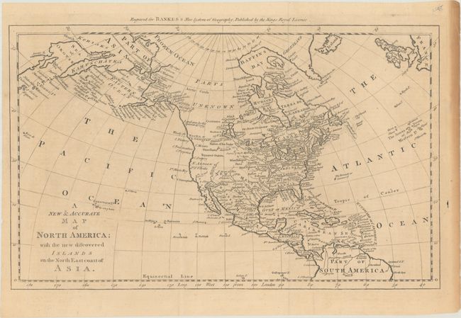
Lot 74
Subject: North America
Bowen, Thomas
A New & Accurate Map of North America; with the New Discovered Islands on the North East Coast of Asia, 1787
Size: 17.1 x 10.6 inches (43.4 x 26.9 cm)
Estimate: $275 - $350
Price reduced by $25
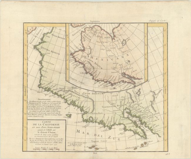
Lot 83
Subject: Western North America
Robert de Vaugondy/Diderot
Carte de la Californie et des Pays Nord-Ouest Separes de l'Asie par le Detroit d'Anian..., 1772
Size: 12.9 x 11.4 inches (32.8 x 29 cm)
Estimate: $150 - $180
Price reduced by $20
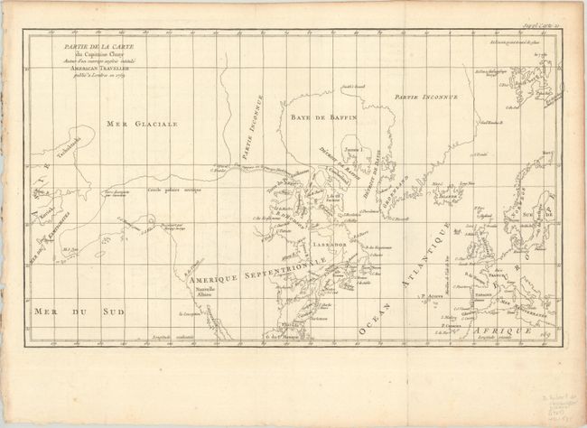
Lot 95
Subject: Colonial United States & Canada, Arctic
Robert de Vaugondy, Didier
Partie de la Carte du Capitaine Cluny Auteur d'un Ouvrage Anglois Intitule American Traveller Publie a Londres en 1769, 1773
Size: 19.6 x 11.6 inches (49.8 x 29.5 cm)
Estimate: $120 - $150
Price reduced by $30
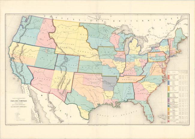
Lot 102
Subject: Eastern United States & Canada
SDUK Society for the Diffusion of Useful Knowledge
[Lot of 14 - United States & Canada], 1835
Size: See Description
Estimate: $1,000 - $1,300
Price reduced by $150
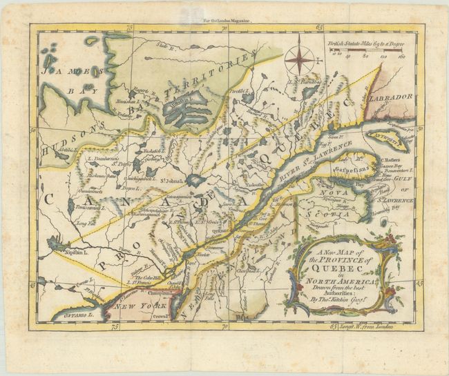
Lot 105
Subject: Colonial Northeastern United States & Canada
Kitchin, Thomas
A New Map of the Province of Quebec in North America; Drawn from the Best Authorities, 1764
Size: 8.7 x 6.8 inches (22.1 x 17.3 cm)
Estimate: $220 - $250
Lot 107
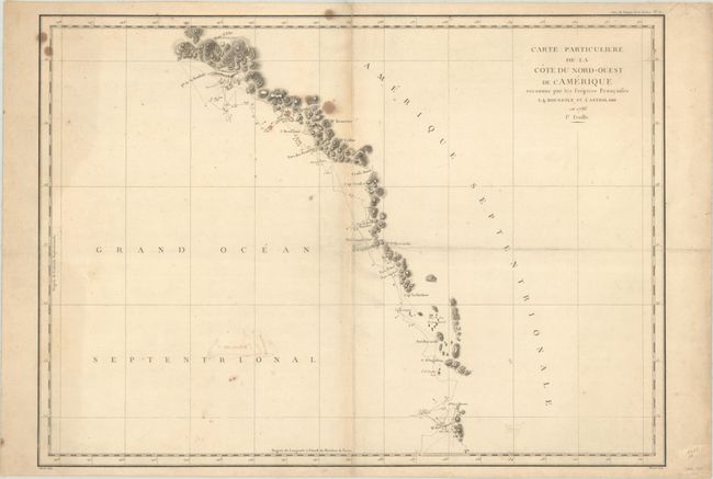
Subject: Western United States & Canada, Alaska
La Perouse, Comte Jean F. Galoup, de
[Lot of 2] Carte Particuliere de la Cote du Nord-Ouest de l'Amerique Reconnue par les Fregates Francaises la Boussole et l'Astrolabe en 1786. 1e Feuille [and] ... 2e Feuille, 1797
Size: 27.1 x 19.5 inches (68.8 x 49.5 cm)
Estimate: $300 - $375
Price reduced by $45
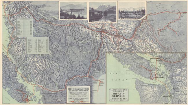
Lot 110
Subject: Northwestern United States & Canada
Railroad Companies, (Various)
The Triangle Tour of British Columbia - Jasper National Park Mount Robson Park Canadian Rockies and the Scenic Seas of the North Pacific Coast [on verso] Alaska and the Yukon, 1930
Size: 29.8 x 16.8 inches (75.7 x 42.7 cm)
Estimate: $150 - $180
Price reduced by $30
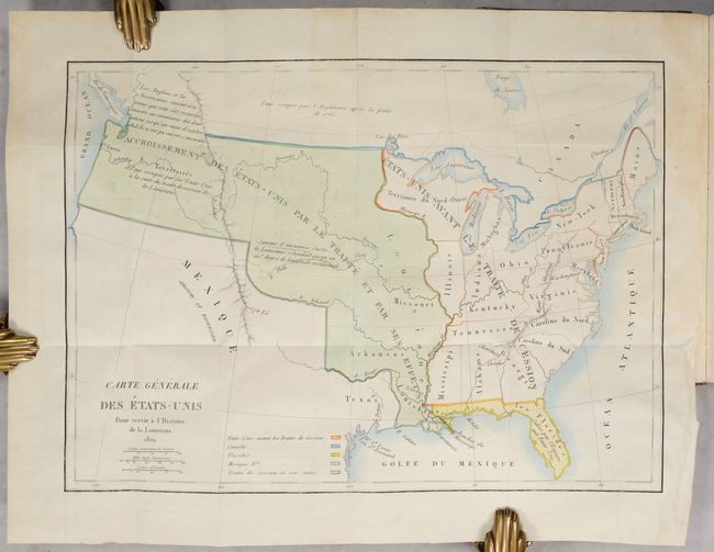
Lot 112
Subject: United States, Louisiana Purchase
Barbe-Marbois, Francois
[Map in Book] Carte Generale des Etats-Unis pour Servir a l'Histoire de la Louisiane [in] Histoire de la Louisiane et de la Cession de Cette Colonie par la France aux Etats-Unis de l'Amerique Septentrionale..., 1829
Size: 13.3 x 9.4 inches (33.8 x 23.9 cm)
Estimate: $800 - $1,000
Price reduced by $100! History of the Louisiana Purchase
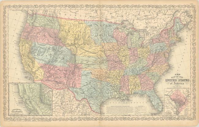
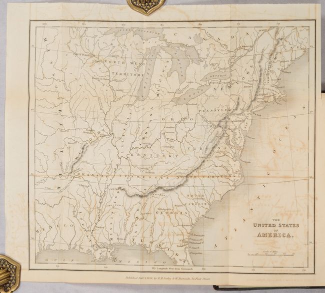
Lot 116
Subject: United States
Desilver, Charles
A New Map of the United States of America by J.H. Young, 1857
Size: 26.4 x 15.9 inches (67.1 x 40.4 cm)
Estimate: $275 - $350
Lot 117
Subject: United States
Phelps & Watson
Phelps' New National Map of the United States, 1859
Size: 36.5 x 37.8 inches (92.7 x 96 cm)
Estimate: $2,200 - $2,500
Price reduced by $200! Attractive Wall Map Issued at the Onset of the Civil War
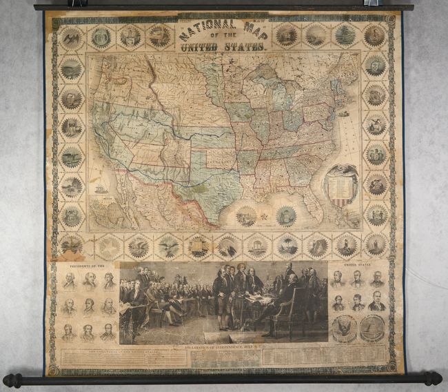
Lot 119
Subject: United States
Carte Ecclesiastique des Etats-Unis d'Amerique Dressee Specialement pour le Bulletin Hebdomadaire les Missions Catholiques, 1877
Size: 30.1 x 18.2 inches (76.5 x 46.2 cm)
Estimate: $275 - $350
Price reduced by $20 - Thematic Map Showing the Boom in American Catholicism in the Late 19th Century
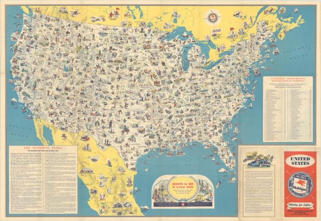
Lot 125
Subject: United States
Sights to See in Every State - And There Are Ever So Many More That Could Never Be Shown on a Map of This Size, 1936
Size: 30.8 x 21.3 inches (78.2 x 54.1 cm)
Estimate: $140 - $170
Price reduced by $50 - Early Version of a Popular Pictorial Map
Lot 126
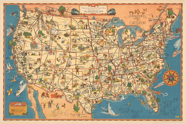
Subject: United States
A Good-Natured Map of the United States Setting Forth the Services of the Greyhound Lines and a Few Principal Connecting Bus Lines, 1939
Size: 29 x 19.1 inches (73.7 x 48.5 cm)
Estimate: $160 - $190
Price reduced by $45
Lot 131
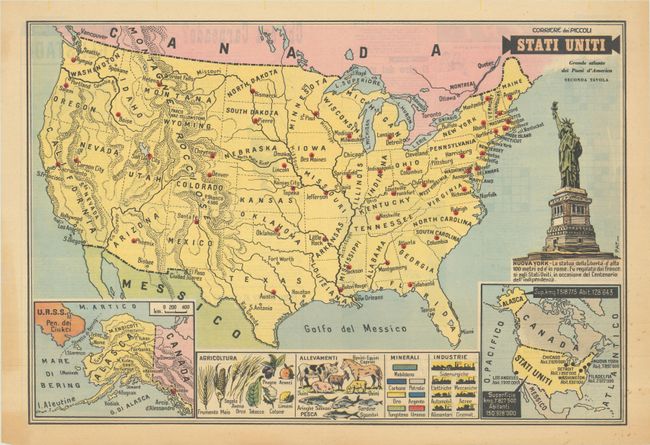
Subject: United States
Stati Uniti - Grande Atlante dei Paesi d'America Seconda Tavola, 1958
Size: 21 x 14.3 inches (53.3 x 36.3 cm)
Estimate: $120 - $150
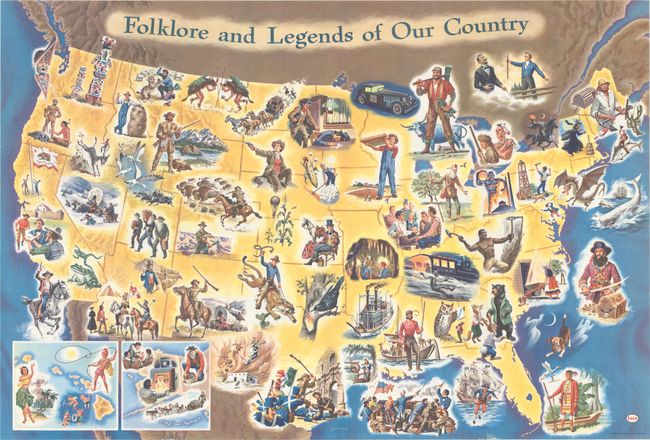
Lot 132
Subject: United States
Folklore and Legends of Our Country, 1960
Size: 35.5 x 24 inches (90.2 x 61 cm)
Estimate: $160 - $190
Price reduced by $30
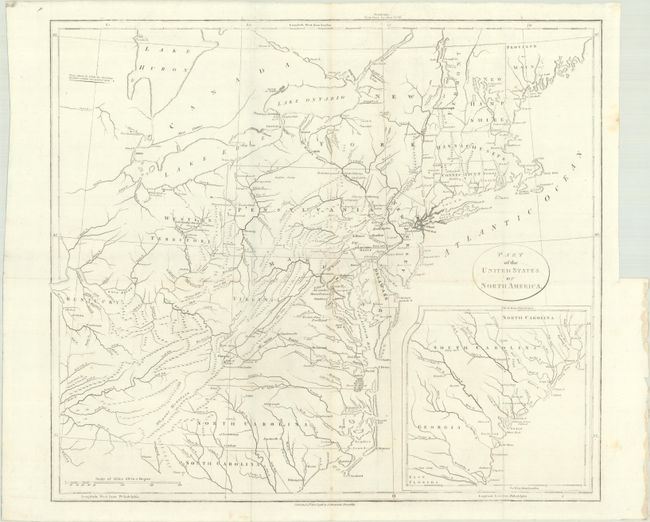
Lot 135
Subject: Eastern United States
Stockdale, John
Part of the United States of North America, 1798
Size: 18.5 x 16.2 inches (47 x 41.1 cm)
Estimate: $200 - $230
Price reduced by $10
Lot 136
Subject: Eastern United States, Revolutionary War
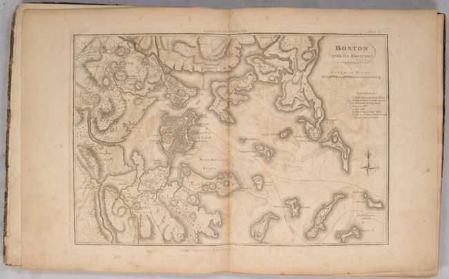
Marshall, John
[Atlas Volume] The Life of George Washington. Maps and Subscribers' Names, 1807
Size: 9.2 x 11.3 inches (23.4 x 28.7 cm)
Estimate: $1,000 - $1,300
Price reduced by $150!
Lot 139
Subject: Eastern United States
[Map in Book] The United States of America [in] The Rambler in North America (Volume 1), 1836
Size: 11.5 x 9.8 inches (29.2 x 24.9 cm)
Estimate: $140 - $170
Price reduced by $24
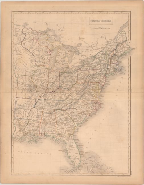
Lot 141
Subject: Eastern United States
Black, Adam & Charles
United States, 1840
Size: 15.3 x 19.8 inches (38.9 x 50.3 cm)
Estimate: $110 - $140
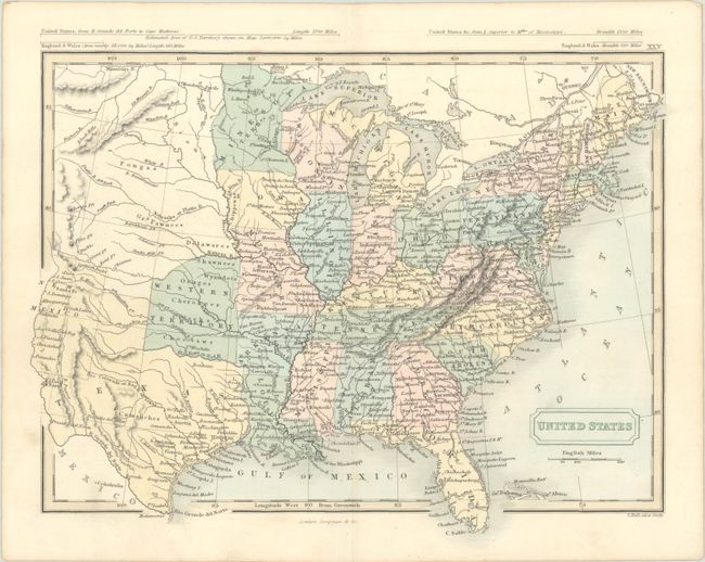
Lot 142
Subject: Eastern United States
Hall, Sidney
United States, 1849
Size: 10.4 x 8.1 inches (26.4 x 20.6 cm)
Estimate: $150 - $180
Lot 145
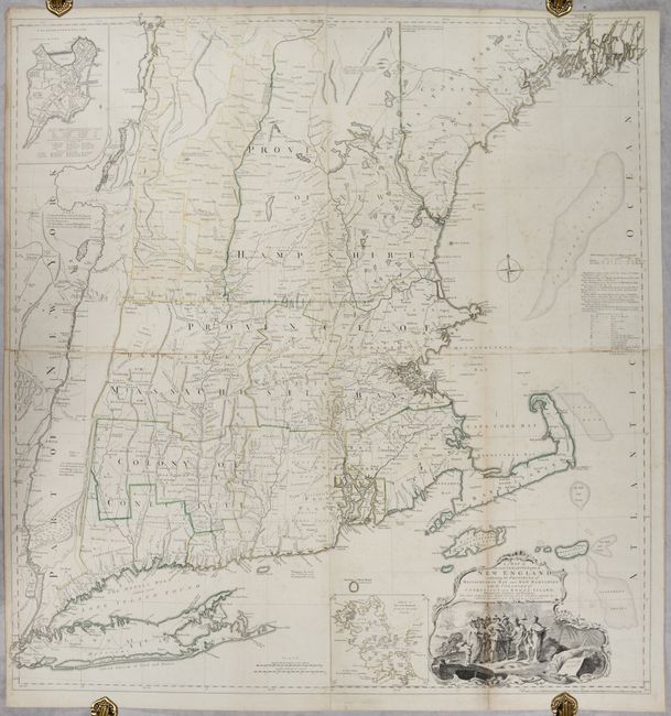
Subject: Colonial New England United States
Jefferys, Thomas
A Map of the Most Inhabited Part of New England, Containing the Provinces of Massachusets Bay and New Hampshire, with the Colonies of Conecticut and Rhode Island..., 1755
Size: 39.1 x 40.8 inches (99.3 x 103.6 cm)
Estimate: $4,750 - $6,000
Rare State of Jefferys' Influential Map of New England in Contemporary Color
281 lots
Page 1 of 6