Subject: Western Hemisphere - America
Period: 1826 (dated)
Publication:
Color: Hand Color
Size:
23.9 x 19.3 inches
60.7 x 49 cm
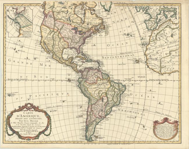
This is a later, updated edition of one of the most popular maps of the 18th century. It was first issued by Delisle in 1722 and went through 19 different versions according to Tooley. This version and another one dated 1817 are not mentioned by him, which would make it 21 versions. This edition was issued by Dezauche, the successor to the Delisle cartographic firm, and has been extensively updated through numerous revisions. The map includes the information from Cook's discoveries in the Northwest and Alaska in an inset "Supplement a la Partie Nord Ouest de l'Amerique d'apres les Decouvertes du Capitaine Cook." The United States includes the Louisiana Territory and extends into present-day Canada in the Pacific Northwest, reflecting American interests. The map shows a number of spurious mountains ranges in the West, going east to west and north to south, and sometimes doing both within the same range. This edition has been updated from the 1817 edition, with more detail of the rivers and lakes in the Pacific Northwest. A garland style title cartouche and another cartouche containing an advertisement decorate the lower corners.
References: cf. Tooley (America) p. 16, #18.
Condition: A
A sharp impression on a bright sheet with a "T Dupuy" watermark, issued folding and now pressed flat. There is a hint of offsetting, a tiny rust spot in the south Pacific, and a few tiny chips along the edges of the sheet.