Showing Unsold Lots(remove filter)
Filtered by Category:Books, Atlases, Travel Guides, Geography & Reference Books(Show All Categories)
Current Auction
9 lots
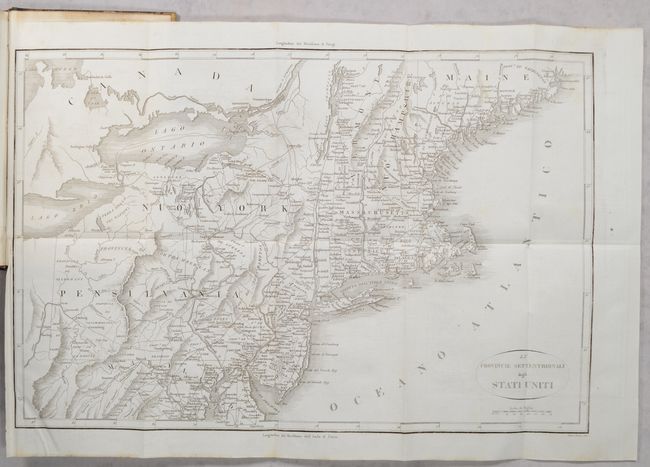
Lot 146
Subject: Eastern United States, Revolutionary War
Botta, Carlo
[2 Maps in 3 Volumes] Le Provincie Meridionali degli Stati Uniti [and] Le Provincie Settentrionali degli Stati Uniti [in] Storia della Guerra della Independenza degli Stati Uniti di America Volume Primo [and] Volume Secondo [and] Volume Terzo, 1820
Size: 5.5 x 8.5 inches (14 x 21.6 cm)
Estimate: $300 - $400
Price reduced by $20 - "The Most Valuable History of the Revolution Up to its Date" - Howes
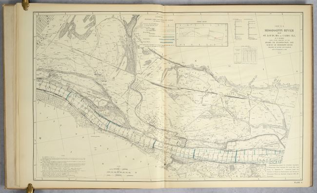
Lot 166
Subject: Mississippi River, Missouri, Illinois
U.S. Government
Atlas Illustrating Report of March 20, 1909, of Board on Examination and Survey of Mississippi River..., 1909
Size: 22.8 x 36.8 inches (57.9 x 93.5 cm)
Estimate: $300 - $400
Price reduced by $20
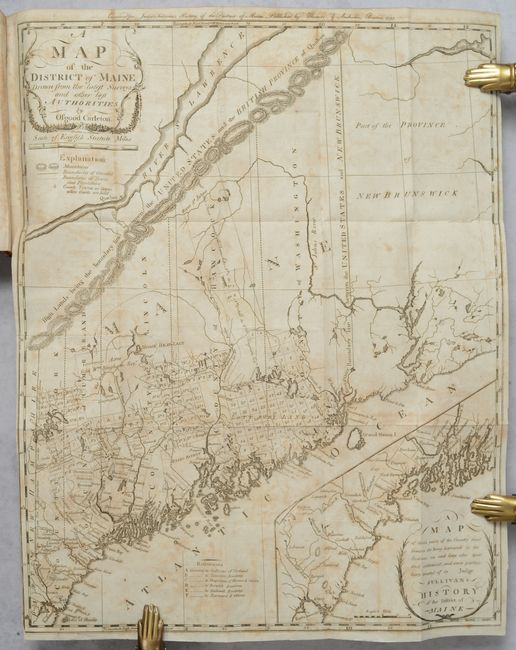
Lot 244
Subject: Maine
Carleton, Osgood
[Map in Book] A Map of the District of Maine, Drawn from the Latest Surveys and Other Best Authorities [in] The History of the District of Maine, 1795
Size: 16.4 x 20.4 inches (41.7 x 51.8 cm)
Estimate: $1,800 - $2,200
Price reduced by $100! The Second Printed Map of Maine
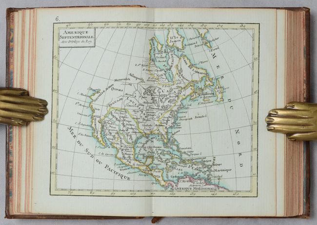
Lot 696
Subject: Atlases
Rizzi-Zannoni, Giovanni Antonio
Atlas Geographique Contenant la Mappemonde et les Quatre Parties, avec les Differents Etats d'Europe..., 1782
Size: 3.5 x 5.1 inches (8.9 x 13 cm)
Estimate: $1,200 - $1,500
Price reduced by $400! Remarkable Miniature Atlas with 30 Maps
Lot 698
Subject: Atlases
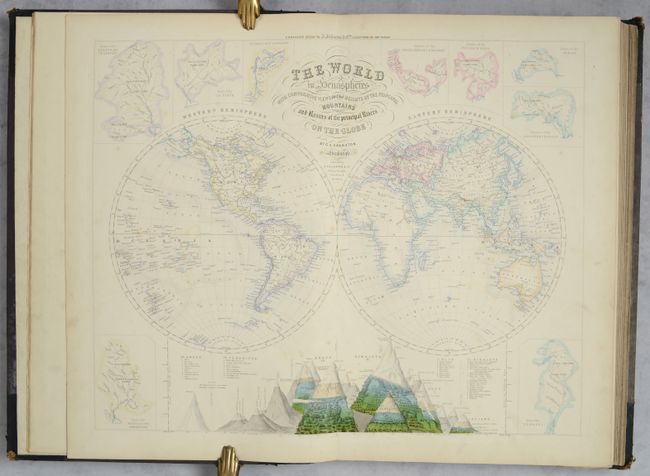
Swanston/Fullarton
[Companion Atlas to the Gazetteer of the World], 1860
Size: 13.3 x 19.2 inches (33.8 x 48.8 cm)
Estimate: $800 - $950
Price reduced by $100!
Lot 700
Subject: Atlases
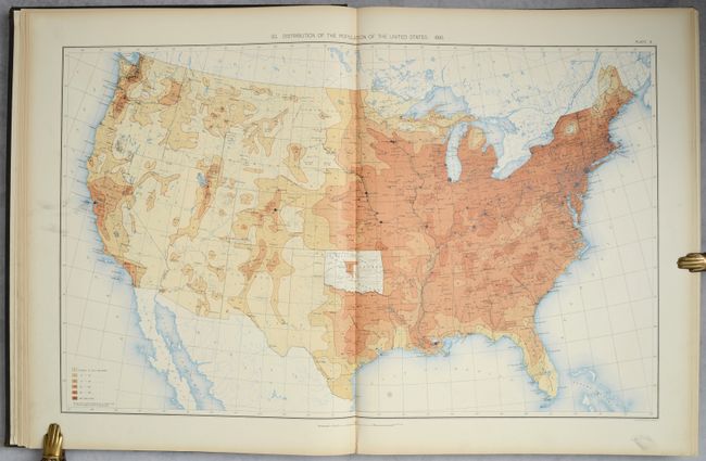
U.S. Department of Interior
Statistical Atlas of the United States, Based Upon Results of the Eleventh Census, 1898
Size: 16.8 x 21.3 inches (42.7 x 54.1 cm)
Estimate: $350 - $425
Lot 713
Subject: References, Incunabula
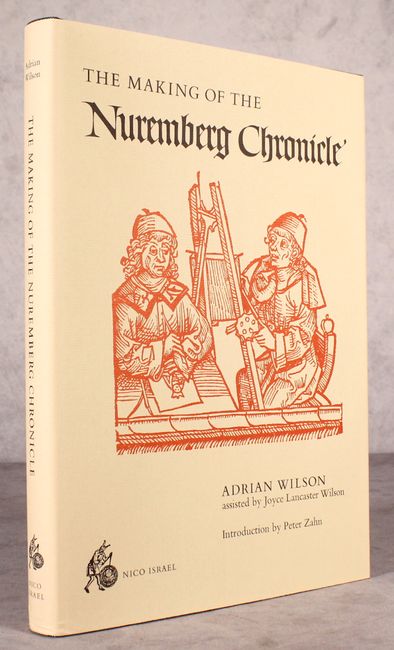
Wilson, Adrian
The Making of the Nuremberg Chronicle, 1978
Size: 9.8 x 14 inches (24.9 x 35.6 cm)
Estimate: $140 - $170
Lot 715
Subject: References, Globes
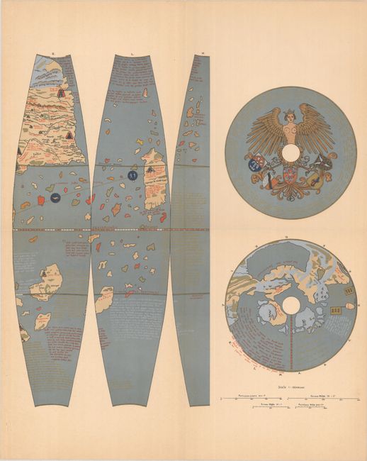
Philip, George
Martin Behaim His Life and His Globe, 1908
Size: 12.6 x 15.5 inches (32 x 39.4 cm)
Estimate: $300 - $375
Price reduced by $110!
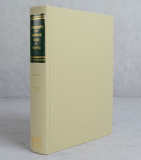
Lot 722
Subject: References, Northwestern United States & Canada
Wagner, Henry R.
The Cartography of the Northwest Coast of America to the Year 1800, 1999
Size: 8.6 x 11.1 inches (21.8 x 28.2 cm)
Estimate: $140 - $170
9 lots