Subject: United States
Period: 1854 (published)
Publication:
Color: Hand Color
Size:
29.3 x 24.6 inches
74.4 x 62.5 cm
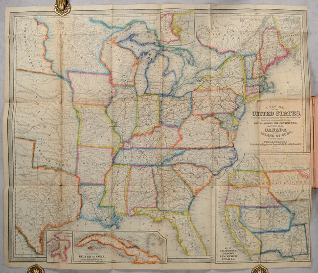
This highly detailed and beautifully engraved map is vividly colored and features inset maps of Niagara River and Falls, Havana, the island of Cuba, and a great Map of California, Oregon, New Mexico Utah &c. The main map shows the country as far west as the Texas panhandle and the Great Plains, which is divided into two large territories: Nebraska (incorporating Indian Territory and with no mention of Kansas) and Part of the Northwest Terry. (the region of present-day North and South Dakota). There are numerous forts, railroads, trade routes, and the tracks of several explorers. The inset map of the pre-Gadsden Purchase West (9.3 x 10.5") shows explorers' routes and immigrant trails, most notably the Oregon Route. The Great Basin in Utah Territory is bounded by a mountain range labeled "Dividing Range between the Waters of the Pacific and the Waters of the Great Basin." In the Northwest, Ft. Nisqually and Olympia are located but Seattle (officially founded in 1851) is not named. Portland is Oregon City, and Fillmore City is the capital of Utah. Also locates the Trail from Santa Fe to the Pacific and the Santa Fe Trail. Copyright dated 1851.
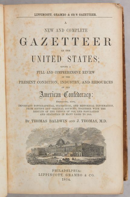
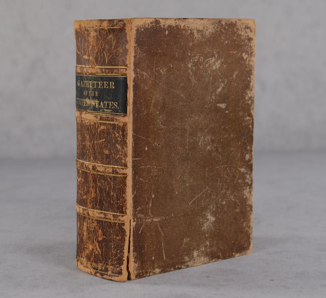
This folding map is adhered to the inside front cover of A New and Complete Gazetteer of the United States; Giving a Full and Comprehensive Review of the Present Condition, Industry, and Resources of the American Confederacy… The gazetteer presents a massive collection of statistical information reflecting the tremendous growth of the United States in the mid-19th century. The authors, Thomas Baldwin and Joseph Thomas, state in the preface that the territory of the country recently expanded by more than 800,000 square miles, bringing the total amount of land comprising the U.S. to over 3,000,000 square miles, "nearly equaling the whole of continental Europe." The population statistics are based on the census of 1850, and were revised in 1853, due to this growth. 1364 pages. Hardbound in original brown leather with gilt title label on spine and marbled fore-edges.
References: Wheat (TMW) #769 and #818.
Condition: B
The colorful folding map has one fold panel pasted down to the inside front cover. There is light toning along the fold lines, a few short fold separations with minute loss at a couple of junctions, and a vertical extraneous crease at left. Text is foxed with occasional light dampstaining. Front hinge is starting. Binding has moderate to heavy shelf wear.