Subject: Eastern United States, Revolutionary War
Period: 1820 (published)
Publication:
Color: Black & White
Size:
5.5 x 8.5 inches
14 x 21.6 cm
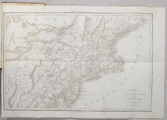
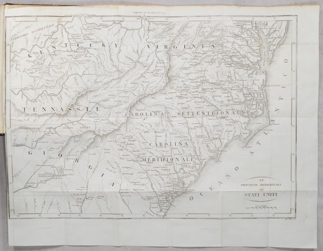
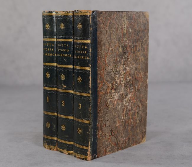
This lot features an uncommon pair of maps bound in Carlo Botta's Storia della Guerra della Independenza degli Stati Uniti di America. According to Howes, Botta's work, first published in 1809, was the "most valuable history of the Revolution up to its date." It was published in several editions between 1809 and 1860, including French and English translations. This three-volume set is the Nicolo Bettoni edition, published in Milan in 1820. Although Sabin states the Milan edition of 1820 features four volumes, we have found examples on the market with only three, and this example appears to be complete, with its chronology going up to 1783. The northern map (18.8 x 12.3") covers the area from Maine, south to Maryland, and west to the Ohio-Pennsylvania boundary. The map has good detail of the topography, watershed, and settlements of the region. The southern sheet (18.5 x 13.1") covers the states of Kentucky, Virginia, Tennessee, North and South Carolina, and part of Georgia. It provides a good view of early settlements and roads, as well as the mountains, forests, and Indian villages. Between Tennessee and Georgia is a long strip of land labeled Territorio degli Stati Uniti. This land originally belonged to South Carolina but was ceded back to the United States in 1787, subject to Indian occupancy. Numerous Indian villages are shown, especially in the region of present-day Alabama. Both maps are bound into the back of Volume III. Vol. I - 456 pages; Vol. II - 556 pages; Vol. III - 516 pages. Hardbound in contemporary quarter leather over marbled boards with gilt titles on spines.
References: Howes #B-636; Sabin #6818.
Condition: B+
Both maps are near fine with minor offsetting. The southern map has a 2" binding tear at left that has been closed on verso with archival tape. Text is very clean and bright throughout all three volumes, with a bit of foxing mostly confined to the opening pages and far edges. Bindings are scuffed and worn. Ex libris.