Subject: Northwestern Pennsylvania
Period: 1857 (published)
Publication:
Color: Printed Color
Size:
6 x 9.1 inches
15.2 x 23.1 cm
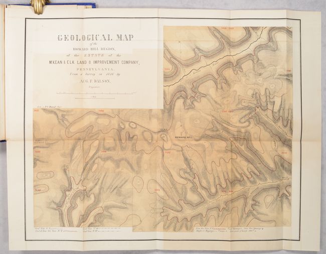
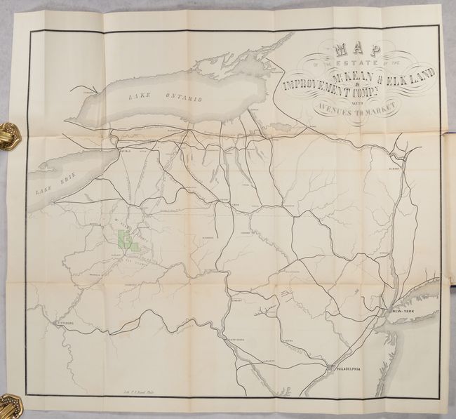
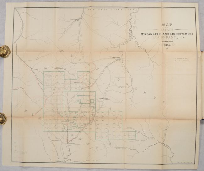
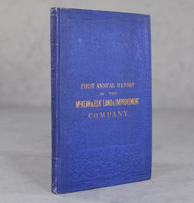
This annual report is one of the more elaborate stockholder publications we have encountered. The 35 pages of text describes the company's coal and iron mining ventures located between Smethport and Ridgway in northwestern Pennsylvania. The text is accompanied by 3 folding geological profiles and columnar sections and the following four folding maps:
Map of the Estate of the McKean & Elk Land & Improvement Company (24 x 20.5"). Condition: There is light toning along the fold lines, short binding tears at right, and a few pencil notations in the image. (B)
Map of the Estate of the McKean & Elk Land & Improvement Company with Avenues to Market (23.7 x 21.2"). Condition: There is some minor offsetting and short binding tears at right (B+)
Geological Map of the Howard Hill Region, of the Estate... by August F. Dalson (18.0 x 14.3"). Condition: Offsetting at upper left. (B)
Map of the Coal Fields of the North East Corner of the Estate... (9.3 x 9.8"). Condition: Light offsetting. (B+)
The maps show the location of the property, transportation routes to the large eastern markets, coal deposits, and a geological map by Dalson that would later be reprinted in Ashburner’s "The Geology of McKean County", 1880 (Marcou #277). The geological profiles and sections use as many as nine printed color and pattern combinations to make a beautifully finished display. Dalson, a Finlander, served as an assistant with the first Pennsylvania Geological Survey and is largely responsible for the large map two sheet of the anthracite regions published with Rogers’ Final Report. First edition. In original blindstamped blue cloth boards with gilt front cover title. Not in Marcou, Munn, or Nickles.
References:
Condition:
See description for map condition grades. Text is clean with some minor creasing. Covers have some light soiling and shelf wear. Binding (B+)