Showing Featured Lots(remove filter)
Showing results for:Auction 140
Catalog Archive
83 lots
Page 1 of 2
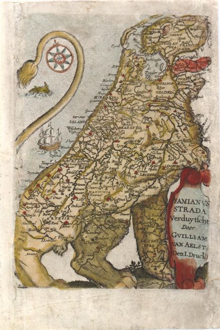
Auction 140, Lot 2
Subject: Title Pages
Strada, Famiamo, S.J.
[Leo Belgicus] Verduytscht door Guilliam van Aelst Den. I. Druck, 1645
Size: 3.5 x 5 inches (8.9 x 12.7 cm)
Estimate: $950 - $1,100
Sold for: $700
Closed on 5/23/2012
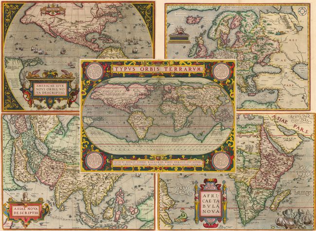
Auction 140, Lot 8
Subject: World & Continents
Ortelius, Abraham
[Lot of 5] Typus Orbis Terrarum [and] Americae sive Novi Orbis, Nova Descriptio [and] Africae Tabula Nova [and] Asiae Nova Descriptio [and] Europae, 1598
Size: 19.5 x 14 inches (49.5 x 35.6 cm)
Estimate: $24,000 - $28,000
Superb Folio Set of Ortelius World and Continents
Unsold
Closed on 5/23/2012
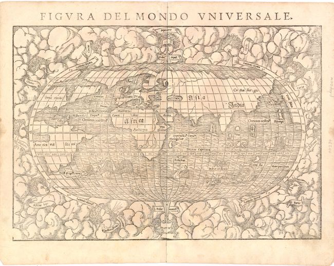
Auction 140, Lot 9
Subject: World
Munster, Sebastian
Figura del Mondo Universale, 1571
Size: 15 x 11 inches (38.1 x 27.9 cm)
Estimate: $1,900 - $2,200
Sold for: $1,400
Closed on 5/23/2012
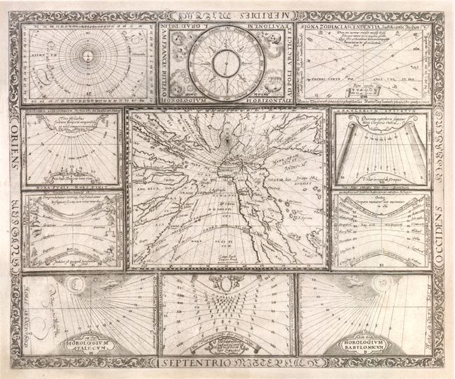
Auction 140, Lot 12
Subject: World
Ritter, Franz
[Untitled - World and Horological Diagrams], 1607
Size: 13.3 x 11 inches (33.8 x 27.9 cm)
Estimate: $3,000 - $4,000
Ritter's Unusual Sun-Dial World Map
Sold for: $2,200
Closed on 5/23/2012
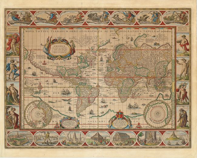
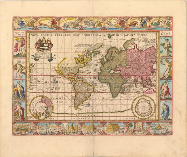
Auction 140, Lot 13
Subject: World
Blaeu, Willem
Nova Totius Terrarum Orbis Geographica ac Hydrographica Tabula, 1635
Size: 21.3 x 16.3 inches (54.1 x 41.4 cm)
Estimate: $17,000 - $20,000
Blaeu's Magnificent World Map
Sold for: $13,500
Closed on 5/23/2012
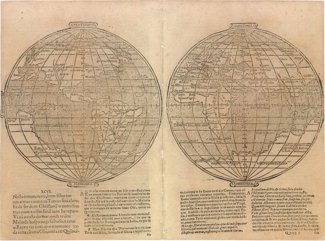
Auction 140, Lot 15
Subject: World
Camoens, Luis de
[Untitled - World], 1639
Size: 15.3 x 8 inches (38.9 x 20.3 cm)
Estimate: $6,500 - $7,500
A Scarce Spanish World Map
Unsold
Closed on 5/23/2012
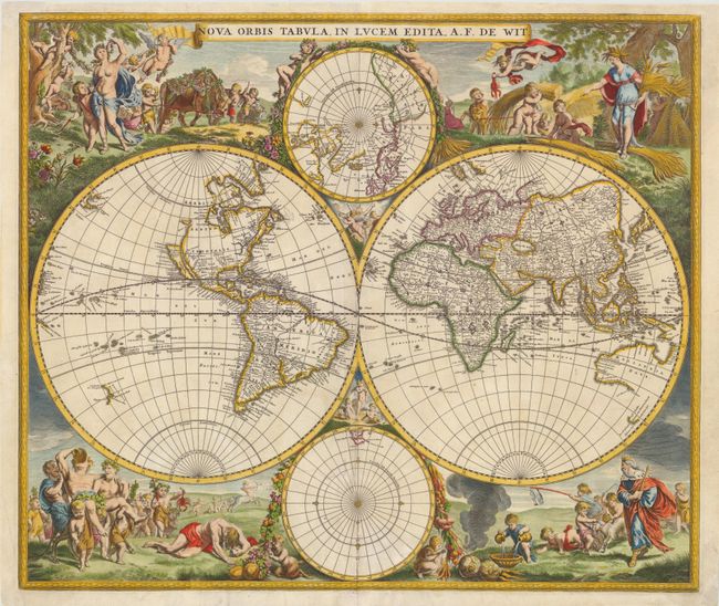
Auction 140, Lot 16
Subject: World
Wit, Frederick de
Nova Orbis Tabula, in Lucem Edita, 1675
Size: 22.3 x 19 inches (56.6 x 48.3 cm)
Estimate: $4,250 - $5,000
De Wit's Stunning Double-Hemisphere Map
Unsold
Closed on 5/23/2012
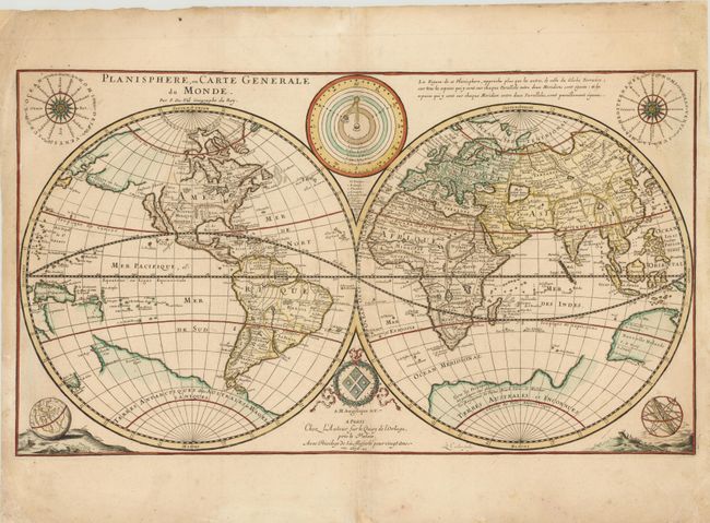
Auction 140, Lot 17
Subject: World
Duval, Pierre
Planisphere, ou Carte Generale du Monde…, 1676
Size: 23.5 x 13.3 inches (59.7 x 33.8 cm)
Estimate: $1,900 - $2,200
Unsold
Closed on 5/23/2012
Auction 140, Lot 18
Subject: World
Pitt, Moses
Nova Totius Terrarum Orbis Geographica ac Hydrographica Tabula, 1680
Size: 20.8 x 15.5 inches (52.8 x 39.4 cm)
Estimate: $13,000 - $18,000
Sold for: $8,500
Closed on 5/23/2012
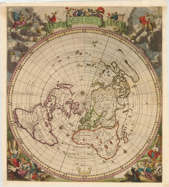
Auction 140, Lot 22
Subject: World
Robijn (Robyn), Jacobus
Nieuw Aerdsch Pleyn, 1700
Size: 20.5 x 23.3 inches (52.1 x 59.2 cm)
Estimate: $7,000 - $8,000
Rare World Map on a Singular Polar Projection
Sold for: $5,500
Closed on 5/23/2012
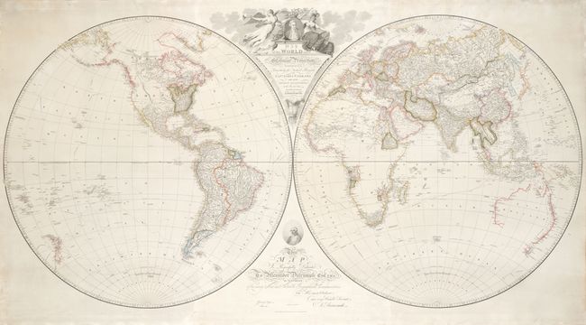
Auction 140, Lot 33
Subject: World
Arrowsmith, Aaron, Sr.
Map of the World on a Globular Projection Exhibiting Particularly the Nautical Researches of Capn. James Cook…, 1799
Size: 72.5 x 38.5 inches (184.2 x 97.8 cm)
Estimate: $16,000 - $20,000
A Seminal Map Illustrating the Important Discoveries of the Last Decade of the 18th Century
Sold for: $12,000
Closed on 5/23/2012
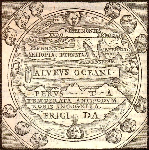
Auction 140, Lot 42
Subject: Ancient World
Macrobius, Ambrosius Aurelius Theodo
Macrobii Ambrosii Aurelii Theodosii, uiri Consularis, et Illustris, In Somnium Scipionis, Lib. II. Saturnaliorum. Lib. VII…, 1574
Size: 5 x 7 inches (12.7 x 17.8 cm)
Estimate: $1,500 - $1,800
Macrobius' Miniature World Map
Unsold
Closed on 5/23/2012
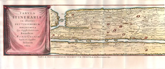
Auction 140, Lot 43
Subject: Ancient World
Jansson, Jan
Tabula Itineraria ex Illustri Peutingerorum Bibliotheca…, 1650
Size: 159.3 x 7.3 inches (404.6 x 18.5 cm)
Estimate: $2,750 - $3,500
Sold for: $4,000
Closed on 5/23/2012
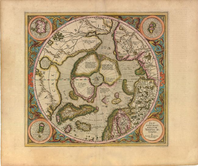
Auction 140, Lot 45
Subject: North Pole
Mercator, Gerard
Septentrionalium Terrarum Descriptio, 1613
Size: 15.5 x 14.8 inches (39.4 x 37.6 cm)
Estimate: $2,500 - $3,250
The First Printed Map Devoted to the Arctic
Sold for: $1,900
Closed on 5/23/2012
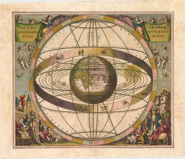
Auction 140, Lot 55
Subject: Solar System
Cellarius, Andreas
Scenographia Systematis Mundani Ptolemaici, 1661
Size: 20 x 17 inches (50.8 x 43.2 cm)
Estimate: $2,500 - $3,000
Sold for: $1,900
Closed on 5/23/2012
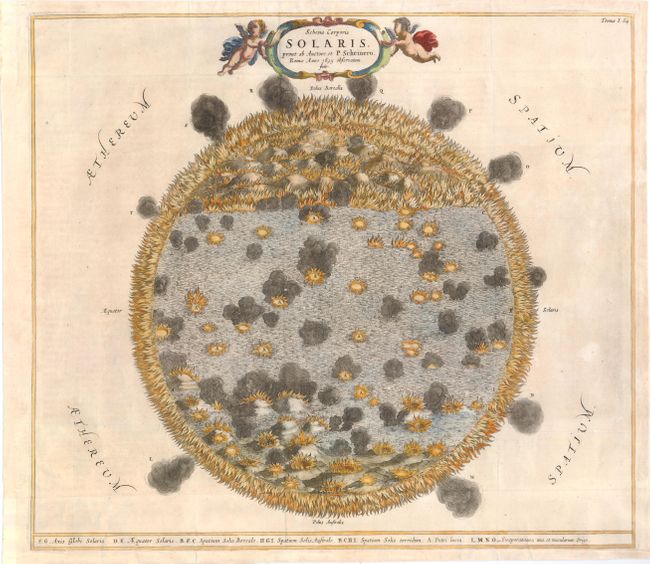
Auction 140, Lot 58
Subject: Sun
Kircher, Athanasius
Schema Corporis Solaris, prout ab Auctore et P. Scheinero…, 1682
Size: 16.1 x 14.3 inches (40.9 x 36.3 cm)
Estimate: $1,100 - $1,400
Sold for: $800
Closed on 5/23/2012
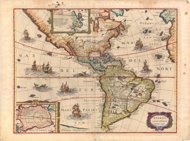
Auction 140, Lot 68
Subject: Western Hemisphere
Boisseau, Jean
America Noviter Delineata, 1636
Size: 19.8 x 15 inches (50.3 x 38.1 cm)
Estimate: $3,250 - $4,250
Rare Boisseau Edition of Hondius' Famous Map of the Americas
Unsold
Closed on 5/23/2012
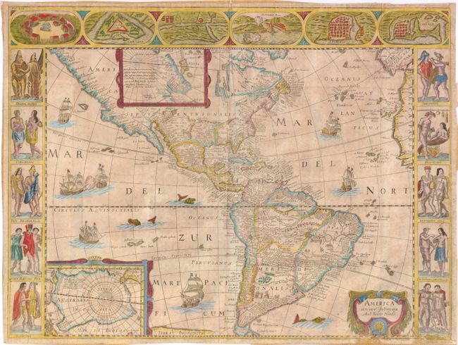
Auction 140, Lot 69
Subject: Western Hemisphere
Anon.
America Noviter Delineata Auct: Judoco Hondio, 1659
Size: 21.5 x 16.2 inches (54.6 x 41.1 cm)
Estimate: $4,000 - $5,500
Very Rare Derivative of Hondius' Map of the Americas
Unsold
Closed on 5/23/2012
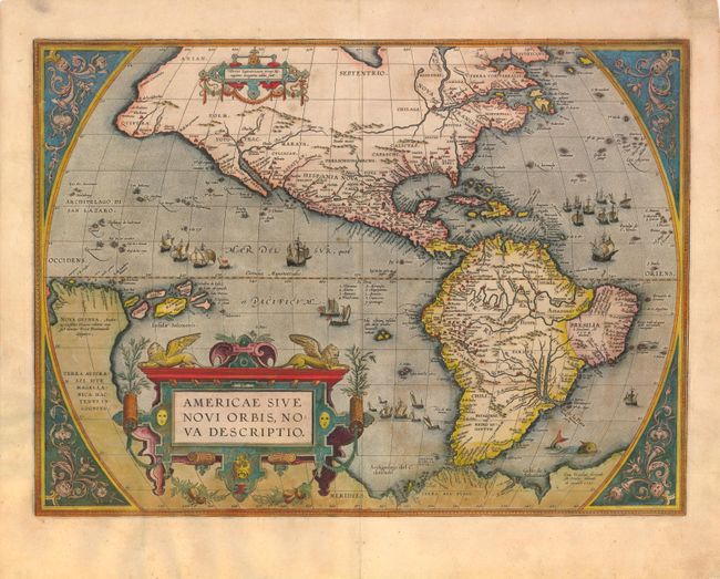
Auction 140, Lot 79
Subject: Western Hemisphere
Ortelius, Abraham
Americae sive Novi Orbis, Nova Descriptio, 1587
Size: 19.3 x 14 inches (49 x 35.6 cm)
Estimate: $5,000 - $6,000
Ortelius' Influential Map of the New World
Unsold
Closed on 5/23/2012
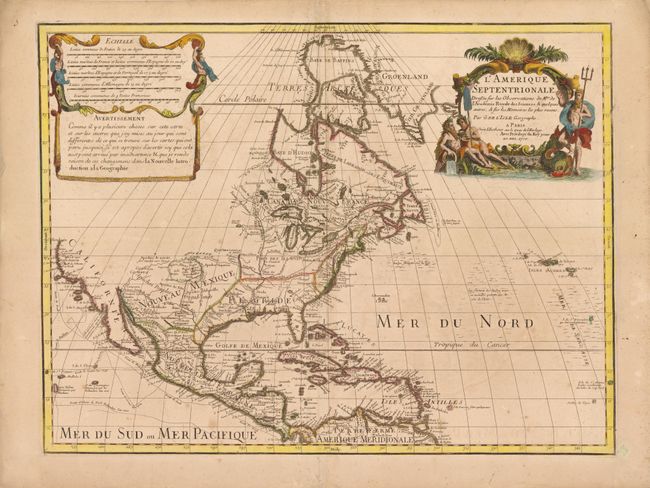
Auction 140, Lot 85
Subject: North America
Delisle, Guillaume
L'Amerique Septentrionale Dressee sur les Observations de Mrs. de l'Academie Royale des Sciences…, 1700
Size: 23.8 x 18 inches (60.5 x 45.7 cm)
Estimate: $2,000 - $2,500
Delisle's Foundation Map of North America
Unsold
Closed on 5/23/2012
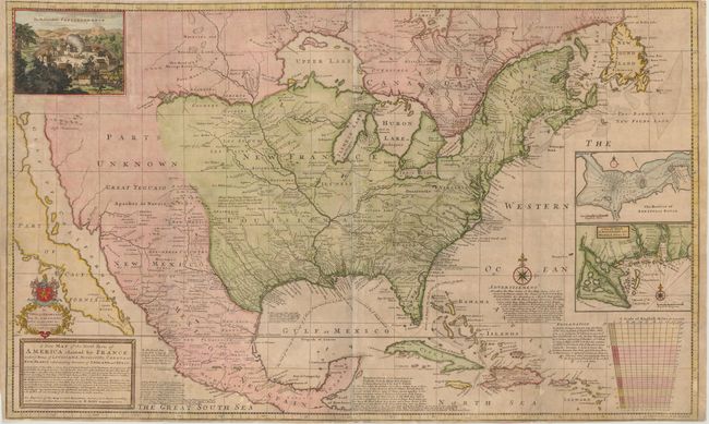
Auction 140, Lot 87
Subject: North America
Moll, Herman
A New Map of the North Parts of America Claimed by France under ye Names of Louisiana, Mississipi, Canada and New France with ye Adjoyning Territories of England and Spain, 1720
Size: 39.8 x 24.3 inches (101.1 x 61.7 cm)
Estimate: $4,500 - $5,500
First State of Moll's Map of North America
Sold for: $5,500
Closed on 5/23/2012
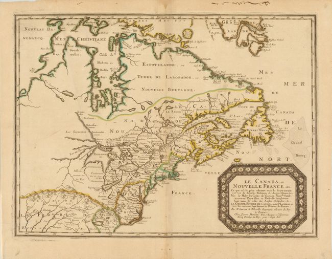
Auction 140, Lot 109
Subject: Colonial United States and Canada - Great Lakes
Sanson, Nicolas
Le Canada, ou Nouvelle France, &c., 1656
Size: 21.5 x 15.8 inches (54.6 x 40.1 cm)
Estimate: $4,750 - $6,000
Keystone Map for Great Lakes Collections
Sold for: $3,000
Closed on 5/23/2012
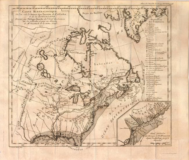
Auction 140, Lot 112
Subject: Colonial United States and Canada, Switzerland and Geology
Guettard, Jean Etienne
Carte Mineralogique, ou l'on voit la Nature des Terreins de Canada et de la Louisiane, Dressee par Philippe Buache…1752 [and] Carte Mineralogique de la Suisse par Philippe Buache pour servir aux recherches et pour un Memoire de Mr. Guettard en 1572, 1761
Size: 12 x 10.5 inches (30.5 x 26.7 cm)
Estimate: $1,300 - $1,800
Unsold
Closed on 5/23/2012
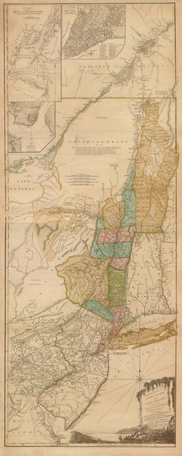
Auction 140, Lot 117
Subject: Colonial Northeast and Quebec
Sayer & Bennett
The Provinces of New York, and New Jersey; with Part of Pensilvania, and the Province of Quebec. Drawn by Major Holland…, 1776
Size: 20.5 x 53 inches (52.1 x 134.6 cm)
Estimate: $5,500 - $6,500
Thomas Jefferys' Important Revolutionary War Period Map
Unsold
Closed on 5/23/2012
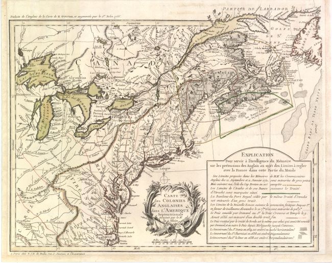
Auction 140, Lot 123
Subject: Eastern Canada & United States
Poilly, N.J.B.
Carte des Colonies Anglaises dans l'Amerique Septentrionale Terminee par la Re. Ohio, 1756
Size: 18.3 x 14.5 inches (46.5 x 36.8 cm)
Estimate: $2,500 - $3,500
An Important French Map Illustrating the Theater of the French and Indian War
Sold for: $1,800
Closed on 5/23/2012
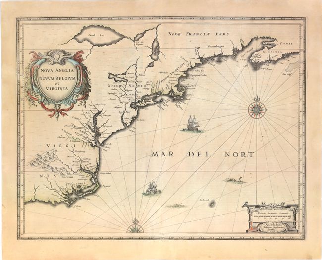
Auction 140, Lot 152
Subject: Colonial New England and Mid-Atlantic
Jansson, Jan
Nova Anglia Novum Belgium et Virginia, 1636
Size: 20 x 15.3 inches (50.8 x 38.9 cm)
Estimate: $1,700 - $2,000
Jansson's Influential Map of the East Coast
Sold for: $1,300
Closed on 5/23/2012
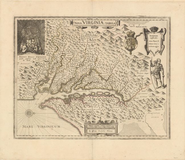
Auction 140, Lot 157
Subject: Colonial Mid-Atlantic
Hondius/Blaeu
Nova Virginiae Tabula, 1642
Size: 19 x 15 inches (48.3 x 38.1 cm)
Estimate: $2,750 - $3,500
One of the Most Important 17th Century Maps of the Chesapeake Bay
Sold for: $2,000
Closed on 5/23/2012
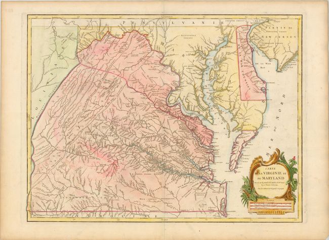
Auction 140, Lot 160
Subject: Mid-Atlantic United States
Robert de Vaugondy, Didier
Carte de la Virginie et du Maryland Dressee sur la Grande Carte Angloise de Mrs. Josue Fry et Pierre Jefferson…, 1793
Size: 25.5 x 19.3 inches (64.8 x 49 cm)
Estimate: $3,000 - $3,500
An Essential Map of Virginia and Maryland
Sold for: $2,100
Closed on 5/23/2012
Auction 140, Lot 170
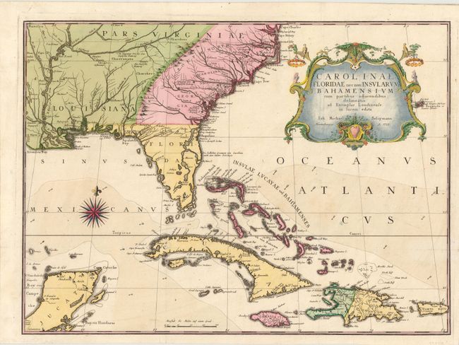
Subject: Colonial Southeast & Bahamas
Seligmann, Johann Michael
Carolinae Floridae nec non Insularum Bahamensium…, 1755
Size: 23 x 16.8 inches (58.4 x 42.7 cm)
Estimate: $5,500 - $6,500
Very Scarce and Important Map of the Southeastern United States
Unsold
Closed on 5/23/2012
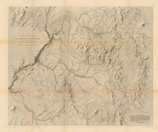
Auction 140, Lot 206
Subject: Southwestern United States
Macomb, J. N. (Col.)
Report of the Exploring Expedition from Santa Fe, New Mexico, to the Junction of the Green Rivers of the Great Colorado of the West, in 1859…, 1876
Size: 9.5 x 12 inches (24.1 x 30.5 cm)
Estimate: $1,500 - $2,000
Sold for: $950
Closed on 5/23/2012
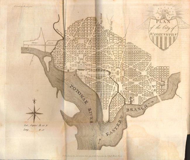
Auction 140, Lot 225
Subject: Washington, D.C.
Good, J.
Plan of the City of Washington, 1793
Size: 10.5 x 9.5 inches (26.7 x 24.1 cm)
Estimate: $2,500 - $3,250
Early British Version of the Thackara & Vallance DC Map
Sold for: $3,000
Closed on 5/23/2012
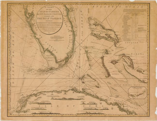
Auction 140, Lot 232
Subject: Southern Florida, Bahamas, Cuba
Faden, William
A Chart of the Gulf of Florida or New Bahama Channel, Commonly Called the Gulf Passage…, 1794
Size: 29 x 23 inches (73.7 x 58.4 cm)
Estimate: $6,000 - $9,000
A Magnificent and Rare Chart of Southern Florida, the Bahamas and Cuba
Sold for: $4,500
Closed on 5/23/2012
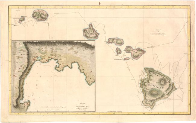
Auction 140, Lot 237
Subject: Hawaii
Cook, James (Capt.)
Chart of the Sandwich Islands, 1785
Size: 18.3 x 11 inches (46.5 x 27.9 cm)
Estimate: $800 - $1,000
The First Printed Map of Hawaii
Sold for: $700
Closed on 5/23/2012
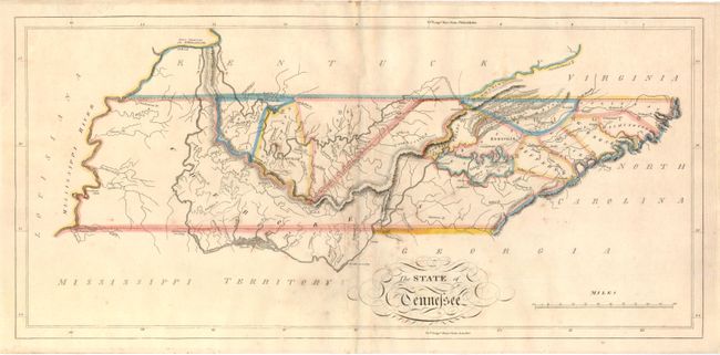
Auction 140, Lot 251
Subject: Tennessee
Carey, Mathew
The State of Tennessee, 1814
Size: 20.8 x 9.8 inches (52.8 x 24.9 cm)
Estimate: $900 - $1,100
Carey's Early Map of Tennessee
Sold for: $650
Closed on 5/23/2012
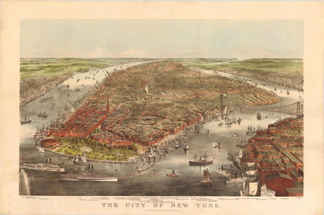
Auction 140, Lot 285
Subject: New York City, New York
Currier & Ives
The City of New York, 1870
Size: 32.8 x 22 inches (83.3 x 55.9 cm)
Estimate: $7,000 - $8,500
Fabulous View of the Brooklyn Bridge Prior to its Completion
Sold for: $4,750
Closed on 5/23/2012
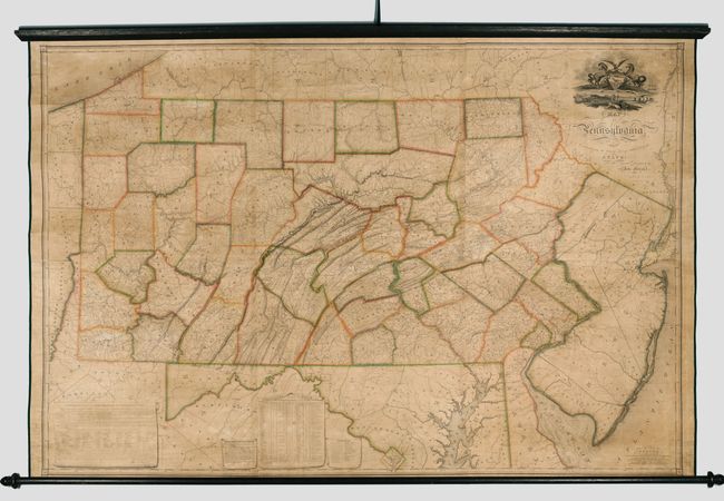
Auction 140, Lot 300
Subject: Pennsylvania
Melish, John
Map of Pennsylvania, Constructed from the County Surveys Authorized by the State; and other Original Documents...Corrected & Improved to 1826, 1826
Size: 73.5 x 42.5 inches (186.7 x 108 cm)
Estimate: $16,000 - $20,000
Melish's Greatest Published Work
Unsold
Closed on 5/23/2012
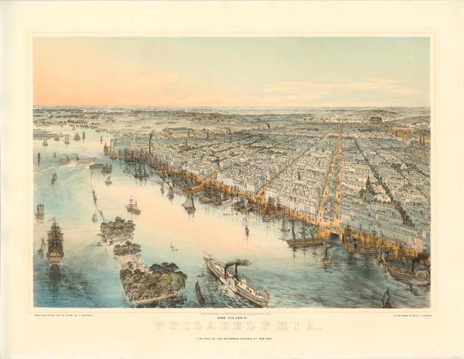
Auction 140, Lot 302
Subject: Philadelphia, Pennsylvania
Bachmann, John
Birds Eye View of Philadelphia, 1850
Size: 27.8 x 21 inches (70.6 x 53.3 cm)
Estimate: $3,750 - $4,500
Stunning View of Philadelphia by John Bachmann
Sold for: $2,750
Closed on 5/23/2012
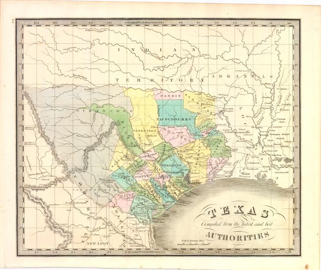
Auction 140, Lot 306
Subject: Texas
Greenleaf, Jeremiah
Texas Compiled from the Latest and Best Authorities, 1842
Size: 13 x 10.8 inches (33 x 27.4 cm)
Estimate: $2,000 - $2,500
Sold for: $1,900
Closed on 5/23/2012
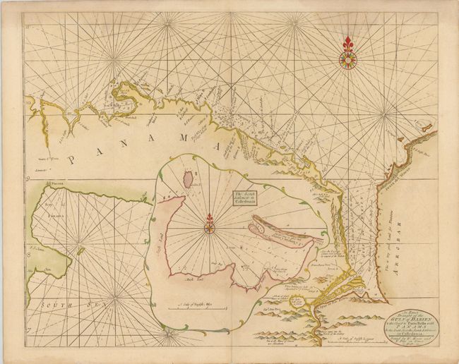
Auction 140, Lot 341
Subject: Panama
Mount & Page
An Exact Draught of the Gulf of Darien & the Coast to Porto Bello with Panama In the South Sea & the Scotch Settlement in Calledonia, 1749
Size: 21 x 17 inches (53.3 x 43.2 cm)
Estimate: $600 - $700
Unsold
Closed on 5/23/2012
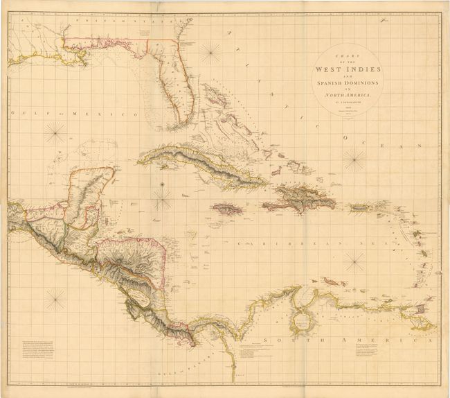
Auction 140, Lot 347
Subject: Gulf of Mexico and Caribbean
Arrowsmith, Aaron, Sr.
[On 2 Sheets] Chart of the West Indies and Spanish Dominions in North America, 1810
Size: 55.1 x 23.8 inches (140 x 60.5 cm)
Estimate: $5,000 - $7,000
The Most Accurate Chart of the West Indies at the Beginning of the 18th Century
Sold for: $3,500
Closed on 5/23/2012
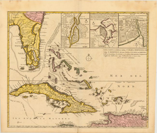
Auction 140, Lot 356
Subject: Florida, Cuba, Bahamas
Ottens, Reiner and Joshua
Nova Tabula Exhibens Insulas Cubam et Hispaniolam vulgo S. Domingo Dictam Insulas Lucaias seu Bahamanas ac Peninsulam Floridae…, 1740
Size: 21.3 x 17.8 inches (54.1 x 45.2 cm)
Estimate: $1,600 - $2,000
Sold for: $1,200
Closed on 5/23/2012
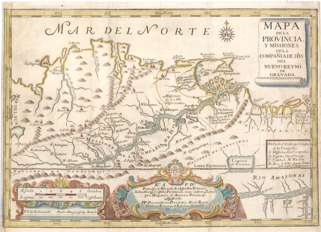
Auction 140, Lot 377
Subject: Northern South America
Mapa de la Provincia, y Missiones de la Compania de IHS del Nuevo Reyno de Granada, 1741
Size: 16 x 11.1 inches (40.6 x 28.2 cm)
Estimate: $1,000 - $1,200
Sold for: $700
Closed on 5/23/2012
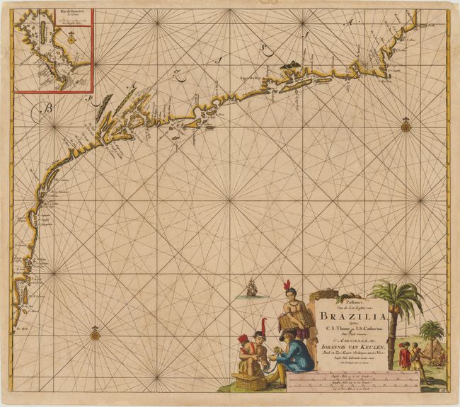
Auction 140, Lot 387
Subject: Brazil
Keulen, Johannes van
Pas-kaart, Van de Zee-Kusten van, Brazilia, Tusschen, C.S. Thome en I.S. Catharina…, 1682
Size: 23 x 20 inches (58.4 x 50.8 cm)
Estimate: $1,500 - $1,700
Sold for: $1,100
Closed on 5/23/2012
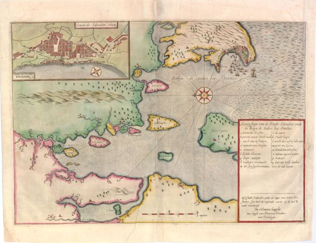
Auction 140, Lot 394
Subject: Salvador, Brazil
Hondius, Henricus
Aenwysinge van de Stadt Salvador, ende de Baya de Todos Los Santtos, 1624
Size: 16.5 x 11.5 inches (41.9 x 29.2 cm)
Estimate: $1,400 - $1,800
Rare contemporary view of the Dutch attack on Salvador
Sold for: $1,000
Closed on 5/23/2012
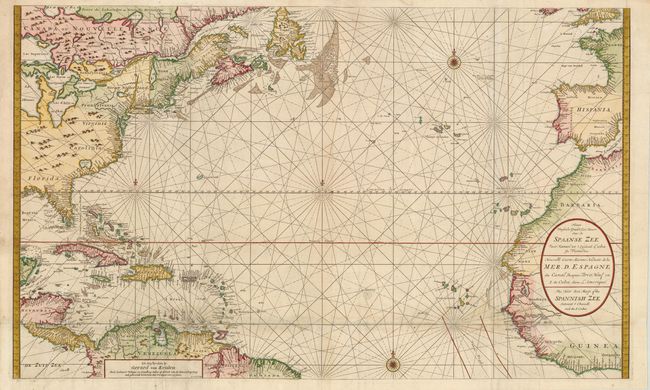
Auction 140, Lot 414
Subject: Atlantic Ocean
Keulen, Gerard van
Nieuwe Wassende Graade Zee Kaart over de Spaanse Zee van't Kanaal tot 't Eyland Cuba in Westindia / Nouvelle Carte Marine Reduite de la Mer. D. Espagne / The New Sea Map of the Spannish Zee, 1710
Size: 39 x 23.5 inches (99.1 x 59.7 cm)
Estimate: $2,400 - $2,750
Unsold
Closed on 5/23/2012
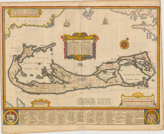
Auction 140, Lot 420
Subject: Bermuda
Speed, John
A Mapp of the Sommer Ilands… / Mappa Aestivarum Insularum…, 1676
Size: 20.8 x 15.8 inches (52.8 x 40.1 cm)
Estimate: $2,300 - $3,000
Unsold
Closed on 5/23/2012
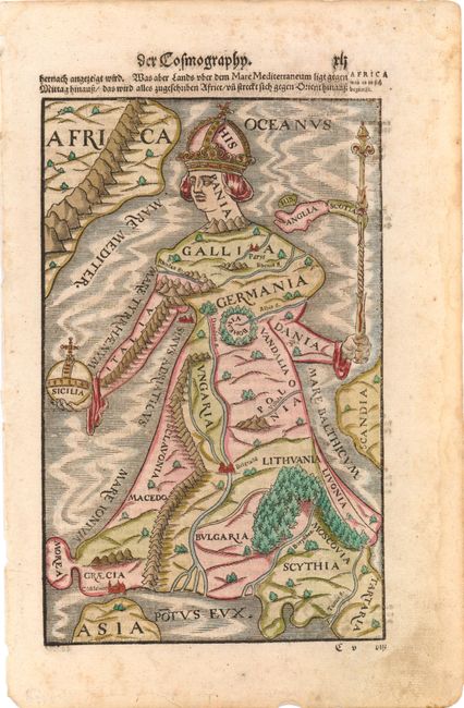
Auction 140, Lot 428
Subject: Europe
Munster, Sebastian
[Europa Regina], 1588
Size: 6.5 x 10 inches (16.5 x 25.4 cm)
Estimate: $1,100 - $1,400
Sold for: $850
Closed on 5/23/2012
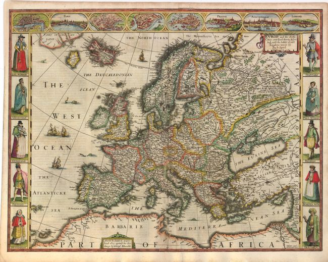
Auction 140, Lot 430
Subject: Europe
Speed, John
Europ, and the Cheife Cities Contayned therein Described; with the Habits of Most Kingdoms Now in Use, 1626
Size: 20 x 15.5 inches (50.8 x 39.4 cm)
Estimate: $3,500 - $4,250
Sold for: $2,500
Closed on 5/23/2012
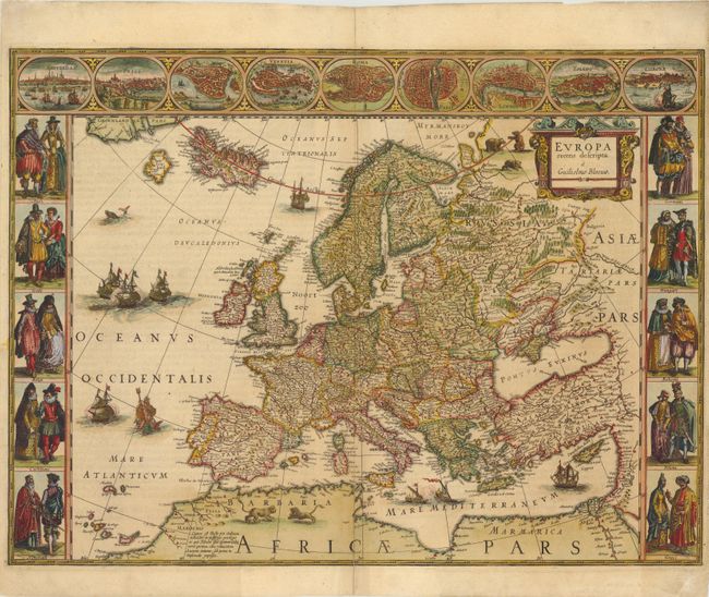
Auction 140, Lot 431
Subject: Europe
Blaeu, Willem
Europa Recens Descripta, 1645
Size: 21.8 x 16.3 inches (55.4 x 41.4 cm)
Estimate: $3,500 - $4,500
Blaeu's Carte-a-Figures Map of Europe
Sold for: $2,500
Closed on 5/23/2012
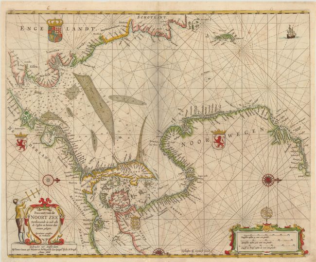
Auction 140, Lot 488
Subject: North Sea
Goos, Pieter
Pascaart van de Noort Zee Verthoonende in zich alle de Custen en havens daer rontom gelegen…, 1669
Size: 22 x 17.5 inches (55.9 x 44.5 cm)
Estimate: $1,600 - $2,000
Sold for: $1,200
Closed on 5/23/2012
83 lots
Page 1 of 2