Subject: World
Period: 1700 (circa)
Publication:
Color: Hand Color
Size:
20.5 x 23.3 inches
52.1 x 59.2 cm
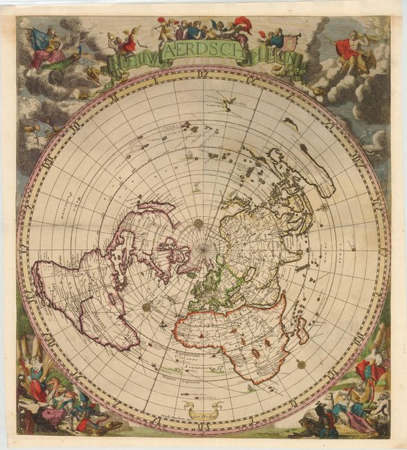
This magnificent world map on a single polar projection was inspired by Cassini's map of 1650. Based on Jacob Robyn and Hendrick Doncker's four-sheet world map, this edition was also likely devised by Andreas van Luchtenburg, with the surrounding allegorical scenes engraved by Jacob Harrewyn. This is the second state with Robyn's imprint replaced with that of Cornelis Danckerts. The map is presented in a circular form on the equidistant azimuthal projection created by Le Mayerne Turquet in 1648, in which the latitudes appear as equidistant concentric circles. In North America, only one Great Lake is depicted, and Nieu Nederland appears on the East Coast as opposed to New York, as it was renamed in 1644. California is shown as an island with a flat northern coastline. In South America, the two mythical lakes Parime Lacus and Xarayes are depicted. Parts of New Zealand and Tasmania are also shown, and Australia is connected to New Guinea.
References: Shirley #582.
Condition: B+
Lovely original color, trimmed to neatlines and remargined on all sides. There is some light soiling, a few faint damp stains, and small abrasions in vignettes. The centerfold has been reinforced on verso with Japanese tissue.