Subject: Ancient World
Period: 1650 (circa)
Publication:
Color: Hand Color
Size:
159.3 x 7.3 inches
404.6 x 18.5 cm
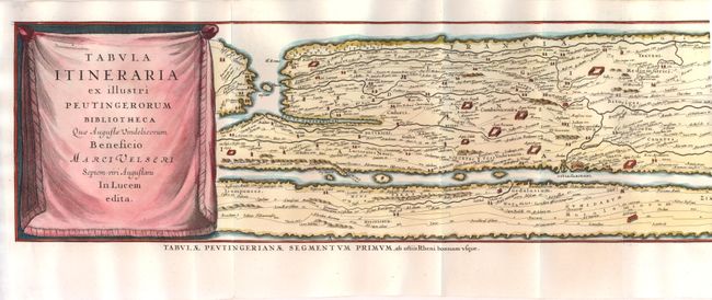
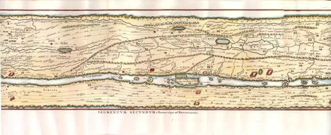
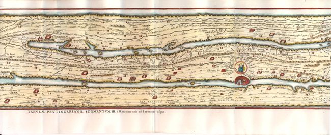
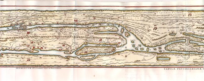
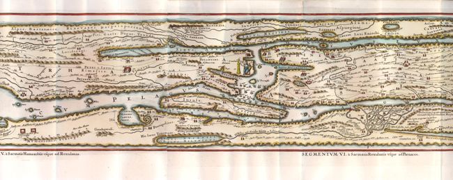
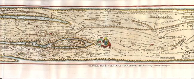
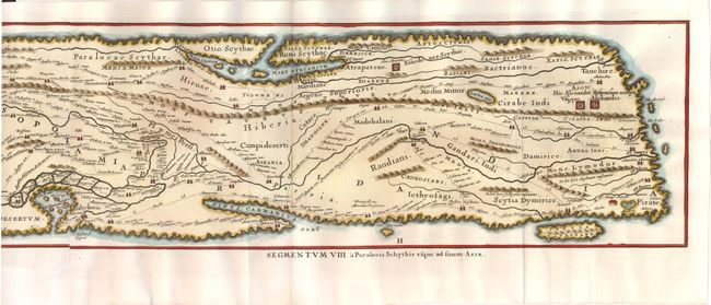
This impressive long map is the famous Peutinger Table, or a Roman road map of the world. The original parchment document was found by Konrad Celtes in a library in Augsburg, came into the hands of Konrad Peutinger and later went to his relative Mark Welser who was the first to publish a copy of it in 1591 at Aldus Manutius in Venice. This map, based on the original manuscript, was first popularized by Ortelius in 1598 and became an important part of his great historical atlas. Jansson's version is nearly identical to that of Ortelius. This decorative strip map depicts the imperial roads and posts within the Roman Empire throughout Europe, North Africa and Asia as far as Toprobana (Sri Lanka). Printed on 8 sheets, now joined.
References: Shirley #393.
Condition: A
Issued folding, with some minor fold separations that have been archivally repaired.