Showing No Reserve Lots(remove filter)
Filtered by Category:United States(Show All Categories)
Showing results for:Auction 157
Catalog Archive
13 lots
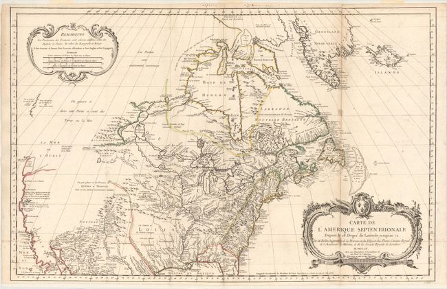
Auction 157, Lot 127
Subject: Colonial United States & Canada
Bellin, Jacques Nicolas
Carte de l'Amerique Septentrionale Depuis le 28 Degre de Latitude Jusqu'au 72, 1755
Size: 34 x 22 inches (86.4 x 55.9 cm)
Estimate: $1,500 - $1,800
NO RESERVE - Bellin's Important, Large Format Map of North America
Sold for: $950
Closed on 5/4/2016
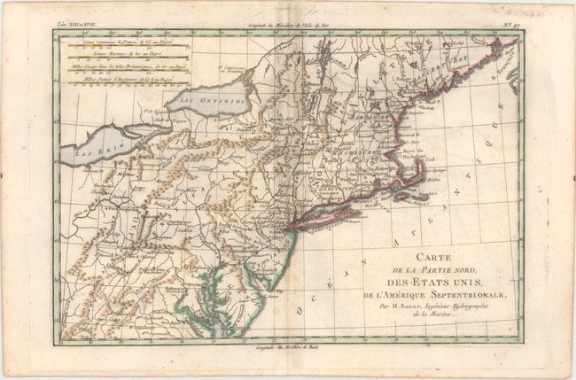
Auction 157, Lot 178
Subject: Colonial New England & Mid-Atlantic
Bonne, Rigobert
Carte de la Partie Nord, des Etats Unis, de l'Amerique Septentrionale, 1782
Size: 12.7 x 8.4 inches (32.3 x 21.3 cm)
Estimate: $80 - $100
NO RESERVE
Sold for: $75
Closed on 5/4/2016
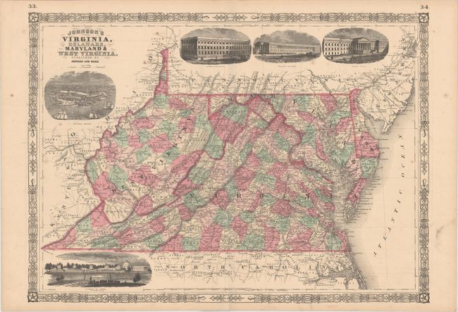
Auction 157, Lot 203
Subject: Mid-Atlantic United States
Johnson & Ward
[Lot of 2] Johnson's Virginia, Delaware, Maryland & West Virginia [and] Johnson's Delaware and Maryland, 1864
Size: See Description
Estimate: $60 - $80
NO RESERVE
Sold for: $75
Closed on 5/4/2016
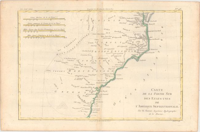
Auction 157, Lot 209
Subject: Colonial Southeast United States
Bonne, Rigobert
Carte de la Partie Sud des Etats Unis de l'Amerique Septentrionale, 1780
Size: 12.6 x 8.4 inches (32 x 21.3 cm)
Estimate: $80 - $100
NO RESERVE
Sold for: $31
Closed on 5/4/2016
Auction 157, Lot 220
Subject: Southern United States, Civil War
U.S. War Department
[Lot of 2] Map of Portions of Mississippi, Alabama and Georgia... [on sheet with] ... Routes of Marches of the Army of Gen. W.T. Sherman... [and] Map of Parts of Brunswick... [on sheet with] Fort Caswell..., 1891-95
Size: 27.3 x 16.4 inches (69.3 x 41.7 cm)
Estimate: $140 - $170
NO RESERVE
Sold for: $27
Closed on 5/4/2016
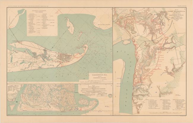
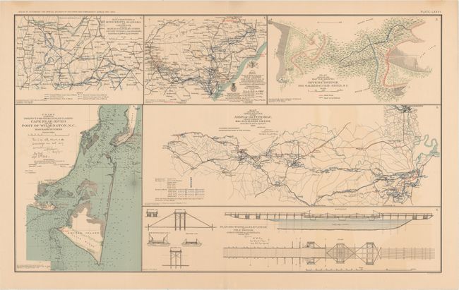
Auction 157, Lot 221
Subject: Southern United States, Civil War
U.S. War Department
[Lot of 2] Galveston, Tex. and Its Fortifications [on sheet with] Map of Siege Operations Against the Defenses of Charleston Harbor... [and] Map Port Hudson, LA. and Vicinity... [and] Coast of Texas and Its Defenses... , 1891-95
Size: 27.3 x 16.4 inches (69.3 x 41.7 cm)
Estimate: $140 - $170
NO RESERVE
Sold for: $220
Closed on 5/4/2016
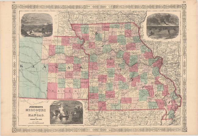
Auction 157, Lot 229
Subject: Central United States
Johnson & Ward
[Lot of 2] Johnson's Missouri and Kansas [and] Johnson's Iowa and Nebraska, 1864
Size: 23.4 x 17.3 inches (59.4 x 43.9 cm)
Estimate: $100 - $130
NO RESERVE
Sold for: $31
Closed on 5/4/2016
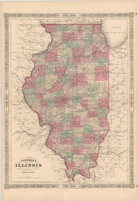
Auction 157, Lot 230
Subject: Central United States
Johnson & Ward
[Lot of 2] Johnson's Illinois [and] Johnson's Indiana, 1864
Size: 17.3 x 23.2 inches (43.9 x 58.9 cm)
Estimate: $60 - $75
NO RESERVE
Sold for: $60
Closed on 5/4/2016
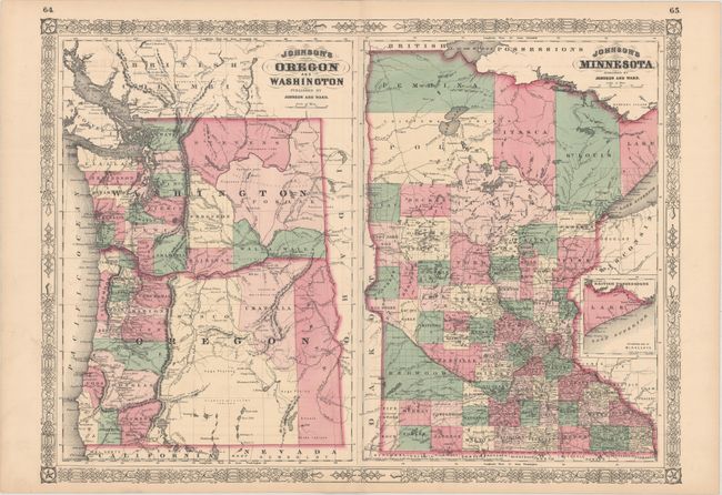
Auction 157, Lot 244
Subject: Northwestern & Central United States
Johnson & Ward
[Lot of 3] Johnson's Oregon and Washington [on sheet with] Johnson's Minnesota [and] Johnson's Wisconsin and Michigan [and] Johnson's Ohio, 1864-65
Size: 23.5 x 17.2 inches (59.7 x 43.7 cm)
Estimate: $80 - $95
NO RESERVE
Sold for: $120
Closed on 5/4/2016
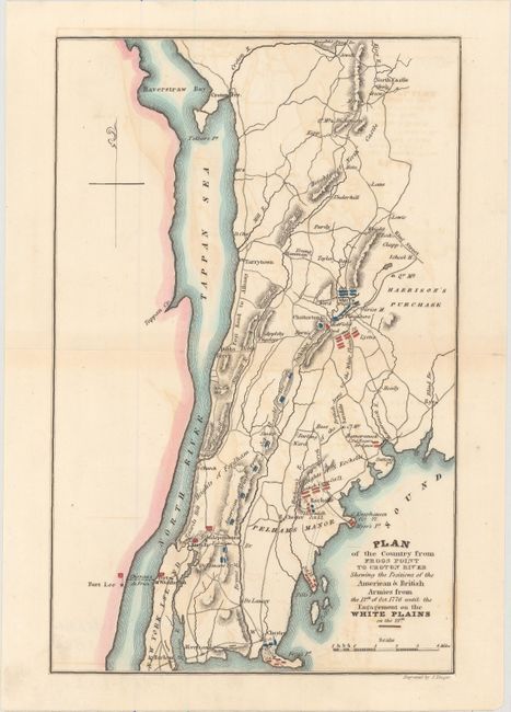
Auction 157, Lot 304
Subject: Southeastern New York, Revolutionary War
Marshall, John
Plan of the Country from Frogs Point to Croton River Shewing the Positions of the American & British Armies from the 12th of Oct. 1776 Until the Engagement on the White Plains on the 28th, 1832
Size: 6.2 x 9.6 inches (15.7 x 24.4 cm)
Estimate: $100 - $130
NO RESERVE
Sold for: $65
Closed on 5/4/2016
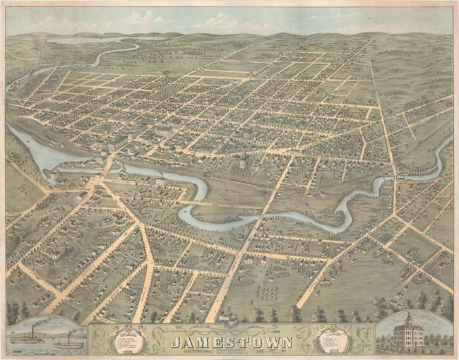
Auction 157, Lot 309
Subject: Jamestown, New York
Birds Eye View of the City of Jamestown Looking North West Chautauqua County New York, 1871
Size: 27.7 x 21.7 inches (70.4 x 55.1 cm)
Estimate: $800 - $1,000
NO RESERVE
Sold for: $475
Closed on 5/4/2016
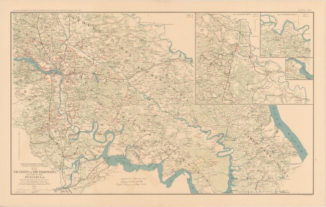
Auction 157, Lot 335
Subject: Virginia, Civil War
U.S. War Department
[Lot of 3] Map of the Vicinity of Richmond, VA... [and] Military Reconnaissance Department of Virginia Major General Wool Commanding... [on sheet with] Yorktown to Williamsburg... [and] Military Map of Suffolk and Vicinity..., 1891-95
Size: 27.3 x 16.4 inches (69.3 x 41.7 cm)
Estimate: $160 - $190
NO RESERVE
Sold for: $60
Closed on 5/4/2016
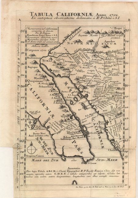
Auction 157, Lot 346
Subject: Southwestern United States & Mexico
Kino, Eusebio Francisco, SJ
Tabula Californiae, Anno 1702. Ex Autoptica Observatione Delineata a R.P. Chino e S.I., 1702
Size: 8.7 x 13.4 inches (22.1 x 34 cm)
Estimate: $1,600 - $2,000
NO RESERVE - Kino's Scarce Second Map of Lower California
Sold for: $500
Closed on 5/4/2016
13 lots