Catalog Archive
Auction 157, Lot 304

NO RESERVE

"Plan of the Country from Frogs Point to Croton River Shewing the Positions of the American & British Armies from the 12th of Oct. 1776 Until the Engagement on the White Plains on the 28th", Marshall, John

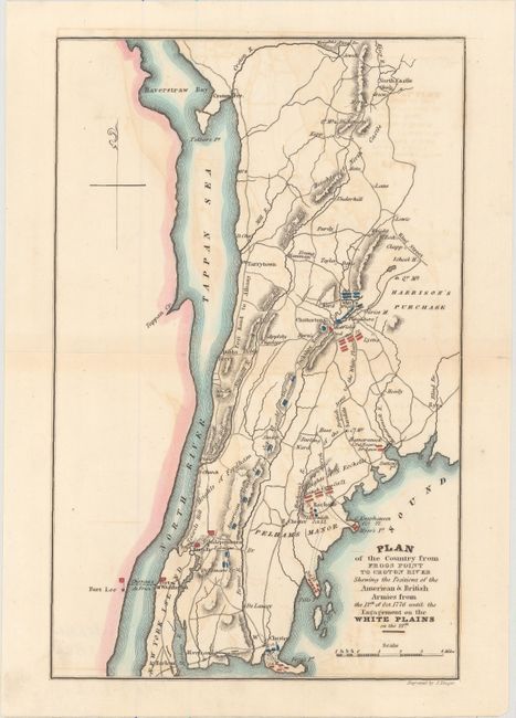
Subject: Southeastern New York, Revolutionary War

Period: 1832 (circa)

Publication: Marshall's Life of Washington

Color: Hand Color

Size:
6.2 x 9.6 inches
15.7 x 24.4 cm
Download High Resolution Image
(or just click on image to launch the Zoom viewer)

This handsome Revolutionary War plan centers roughly on White Plains and details the battles and troop positions. The American forces are shown moving northward from a point near present-day Fordham University. Many property owners, roads, ferries, and towns are named. Several notable places are located, including Fort Washington, Dobbs Ferry, Fort Lee, Fort Independence, and Tarrytown. Engraved by J. Yeager.

References:

Condition: B

Faint offsetting with a complete centerfold separation that has been skillfully closed on verso with archival tape.

Estimate: $100 - $130

Sold for: $65

Closed on 5/4/2016

Archived