Subject: Virginia, Civil War
Period: 1891-95 (published)
Publication: Atlas to Accompany the Official Records of the Union and Confederate Armies...
Color: Printed Color
Size:
27.3 x 16.4 inches
69.3 x 41.7 cm
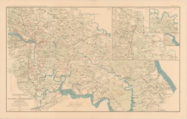
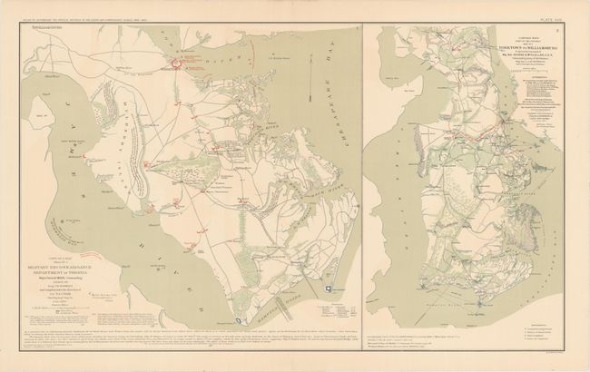
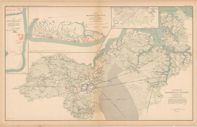
This lot of informative Civil War maps comes from the government's comprehensive atlas covering the War Between the States. These plates were issued between 1891 and 1895 to accompany the Official Army Records and were published under the Secretaries of War Redfield Proctor, Stephen B. Elkins, and Daniel S. Lamont by Maj. Gen. George B. Davis, assisted by civilian experts Leslie Perry and Joseph Kirkley. The first sheet shows the Union and Confederate troops in the counties surrounding Richmond, Virginia, the capital of the Confederacy during the war. An inset expands the scope of the map to cover more land around the Pamunkey River. The two maps on the second sheet focus on Hampton Roads with excellent detail of the fortifications in the area. The third sheet contains four maps, the largest of which also covers the Hampton Roads area, extending to include a large portion of Great Dismal Swamp. Fort Esperanza, Texas, Morris Island, South Carolina, and a small peninsula on the southeast coast of South Carolina are shown in the three smaller maps. Size varies slightly.
A. Map of the Vicinity of Richmond, VA., and Part of the Peninsula.... Condition: Faint color offsetting. (A)
B. Military Reconnaissance Department of Virginia Major General Wool Commanding... [on sheet with] Yorktown to Williamsburg Prepared by Command of Maj. Gen. George B. McClellan, U.S.A.... Condition: Faint offsetting with centerfold separations in the top and bottom blank margins that have been closed on verso with archival tape. (A)
C. Military Map of Suffolk and Vicinity... [on sheet with] Plan of Fort Esperanza, Tex. [and] Map of Morris Island... [and] Proposed Secondary Line of Defenses on the Peninsula Between Ashepoo and Combahee Rivers, S.C.... Condition: There are small chips, short edge tears, and centerfold separations all confined to the blank margins that have been closed on verso with archival materials. Light toning runs along the sheet's edges and the centerfold. (B)
References:
Condition:
See description above.