Catalog Archive
Auction 157, Lot 244

NO RESERVE

"[Lot of 3] Johnson's Oregon and Washington [on sheet with] Johnson's Minnesota [and] Johnson's Wisconsin and Michigan [and] Johnson's Ohio", Johnson & Ward

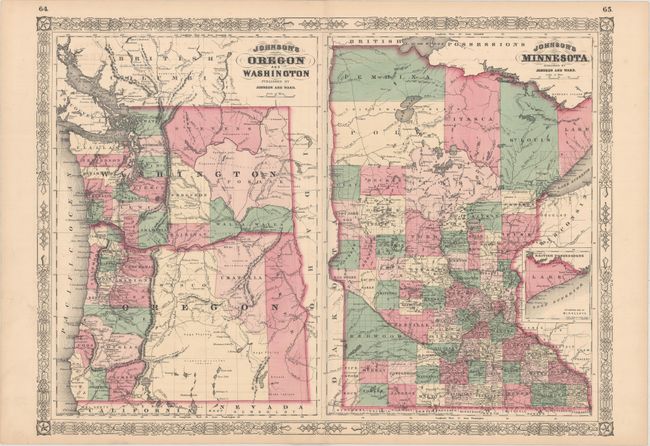
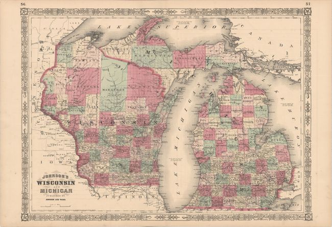
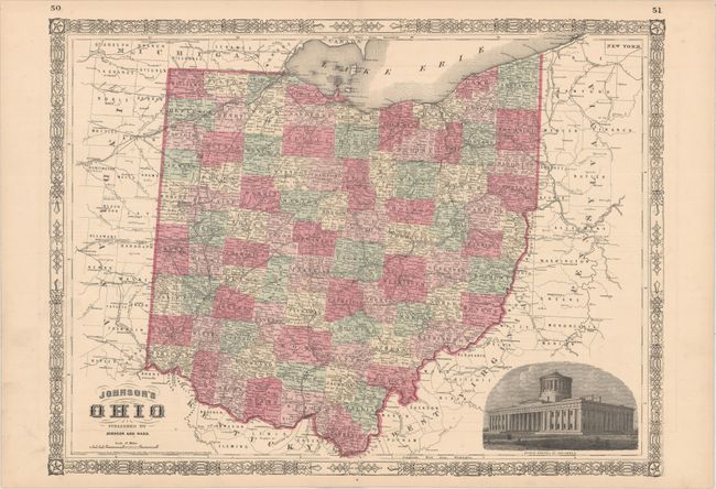
Subject: Northwestern & Central United States

Period: 1864-65 (dated)

Publication: Johnson’s New Illustrated (Steel Plate) Family Atlas

Color: Hand Color

Size:
23.5 x 17.2 inches
59.7 x 43.7 cm
Download High Resolution Image
(or just click on image to launch the Zoom viewer)

These three double-page maps with decorative borders are absolutely filled with details, including county development, towns, roads, railroad routes, trails, forts, and more. County development in Oregon and Washington is circa 1863, with a small Umatilla and a very large Wasco county in Oregon, and Ferguson county still appearing in Washington. Wisconsin is depicted circa 1862, prior to Polk county extending further east into Dallas county. Michigan is depicted circa 1859, prior to the organization of Bleeker County. The map of Ohio includes a vignette of the state capitol in Columbus.

References:

Condition: A

Clean and bright examples with original color and minor offsetting.

Estimate: $80 - $95

Sold for: $120

Closed on 5/4/2016

Archived