Showing Featured Lots(remove filter)
Filtered by Category:United States(Show All Categories)
Showing results for:Auction 129
Catalog Archive
24 lots
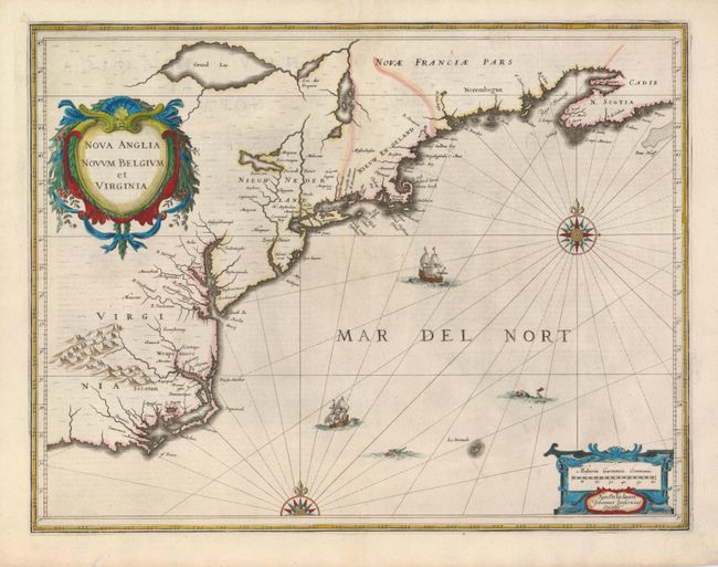
Auction 129, Lot 128
Subject: Colonial New England and Mid-Atlantic
Jansson, Jan
Nova Anglia Novum Belgium et Virginia, 1637
Size: 20 x 15.3 inches (50.8 x 38.9 cm)
Estimate: $1,900 - $2,300
Sold for: $1,400
Closed on 9/23/2009
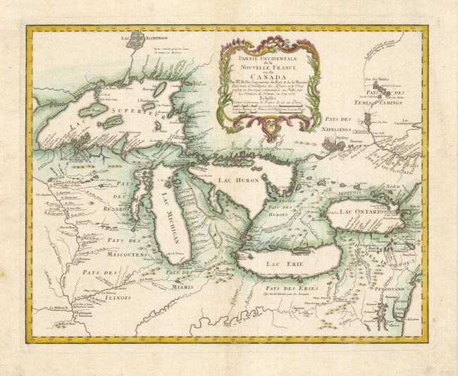
Auction 129, Lot 135
Subject: Great Lakes
Bellin/Homann Heirs
Partie Occidentale de la Nouvelle France ou du Canada, 1755
Size: 21.3 x 16.9 inches (54.1 x 42.9 cm)
Estimate: $2,100 - $2,400
Sold for: $1,300
Closed on 9/23/2009
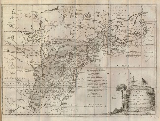
Auction 129, Lot 137
Subject: Colonial United States and Canada
Ridge, John
Map of the British and French Settlements in North America, 1758
Size: 15 x 10.8 inches (38.1 x 27.4 cm)
Estimate: $500 - $700
Sold for: $475
Closed on 9/23/2009
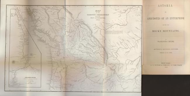
Auction 129, Lot 152
Subject: Western Canada and United States
Wilkes, Charles
Map of the Oregon Territory from the Best Authorities, 1854
Size: 13 x 8 inches (33 x 20.3 cm)
Estimate: $400 - $500
Sold for: $300
Closed on 9/23/2009
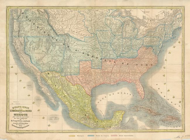
Auction 129, Lot 158
Subject: United States
Le Chevalier, Armand
Etats-Unis de l'Amerique du Nord et Mexique pour Suivre les Operations des Etats Belligerants et de l'Expedition Combinee, 1861
Size: 24 x 17 inches (61 x 43.2 cm)
Estimate: $750 - $850
Sold for: $650
Closed on 9/23/2009
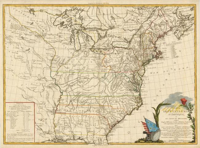
Auction 129, Lot 170
Subject: Eastern United States
Brion de la Tour, Louis
Carte des Etats-Unis d'Amerique et du Cours du Mississipi…, 1784
Size: 27.5 x 20 inches (69.9 x 50.8 cm)
Estimate: $3,000 - $3,750
Sold for: $1,800
Closed on 9/23/2009
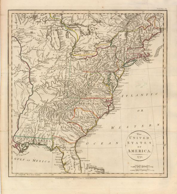
Auction 129, Lot 172
Subject: Eastern United States
Payne, John
The United States of America, 1791
Size: 13.5 x 14.5 inches (34.3 x 36.8 cm)
Estimate: $700 - $1,000
Sold for: $950
Closed on 9/23/2009
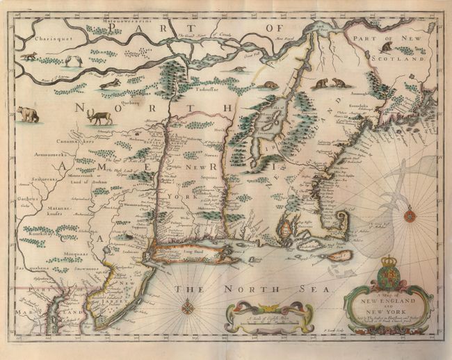
Auction 129, Lot 189
Subject: Colonial New England and New York
Speed/Lamb
A Map of New England and New York, 1676
Size: 19.7 x 15 inches (50 x 38.1 cm)
Estimate: $5,500 - $6,500
Sold for: $3,600
Closed on 9/23/2009
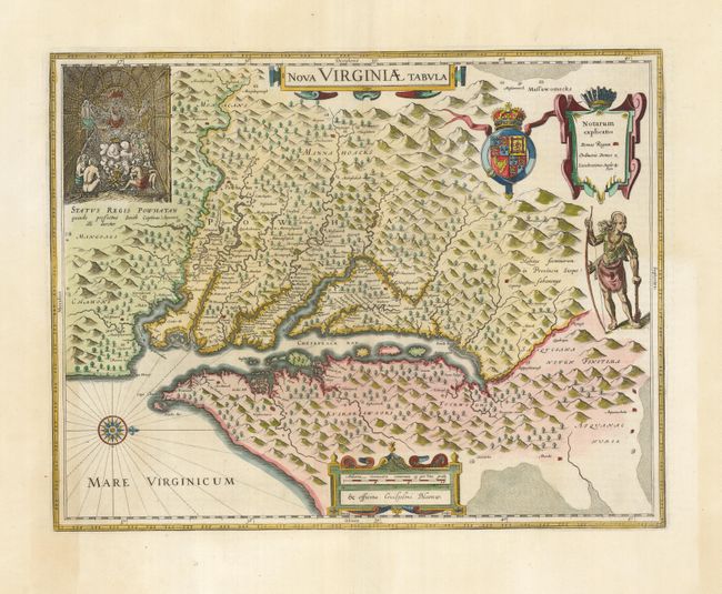
Auction 129, Lot 198
Subject: Colonial Mid-Atlantic
Hondius/Blaeu
Nova Virginiae Tabula, 1662
Size: 18.3 x 14.5 inches (46.5 x 36.8 cm)
Estimate: $2,400 - $3,000
Sold for: $1,800
Closed on 9/23/2009
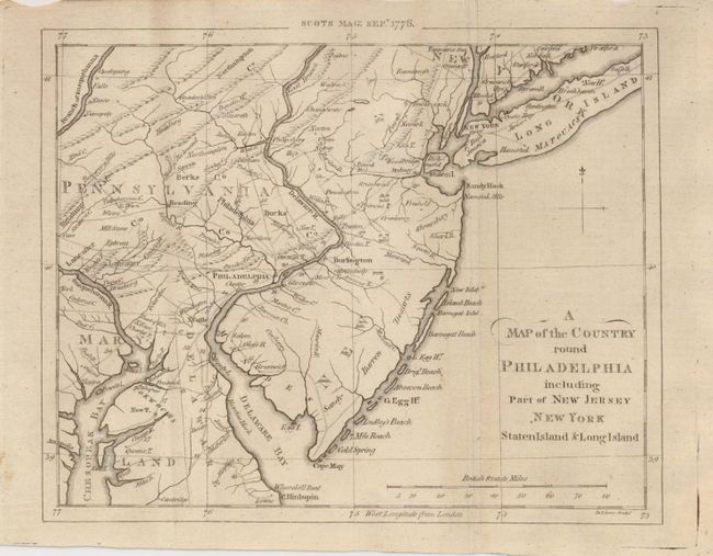
Auction 129, Lot 203
Subject: Colonial Mid-Atlantic
Scots Magazine
A Map of the Country round Philadelphia including Part of New Jersey, New York, Staten Island & Long Island, 1776
Size: 9 x 7 inches (22.9 x 17.8 cm)
Estimate: $250 - $300
Sold for: $210
Closed on 9/23/2009
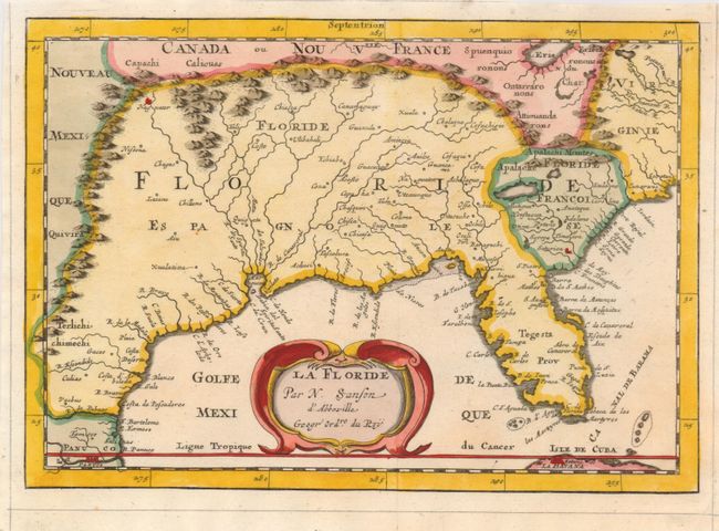
Auction 129, Lot 208
Subject: Colonial South
Sanson, Nicolas
La Floride, 1682
Size: 9.8 x 7 inches (24.9 x 17.8 cm)
Estimate: $500 - $700
Sold for: $850
Closed on 9/23/2009
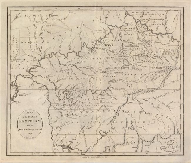
Auction 129, Lot 211
Subject: Southern United States - Kentucky and Tennessee
Reid, John
Map of the State of Kentucky; with the Adjoining Territories, 1795
Size: 17.5 x 14.5 inches (44.5 x 36.8 cm)
Estimate: $1,000 - $1,300
Sold for: $750
Closed on 9/23/2009
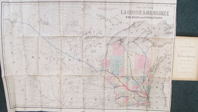
Auction 129, Lot 227
Subject: United States - Midwest
Colton, Joseph Hutchins
Map of the La Crosse & Milwaukee Railroad and Connections, 1857
Size: 33 x 20.5 inches (83.8 x 52.1 cm)
Estimate: $300 - $500
Sold for: $375
Closed on 9/23/2009
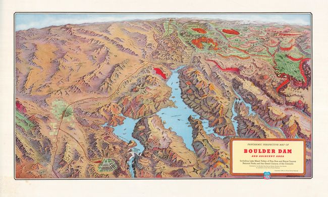
Auction 129, Lot 240
Subject: Southwestern United States
Railroad Companies, (Various)
Panoramic Perspective Map of Boulder Dam and Adjacent Area Including Lake Mead, Valley of Fire, Zion and Bryce Canyon National Parks, and the Grand Canyon of the Colorado, 1938
Size: 30 x 17 inches (76.2 x 43.2 cm)
Estimate: $200 - $300
Sold for: $150
Closed on 9/23/2009
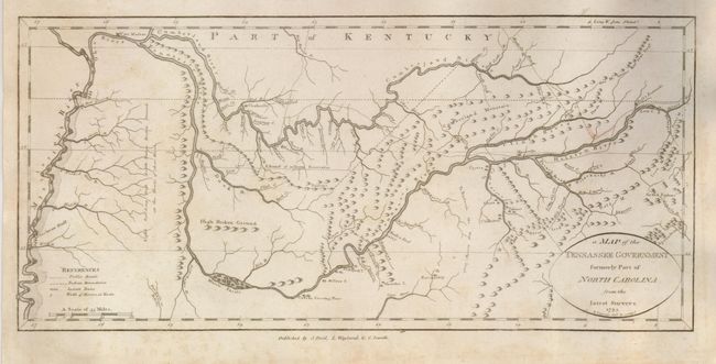
Auction 129, Lot 276
Subject: Tennessee
Reid, John
A Map of the Tennassee Government formerly Part of North Carolina from the latest Surveys, 1795
Size: 15.2 x 7 inches (38.6 x 17.8 cm)
Estimate: $1,100 - $1,400
Sold for: $1,000
Closed on 9/23/2009
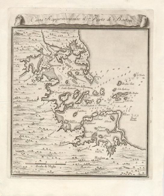
Auction 129, Lot 282
Subject: Boston, Massachusetts
Gazzettiere Americano
Carte Rappresentante il Porto di Boston, 1757
Size: 7 x 7.5 inches (17.8 x 19.1 cm)
Estimate: $250 - $300
Sold for: $190
Closed on 9/23/2009
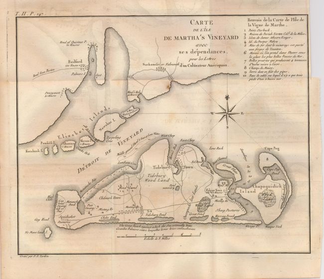
Auction 129, Lot 284
Subject: Massachusetts
Tardieu, Pierre Francois
Carte de l'Ile de Martha's Vineyard avec ses dependances…, 1787
Size: 10.3 x 8.3 inches (26.2 x 21.1 cm)
Estimate: $1,400 - $1,600
Sold for: $1,200
Closed on 9/23/2009
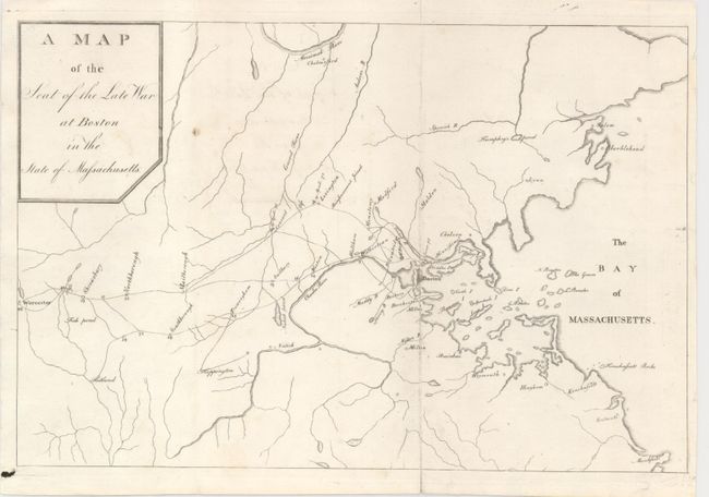
Auction 129, Lot 285
Subject: Boston, Massachusetts
A Map of the Seat of the Late War at Boston in the State of Massachusetts, 1789
Size: 10.2 x 6.8 inches (25.9 x 17.3 cm)
Estimate: $350 - $450
Sold for: $190
Closed on 9/23/2009
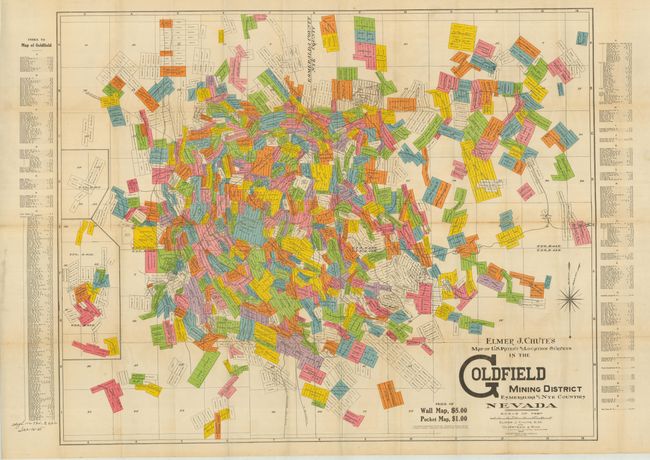
Auction 129, Lot 299
Subject: Nevada
Map of the U.S. Patent and Location Surveys in the Goldfield Mining District Esmeralda and Nye Counties Nevada, 1907
Size: 32 x 20.5 inches (81.3 x 52.1 cm)
Estimate: $450 - $600
Sold for: $375
Closed on 9/23/2009
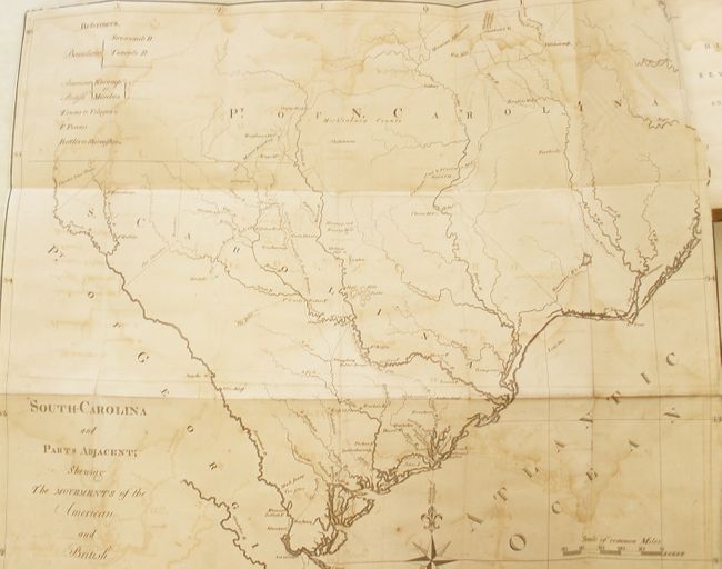
Auction 129, Lot 330
Subject: South Carolina
The History of the Revolution of South Carolina, from a British Province to an Independent State… in Two Volumes, 1785
Size: 5.3 x 8 inches (13.5 x 20.3 cm)
Estimate: $1,600 - $2,000
Sold for: $2,500
Closed on 9/23/2009
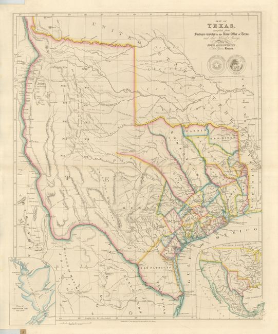
Auction 129, Lot 333
Subject: Texas
Arrowsmith, John
Map of Texas, compiled from Surveys recorded in the Land Office of Texas, and other Official Surveys, 1843
Size: 19.8 x 24 inches (50.3 x 61 cm)
Estimate: $12,000 - $16,000
Sold for: $18,000
Closed on 9/23/2009
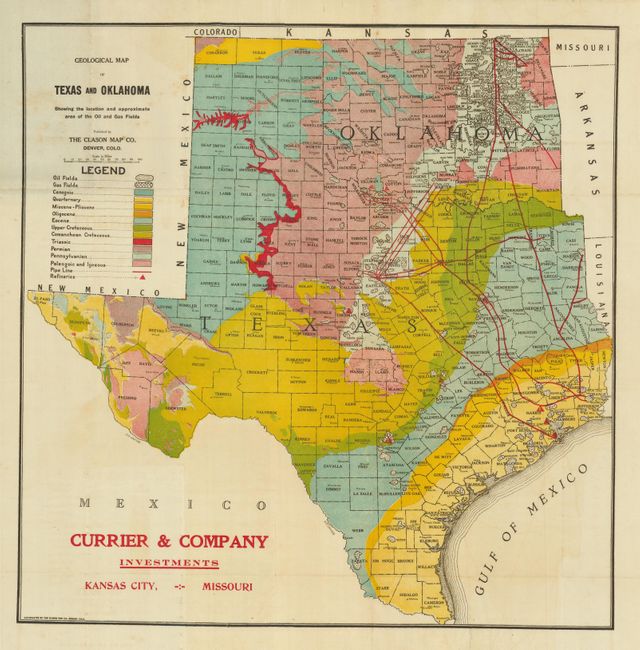
Auction 129, Lot 342
Subject: Texas and Oklahoma
Clason Map Company
Geological Map of Texas and Oklahoma Showing the Location and Approximate Area of the Oil and Gas Fields, 1919
Size: 18 x 20 inches (45.7 x 50.8 cm)
Estimate: $300 - $400
Sold for: $375
Closed on 9/23/2009
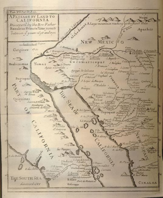
Auction 129, Lot 355
Subject: Southwestern United States, California and Mexico
Kino, Eusebio Francisco, SJ
A Passage by Land to California Discover'd by the Rev. Father Eusebius Francis Kino Jesuite between ye years 1698 and 1701, 1721
Size: 7.8 x 9 inches (19.8 x 22.9 cm)
Estimate: $1,400 - $1,600
Sold for: $1,200
Closed on 9/23/2009
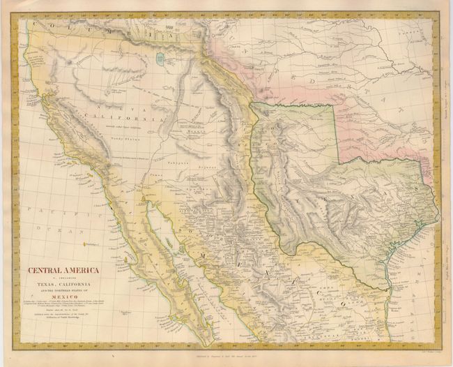
Auction 129, Lot 362
Subject: Southwestern United States, Texas and Mexico
SDUK Society for the Diffusion of Useful Knowledge
Central America II. Including Texas, California and the Northern States of Mexico, 1842
Size: 15.5 x 12 inches (39.4 x 30.5 cm)
Estimate: $500 - $700
Sold for: $600
Closed on 9/23/2009
24 lots