Filtered by Category:Canada(Show All Categories)
Showing results for:Auction 193
Catalog Archive
26 lots
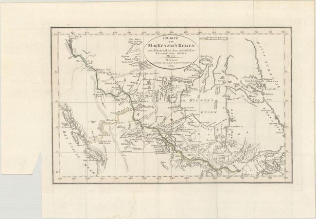
Auction 193, Lot 101
Subject: Canada
Weimar Geographisches Institut
Charte von MacKenzie's Reisen von Montreal zu dem Nordlichen Eis=und dem Stillen Meere, 1802
Size: 11.3 x 7.4 inches (28.7 x 18.8 cm)
Estimate: $140 - $170
Sold for: $140
Closed on 6/21/2023
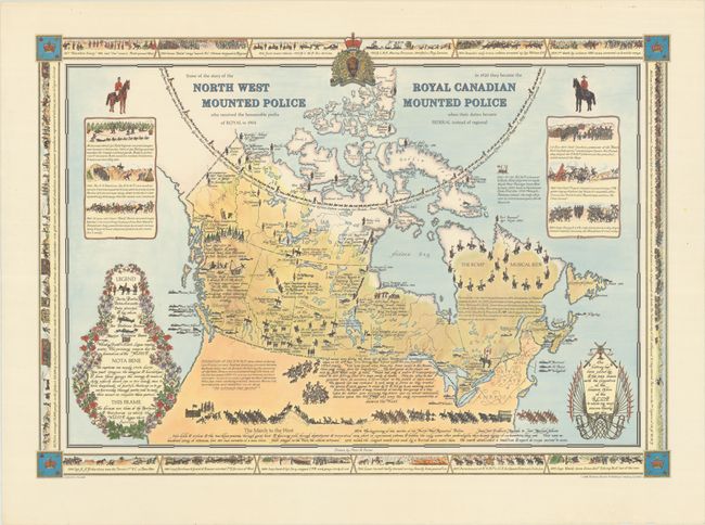
Auction 193, Lot 102
Subject: Canada
Some of the Story of the North West Mounted Police ... In 1920 They Became the Royal Canadian Mounted Police..., 1966
Size: 27.3 x 19.1 inches (69.3 x 48.5 cm)
Estimate: $300 - $375
Rare Pictorial Map Celebrating Canada's Mounties, from the Estate of the Artist
Sold for: $375
Closed on 6/21/2023
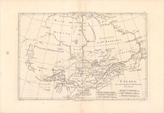
Auction 193, Lot 103
Subject: Eastern Canada
Bonne, Rigobert
Canada, 1788
Size: 13.6 x 9.3 inches (34.5 x 23.6 cm)
Estimate: $110 - $140
Sold for: $80
Closed on 6/21/2023
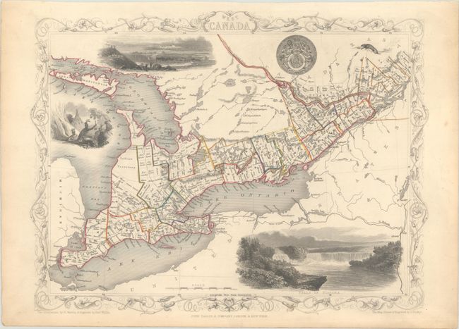
Auction 193, Lot 104
Subject: Eastern Canada, Great Lakes
Tallis, John
West Canada, 1851
Size: 13 x 9.9 inches (33 x 25.1 cm)
Estimate: $110 - $140
Sold for: $80
Closed on 6/21/2023
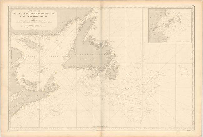
Auction 193, Lot 105
Subject: Eastern Canada
Robiquet, Aime
Carte Generale de l'Ile et des Bancs de Terre-Neuve et du Golfe Saint Laurent..., 1852
Size: 38.6 x 25.9 inches (98 x 65.8 cm)
Estimate: $275 - $350
Sold for: $150
Closed on 6/21/2023
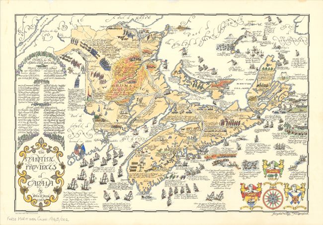
Auction 193, Lot 106
Subject: Eastern Canada
The Maritime Provinces of Canada, 1963
Size: 22 x 14.9 inches (55.9 x 37.8 cm)
Estimate: $475 - $600
Rare Hand Colored Pictorial Map of the Maritimes, from the Estate of the Artist
Sold for: $375
Closed on 6/21/2023
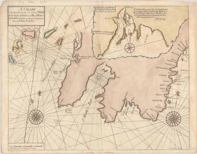
Auction 193, Lot 107
Subject: Newfoundland, Canada
Mount & Page
A Chart Shewing Part of the Sea Coast of Newfoundland from ye Bay of Bulls to Little Plecentia Exactly and Carefully Lay'd Down by Iohn Gaudy, 1748
Size: 21.9 x 17.4 inches (55.6 x 44.2 cm)
Estimate: $325 - $400
Sold for: $170
Closed on 6/21/2023
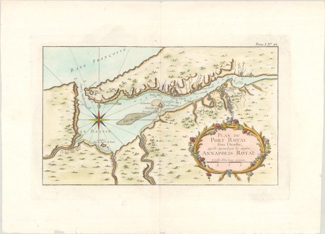
Auction 193, Lot 108
Subject: Nova Scotia, Canada
Bellin, Jacques Nicolas
[Lot of 2] Plan du Port Royal dans l'Acadie, Appelle Aujour d'par les Anglois Annapolis Royal [and] Baye Ste. Anne ou le Port Dauphin dans l'Isle Royale, 1764
Size: 13.3 x 7.9 inches (33.8 x 20.1 cm)
Estimate: $250 - $325
Sold for: $325
Closed on 6/21/2023
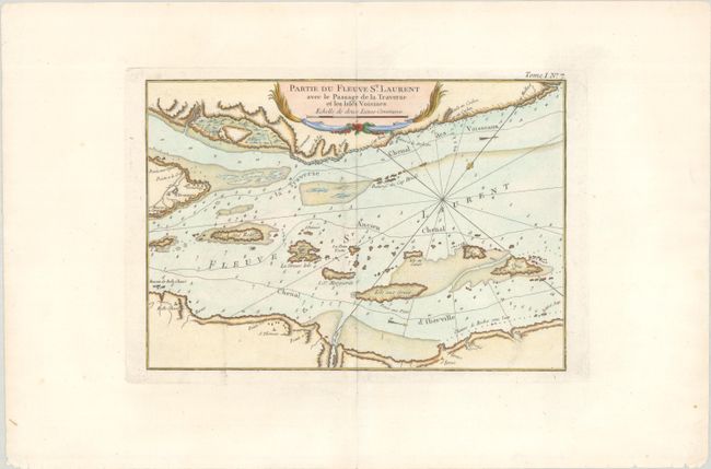
Auction 193, Lot 109
Subject: St. Lawrence River, Canada
Bellin, Jacques Nicolas
[Lot of 2] Partie du Fleuve St. Laurent avec le Passage de la Traverse et les Isles Voisines [and] Partie du Fleuve de Saint Laurent avec le Bassin de Quebec et l'Isle d'Orleans, 1764
Size: 11.9 x 8.3 inches (30.2 x 21.1 cm)
Estimate: $275 - $350
Sold for: $210
Closed on 6/21/2023
Auction 193, Lot 110
Subject: Southeastern Canada
Popple, Henry
[Lot of 2 - A Map of the British Empire in America (Sheets 1 & 2) - Northwestern Ontario & Lower Quebec], 1733
Size: 26.3 x 19.3 inches (66.8 x 49 cm)
Estimate: $1,600 - $1,900
First Two Sheets of Popple's Epic Map
Sold for: $1,200
Closed on 6/21/2023
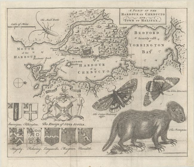
Auction 193, Lot 111
Subject: Halifax, Canada
A Plan of the Harbour of Chebucto and Town of Halifax, 1750
Size: 10.4 x 8.6 inches (26.4 x 21.8 cm)
Estimate: $600 - $750
Sold for: $425
Closed on 6/21/2023
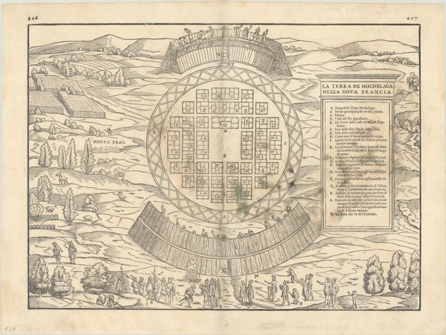
Auction 193, Lot 112
Subject: Montreal, Canada
Gastaldi/Ramusio
La Terra de Hochelaga Nella Nova Francia, 1556
Size: 14.4 x 10.6 inches (36.6 x 26.9 cm)
Estimate: $2,000 - $2,300
The First Published Plan of a Settlement in North America
Sold for: $1,500
Closed on 6/21/2023
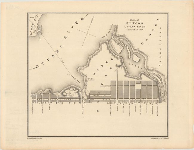
Auction 193, Lot 113
Subject: Ottawa, Ontario
Bouchette, Joseph
Sketch of By Town Ottawa River Founded in 1826, 1832
Size: 8.3 x 7.3 inches (21.1 x 18.5 cm)
Estimate: $160 - $190
Sold for: $120
Closed on 6/21/2023
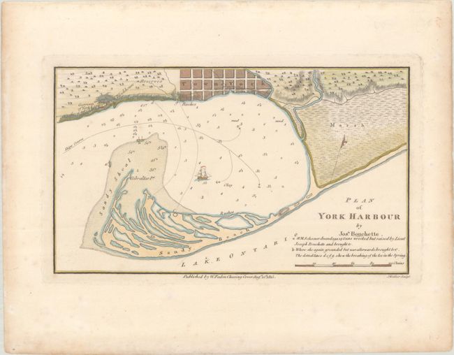
Auction 193, Lot 114
Subject: Toronto, Ontario
Bouchette, Joseph
Plan of York Harbour, 1815
Size: 8.9 x 5.2 inches (22.6 x 13.2 cm)
Estimate: $240 - $300
Early Plan of Toronto
Sold for: $425
Closed on 6/21/2023
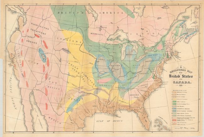
Auction 193, Lot 115
Subject: United States & Canada
Hitchcock, Edward
[Map with Book] A Geological Map of the United States and Canada [with] Outline of the Geology of the Globe, and of the United States in Particular..., 1854
Size: 24.4 x 16.3 inches (62 x 41.4 cm)
Estimate: $400 - $475
Sold for: $300
Closed on 6/21/2023
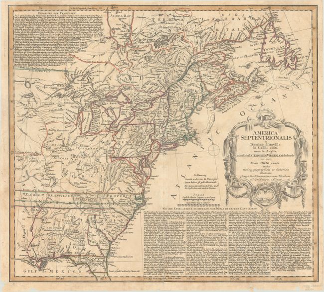
Auction 193, Lot 117
Subject: Colonial Eastern United States & Canada
Homann Heirs
America Septentrionalis a Domino d'Anville in Galliis Edita nunc in Anglia Coloniis in Interiorem Virginiam Deductis nec non Fluvii Ohio Cursu..., 1756
Size: 20.1 x 18.1 inches (51.1 x 46 cm)
Estimate: $550 - $700
Sold for: $550
Closed on 6/21/2023
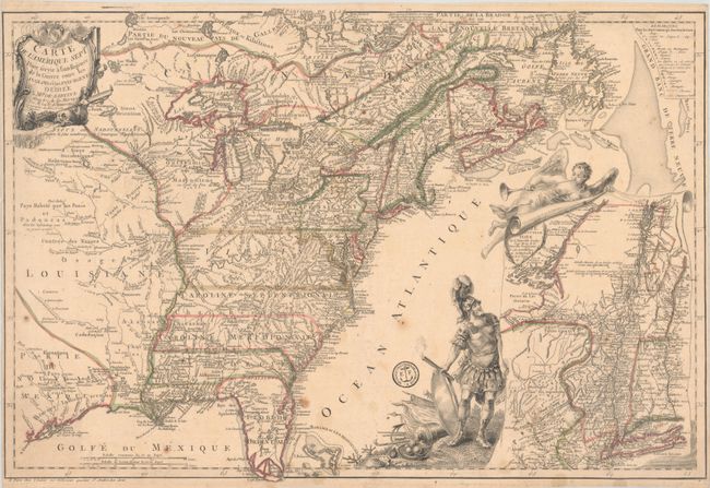
Auction 193, Lot 119
Subject: Colonial Eastern United States & Canada
Beaurain, Jean Chev. De
Carte de l'Amerique Septle pour Servir a l'Intelligence de la Guerre Entre les Anglois et les Insurgents, 1777
Size: 24.4 x 16.4 inches (62 x 41.7 cm)
Estimate: $7,000 - $8,500
Important Map Published Just Prior to France's Entrance in the Revolutionary War
Sold for: $5,000
Closed on 6/21/2023
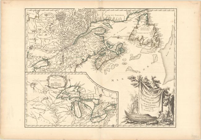
Auction 193, Lot 121
Subject: Colonial Northeastern United States & Canada, Great Lakes
Robert de Vaugondy, Didier
Partie de l'Amerique Septent? qui Comprend la Nouvelle France ou le Canada, 1755
Size: 23.8 x 19 inches (60.5 x 48.3 cm)
Estimate: $600 - $750
Sold for: $450
Closed on 6/21/2023
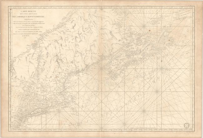
Auction 193, Lot 122
Subject: Colonial Northeastern United States & Canada
Sartine
Carte Reduite des Cotes Orientales de l'Amerique Septentrionale. Contenant Celles des Provinces de New-York et de la Nouvelle Angleterre, Celles de l'Acadie ou Nouvelle Ecosse..., 1780
Size: 34.4 x 23.1 inches (87.4 x 58.7 cm)
Estimate: $800 - $950
Unsold
Closed on 6/21/2023
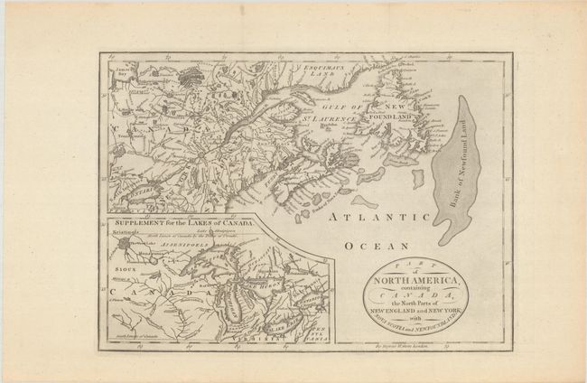
Auction 193, Lot 123
Subject: Northeastern United States & Canada, Great Lakes
Anon.
Part of North America, Containing Canada, the North Parts of New England and New York; with Nova Scotia and Newfoundland, 1794
Size: 11.3 x 8.1 inches (28.7 x 20.6 cm)
Estimate: $160 - $190
Sold for: $180
Closed on 6/21/2023
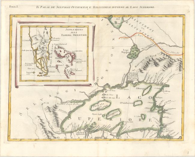
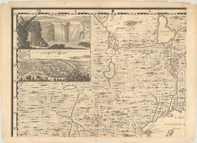
Auction 193, Lot 124
Subject: Colonial Great Lakes & Florida
Zatta, Antonio
Il Paese de Selvaggi Outauacesi, e Kilistinesi Intorno al Lago Superiore, 1778
Size: 16.9 x 12.2 inches (42.9 x 31 cm)
Estimate: $240 - $300
Sold for: $180
Closed on 6/21/2023
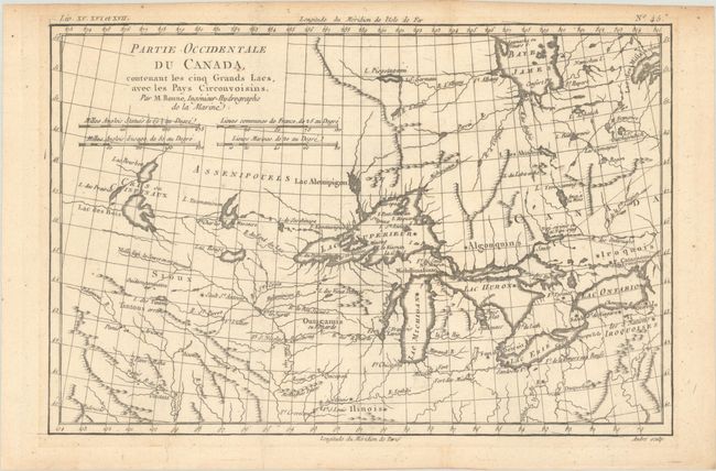
Auction 193, Lot 125
Subject: Colonial Great Lakes
Bonne, Rigobert
Partie Occidentale du Canada, Contenant les Cinq Grands Lacs, avec les Pays Circonvoisins, 1780
Size: 12.8 x 8.5 inches (32.5 x 21.6 cm)
Estimate: $200 - $230
Sold for: $150
Closed on 6/21/2023
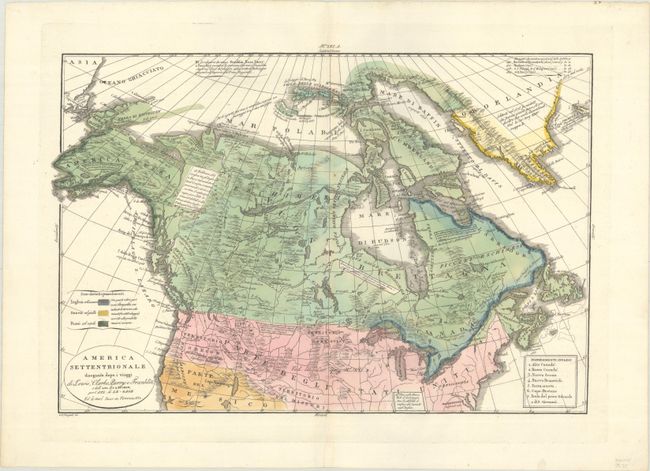
Auction 193, Lot 126
Subject: Northern United States & Canada
Tasso, G.
America Settentrionale Disegnata Dopo i Viaggi di Lewis, Clarke, Parry e Franklin..., 1832
Size: 18.3 x 12.3 inches (46.5 x 31.2 cm)
Estimate: $375 - $450
Sold for: $275
Closed on 6/21/2023
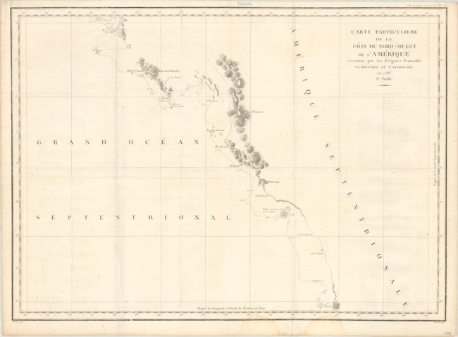
Auction 193, Lot 127
Subject: Western Canada & Alaska
La Perouse, Comte Jean F. Galoup, de
Carte Particuliere de la Cote du Nord-Ouest de l'Amerique Reconnue par les Fregates Francaises la Boussole et l'Astrolabe. en 1786 2e Feuille, 1797
Size: 27.3 x 19.8 inches (69.3 x 50.3 cm)
Estimate: $140 - $170
Sold for: $100
Closed on 6/21/2023
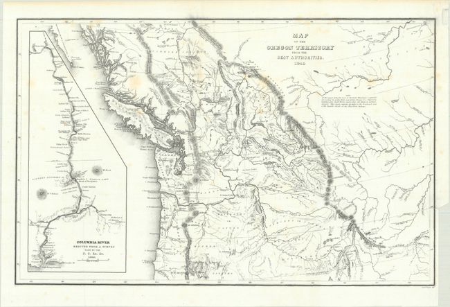
Auction 193, Lot 128
Subject: Northwestern United States & Canada
Wilkes, Charles
Map of the Oregon Territory from the Best Authorities, 1849
Size: 13.3 x 8.5 inches (33.8 x 21.6 cm)
Estimate: $200 - $230
Sold for: $250
Closed on 6/21/2023
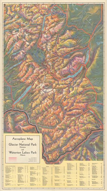
Auction 193, Lot 129
Subject: Glacier National Park, Waterton Lakes & Banff
Railroad Companies, (Various)
[Lot of 2] Aeroplane Map of Glacier National Park Montana and Waterton Lakes Park Alberta [and] The Canadian Rockies - Banff National Park - Yoho Park - Kootenay Park [in] Resorts in the Rockies, 1927-35
Size: See Description
Estimate: $250 - $325
Sold for: $250
Closed on 6/21/2023
26 lots