Subject: Northwestern United States & Canada
Period: 1849 (dated)
Publication:
Color: Black & White
Size:
13.3 x 8.5 inches
33.8 x 21.6 cm
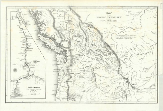
This is a reduced version of one of the most detailed nineteenth century maps of the Northwest region. It covers the entire region west from the Black Hills, north to above the fiftieth parallel, and south to the Sacramento River. Wilkes' expedition did not enter the Great Basin or any part of the Snake River Basin; instead Wilkes relied on other sources including Jedediah Smith and oral information from Hudson Bay trappers he met on the Columbia River. Although the map contains several errors, the areas of today's Oregon, Washington, and Idaho are remarkably well mapped. At left is a large inset of the Columbia River from Ft. Walla Walla to its mouth, where one of Wilkes' ships, the Peacock, was lost on the famous Columbia Bar. According to Wheat, the full version of this map had much influence on later maps of the region. Engraved by Edward Yeager.
References: cf. Wheat (TMW) #457.
Condition: B+
Issued folding on a bright sheet with light foxing and a binding trim at lower right with a tiny associated tear that just enters the map image and has been closed on verso with archival tape.