Subject: St. Lawrence River, Canada
Period: 1764 (circa)
Publication: Le Petit Atlas Maritime
Color: Hand Color
Size:
11.9 x 8.3 inches
30.2 x 21.1 cm
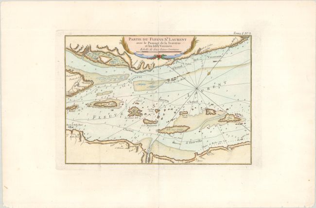
A. Partie du Fleuve St. Laurent avec le Passage de la Traverse et les Isles Voisines. This chart details the St. Lawrence River just northeast of Quebec City and Ile d'Orleans, which is the large unnamed island at far left. The chart shows a number of small islands in the St. Lawrence to the east-northeast of Ile d'Orleans. Three navigable channels are identified -- the Iberville Channel, the "ancient" channel, and the "traverse" channel hugging the northwest shoreline. Rococo-style cartouche at top.
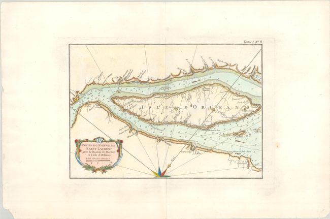
B. Partie du Fleuve de Saint Laurent avec le Bassin de Quebec et l'Isle d'Orleans. This map continues the course up the St. Lawrence River and features good detail of the Ile d'Orleans and locates the fortified city of Quebec to the west. Shows hazards to navigation and soundings in the river. Rhumb lines radiate from a partial compass rose at bottom.
References: Kershaw #661 & 662.
Condition: A
Crisp impressions on bright sheets of watermarked paper. There are some minor edge tears and chips along the bottom sheet edges.