Subject: Colonial Northeastern United States & Canada, Great Lakes
Period: 1755 (dated)
Publication: Atlas Universel
Color: Hand Color
Size:
23.8 x 19 inches
60.5 x 48.3 cm
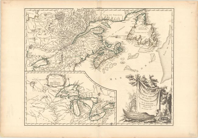
This is the first state of this map depicting Newfoundland, Nova Scotia, and the entire course of the St. Lawrence River. It includes a very large inset of the 1744 Bellin version of the Great Lakes. The wonderful cartouche features the title on a blanket draped over a wooden canoe, which appears beside a threatening beaver. The first state is identifiable by the fact that only "Danby" and "Red I." appear in James Bay and "Ft. de la Presque Isle" is engraved perpendicular to the shore of Lake Erie. Engraved by C. Haussard.
References: Karpinski pp.141-42; Kershaw #354; McCorckle #755.36; Pedley #459; Sellers and Van Ee #61.
Condition: A
A sharp impression with contemporary outline color on a bright sheet with the watermark of a small chapel. There is minor offsetting, a couple of ink spots in the inset, and minor toning along the edges of the sheet.