Current Auction
Rare Map of the State in Contemporary Color Published Two Years After Statehood
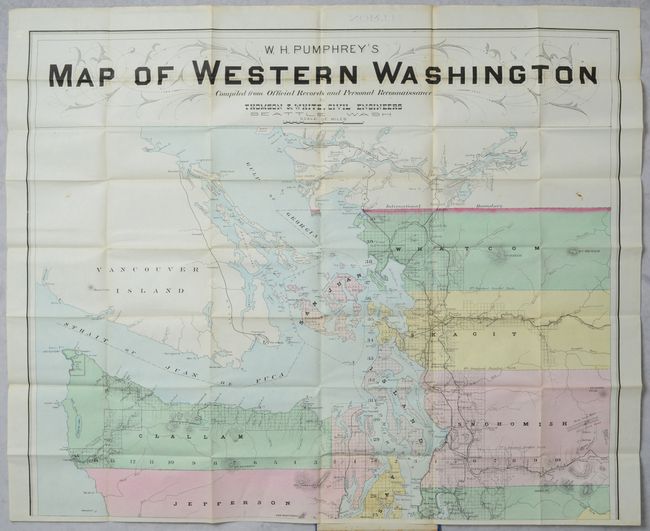
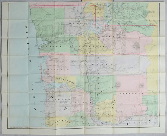
"[On 2 Sheets] W.H. Pumhrey's Map of Western Washington Compiled from Official Records and Personal Reconnaissance"
Subject: Washington
Period: 1891 (dated)
Publication:
Color: Hand Color
Size:
30 x 24.8 inches
76.2 x 63 cm
Download High Resolution Image
(or just click on image to launch the Zoom viewer)
(or just click on image to launch the Zoom viewer)
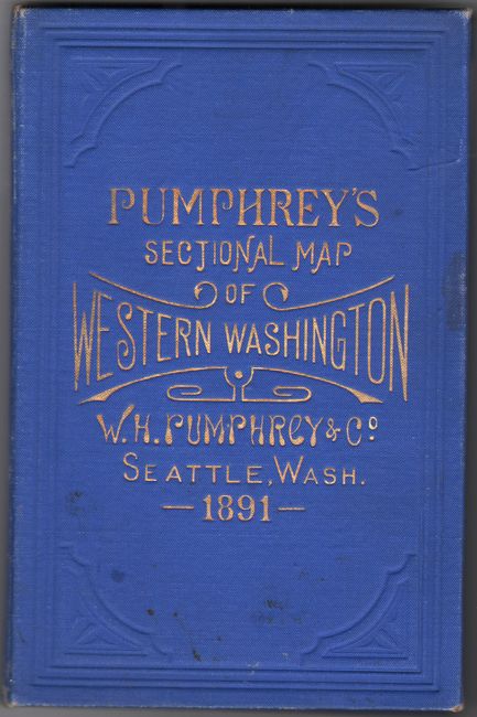
This rare and impressive two-sheet map of western Washington was published 2 years after statehood and drawn by F.M Dehly of the Seattle-based civil engineering firm Thomson & White. It presents the state west of the Cascade Mountains with counties attractively hand-colored (an uncommon practice at this late date) and grid lines indicating the surveyed areas, which was still only about 50% complete at this time. The map has good detail throughout including railroads, rivers, mountain peaks (Rainer, Olympus, Baker, etc.), coal and silver mines, Indian reservations, and much more. It extends south to Oregon as far as Tillamook Bay and Portland and north to include Vancouver. The map was engraved and printed by Edward Noll & Company in Philadelphia and sold by stationer W.H. Pumhrey in Seattle. If joined, the map would measure 30 x 50". Folds into blue cloth boards with gilt title on the front cover. This map is scarce on the market with only 4 sales records in the last 30 years.
References:
Condition: A
Contemporary color on bright sheets with a few spots of foxing and a couple of minor pencil notations. Covers have minor wear and a bit of soiling.
Estimate: $1,800 - $2,200
Current High Bid:
$1,000
Reserve: Reserve Not Met
Next Bid: $1,100
Bid Increments
$1,000 - $2,499$100
$2,500 - $4,999$250
$5,000 - $9,999$500
$10,000 - $24,999$1,000
Terms & Conditions