Subject: Pennsylvania
Period: 1795 (circa)
Publication: Carey's American Edition of Guthrie's Geography Improved
Color: Black & White
Size:
18.3 x 11.6 inches
46.5 x 29.5 cm
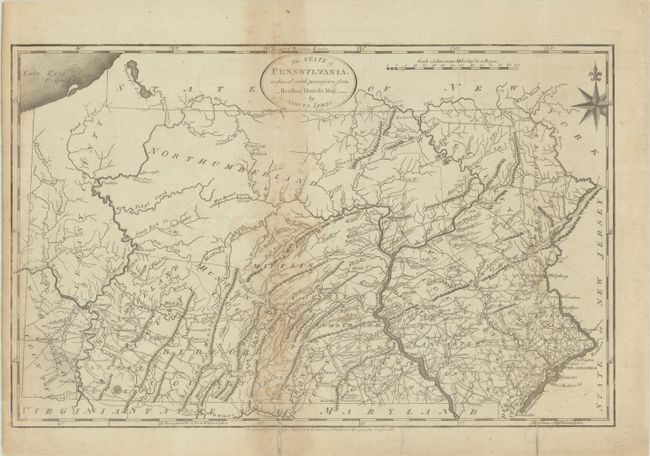
This important map of Pennsylvania was based on Reading Howell's large map of 1792. It is the first detailed map to show the state's proper boundaries and is nicely engraved to show topography, county boundaries, roads, and towns. The important Erie Triangle is included in Pennsylvania, which the federal government sold to Pennsylvania in 1789 and enabled the state to have a freshwater port. Longitude is given from both London and Philadelphia. The map was engraved by James Smither and published in two of Mathew Carey's important early American publications: Carey's General Atlas and The General Atlas for Carey's Edition of Guthrie's Geography Improved (present example).
Mathew Carey was a seminal figure in early American publishing; establishing the first firm to specialize in cartography and issuing the first atlas devoted exclusively to American maps. He set up an elaborate cottage system of craftsmen for compiling, engraving, printing, and coloring maps. This practice was emulated by later American cartographic publishers such as John Melish and Henry S. Tanner. The American Atlas concept was also adopted by other publishers in both the United States and Europe.
References: Ristow, pp.151-153; Wheat & Brun #442.
Condition: B
Issued folding with light toning and offsetting primarily along the central vertical fold. There are archival repairs to a 1" tear at bottom right, an edge tear that just enters the bottom border, and two short fold separations also at bottom.