Subject: California
Period: 1919 (dated)
Publication:
Color: Black & White
Size:
16.5 x 22.1 inches
41.9 x 56.1 cm
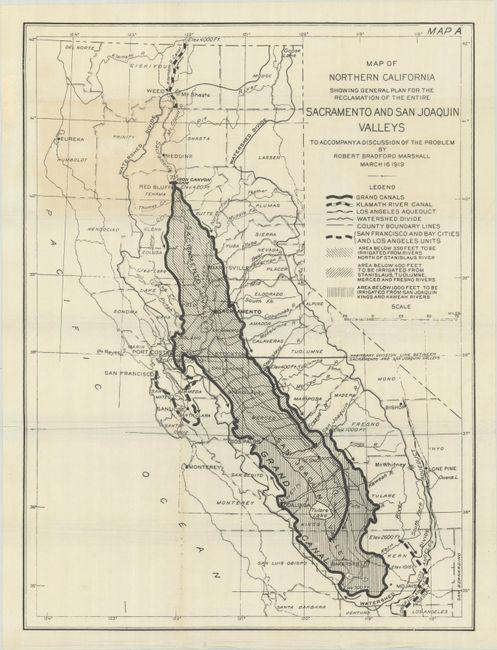
This map was published in the report of Colonel Robert Bradford Marshall, Chief Geographer of the U.S. Geological Survey. Marshall proposed a large-scale plan to transfer water from the Sacramento Valley to the San Joaquin Valley to both prevent water shortages and floods. The map presents most of the state from the northern border to Los Angeles, with "Grand Canals" that would deliver water from the Iron Canyon Dam to the San Joaquin Valley. A legend at left further identifies the Klamath River Canal, Los Angeles Aqueduct, watershed divides, and various elevation levels. The Central Valley Project became the world’s largest water and power project, and an engineering marvel that nurtured the growth of California’s agriculture. Marshall is credited as "The Father of the Central Valley Project."
References:
Condition: B+
Issued folding with light toning in the upper image and some creasing around the fold lines.