Showing Featured Lots(remove filter)
Filtered by Category:United States(Show All Categories)
Showing results for:Auction 190
Catalog Archive
12 lots
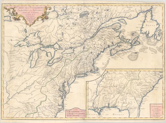
Auction 190, Lot 100
Subject: Colonial Eastern United States & Canada
Longchamp, S. G. (Sieur)
Carte des Possessions Francoises et Angloises dans le Canada, et Partie de la Louisiane, 1756
Size: 30.1 x 21.5 inches (76.5 x 54.6 cm)
Estimate: $1,400 - $1,700
First State of Longchamp's Map of the Theater of the French and Indian War
Sold for: $1,000
Closed on 11/16/2022
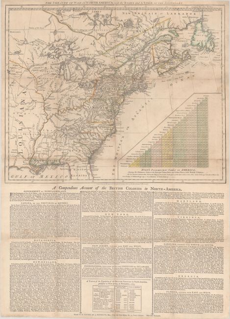
Auction 190, Lot 102
Subject: Colonial Eastern United States & Canada
Sayer & Bennett
The Theatre of War in North America, with the Roads and a Table of the Distances, 1776
Size: 20.1 x 16.1 inches (51.1 x 40.9 cm)
Estimate: $9,500 - $12,000
Early Broadside Informing British Readers of the Brewing War - First State
Sold for: $7,000
Closed on 11/16/2022
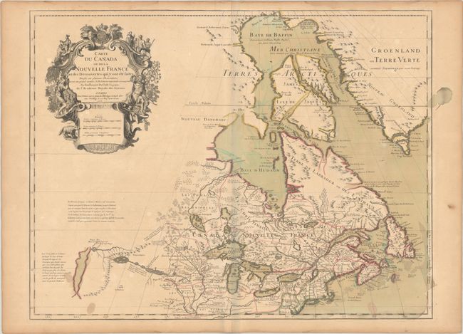
Auction 190, Lot 104
Subject: Colonial Northeastern United States & Canada, Great Lakes
Delisle, Guillaume
Carte du Canada ou de la Nouvelle France et des Decouvertes qui y ont ete Faites..., 1703
Size: 25.6 x 19.6 inches (65 x 49.8 cm)
Estimate: $2,000 - $2,300
Delisle's Seminal Map of Canada and the Great Lakes in Contemporary Color
Sold for: $1,100
Closed on 11/16/2022
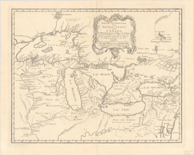
Auction 190, Lot 111
Subject: Colonial Great Lakes
Bellin/Homann Heirs
Partie Occidentale de la Nouvelle France ou du Canada, 1755
Size: 21.3 x 16.9 inches (54.1 x 42.9 cm)
Estimate: $1,600 - $1,900
Influential Map of the Great Lakes
Sold for: $2,100
Closed on 11/16/2022
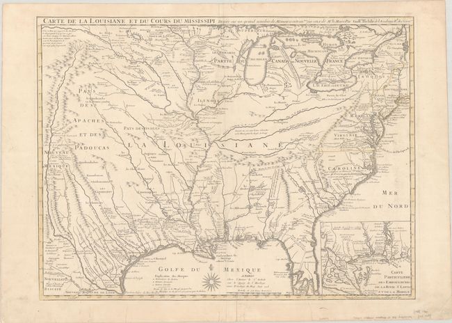
Auction 190, Lot 128
Subject: Colonial Eastern United States, Louisiana Territory
Delisle/Buache
Carte de la Louisiane et du Cours du Mississipi Dressee sur un Grand Nombre de Memoires Entrautres sur ceux de Mr. le Maire, 1745
Size: 25.4 x 19.1 inches (64.5 x 48.5 cm)
Estimate: $1,800 - $2,200
Buache Edition of Delisle's Influential Map of the Louisiana Territory
Sold for: $900
Closed on 11/16/2022
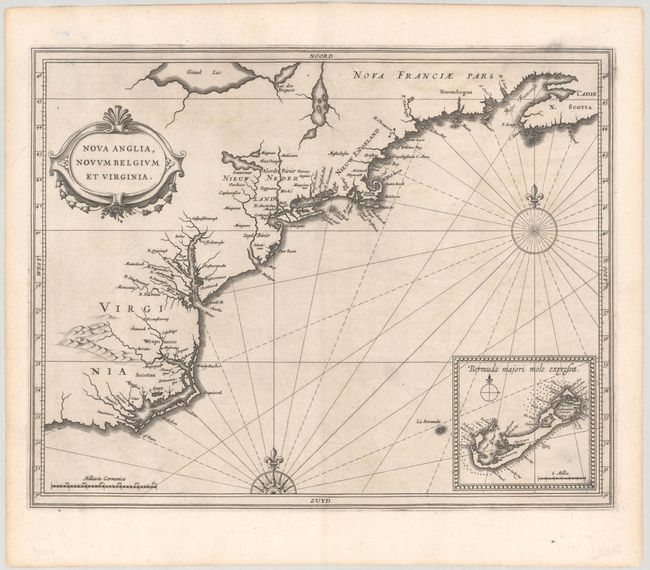
Auction 190, Lot 132
Subject: Colonial New England & Mid-Atlantic United States
Gerritsz/De Laet
Nova Anglia, Novum Belgium et Virginia, 1630
Size: 14 x 11 inches (35.6 x 27.9 cm)
Estimate: $6,000 - $7,500
A Critically Important Map in the Cartographic Evolution of North America
Unsold
Closed on 11/16/2022
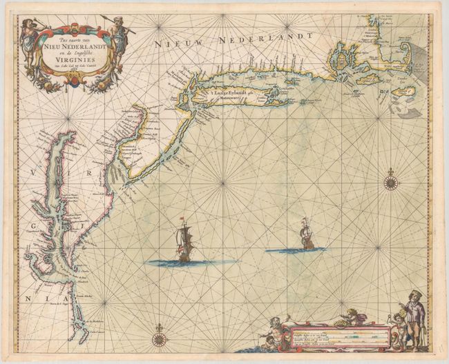
Auction 190, Lot 133
Subject: Colonial New England & Mid-Atlantic United States
Goos, Pieter
Pas Caerte van Nieu Nederlandt en de Engelsche Virginies Van Cabo Cod tot Cabo Canrick, 1666
Size: 20.9 x 16.9 inches (53.1 x 42.9 cm)
Estimate: $7,000 - $8,500
Goos' Gorgeous Chart of the Mid-Atlantic & New England
Unsold
Closed on 11/16/2022
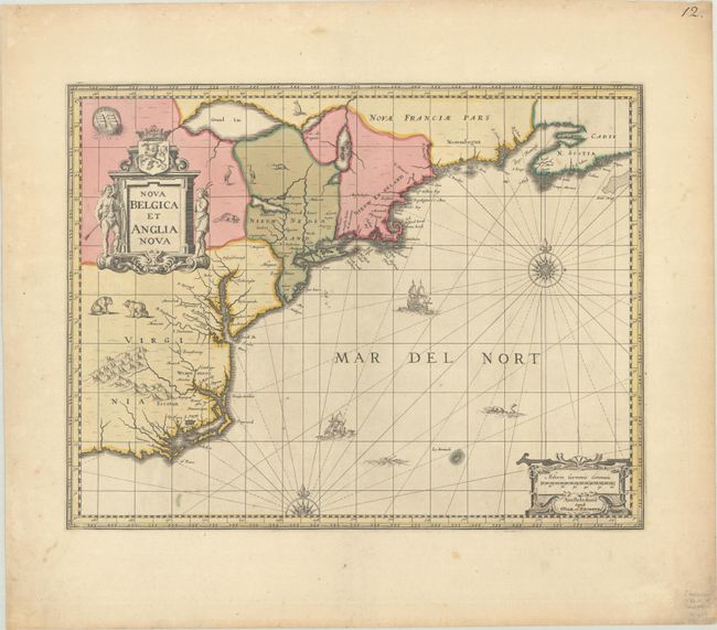
Auction 190, Lot 134
Subject: Colonial New England & Mid-Atlantic United States
Jansson/Valck & Schenk
Nova Belgica et Anglia Nova, 1694
Size: 19.5 x 15.1 inches (49.5 x 38.4 cm)
Estimate: $1,600 - $1,900
Jansson's Influential Map of the East Coast - Valck & Schenk Edition
Sold for: $1,200
Closed on 11/16/2022
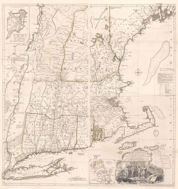
Auction 190, Lot 140
Subject: Colonial New England United States
Jefferys, Thomas
[On 4 Sheets] A Map of the Most Inhabited Part of New England, Containing the Provinces of Massachusets Bay and New Hampshire, with the Colonies of Conecticut and Rhode Island..., 1755
Size: 19.2 x 20.3 inches (48.8 x 51.6 cm)
Estimate: $7,000 - $8,500
Rare State of Jefferys' Influential Map of New England in Contemporary Color
Sold for: $3,250
Closed on 11/16/2022
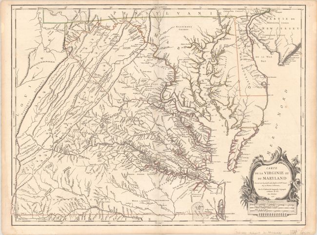
Auction 190, Lot 146
Subject: Colonial Mid-Atlantic United States
Robert de Vaugondy, Didier
Carte de la Virginie et du Maryland Dressee sur la Grande Carte Angloise de Mrs. Josue Fry et Pierre Jefferson..., 1755
Size: 25.4 x 19.1 inches (64.5 x 48.5 cm)
Estimate: $2,500 - $3,250
First State of Robert de Vaugondy's Essential Map of Virginia and Maryland
Sold for: $1,800
Closed on 11/16/2022
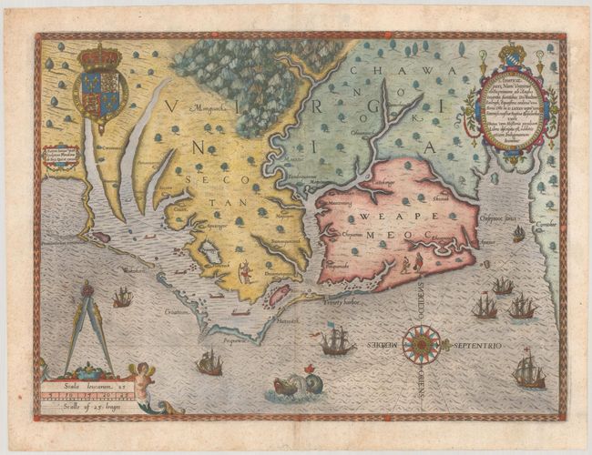
Auction 190, Lot 155
Subject: Colonial Southeast United States
White/De Bry
Americae Pars, nunc Virginia Dicta, Primum ab Anglis Inventa, Sumtibus Dn. Walteri Raleigh..., 1590
Size: 16.2 x 11.8 inches (41.1 x 30 cm)
Estimate: $15,000 - $18,000
The Earliest Collectible Map of Eastern North Carolina & Virginia
Sold for: $12,500
Closed on 11/16/2022
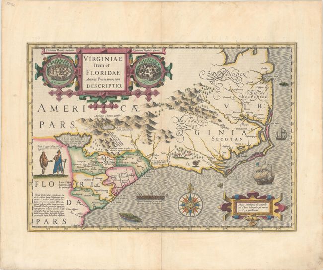
Auction 190, Lot 156
Subject: Colonial Southeast United States
Hondius, Jodocus
Virginiae Item et Floridae Americae Provinciarum, Nova Descriptio, 1628
Size: 19.1 x 13.5 inches (48.5 x 34.3 cm)
Estimate: $2,000 - $2,300
A Seminal Map of the Southeast and Early American Cartography - Full Contemporary Color
Sold for: $3,000
Closed on 11/16/2022
12 lots