Showing Featured Lots(remove filter)
Filtered by Category:North America(Show All Categories)
Showing results for:Auction 164
Catalog Archive
5 lots
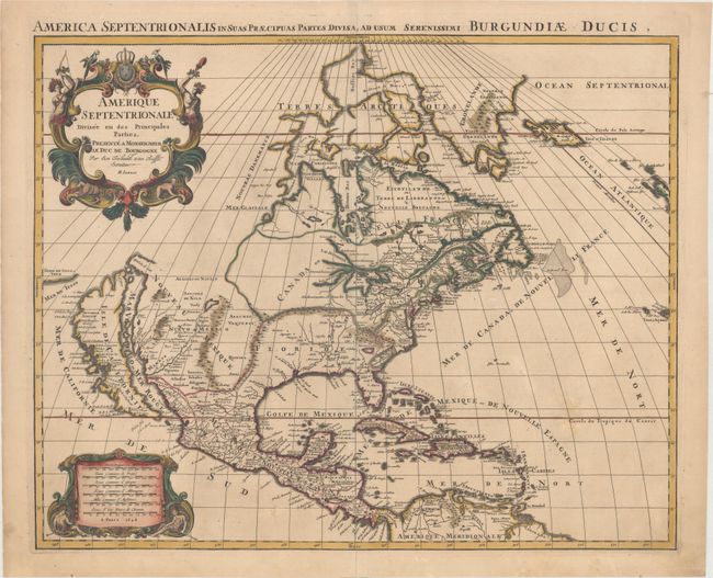
Auction 164, Lot 67
Subject: Colonial North America
Sanson/Jaillot
Amerique Septentrionale Divisee en ses Principales Parties..., 1694
Size: 23 x 18.4 inches (58.4 x 46.7 cm)
Estimate: $2,400 - $3,000
Rare First State with California as an Island
Sold for: $1,900
Closed on 9/13/2017
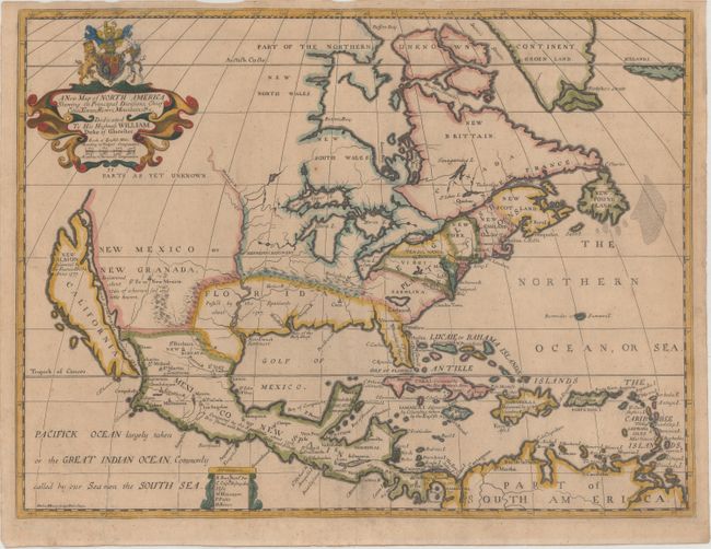
Auction 164, Lot 71
Subject: Colonial North America
Wells, Edward
A New Map of North America Shewing its Principal Divisions, Chief Cities, Townes, Rivers, Mountains, &c., 1704
Size: 19.3 x 14.5 inches (49 x 36.8 cm)
Estimate: $1,400 - $1,700
Wells' Map of North America Featuring California as an Island
Unsold
Closed on 9/13/2017
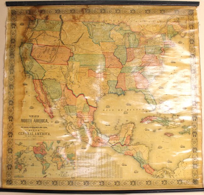
Auction 164, Lot 87
Subject: North America
Monk, Jacob
New Map of That Portion of North America, Exhibiting the United States and Territories, the Canadas, New Brunswick, Nova Scotia, and Mexico, Also, Central America, and the West India Islands..., 1854
Size: 59.1 x 55.6 inches (150.1 x 141.2 cm)
Estimate: $1,100 - $1,400
Large Wall Map Featuring an Enlarged Gold Region of California
Sold for: $700
Closed on 9/13/2017
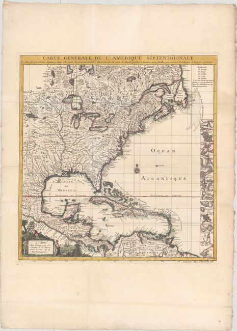
Auction 164, Lot 93
Subject: Colonial Eastern North America & West Indies
Crepy, (Family)
Carte Generale de l'Amerique Septentrionale avec les Possessions Angloises dans Cette Partie du Nouveau Monde, Dressee sur la Carte de Pople..., 1756
Size: 19.4 x 20.2 inches (49.3 x 51.3 cm)
Estimate: $2,000 - $2,300
French Index Sheet of Popple's Map
Unsold
Closed on 9/13/2017
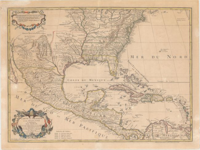
Auction 164, Lot 94
Subject: Colonial Eastern North America & West Indies
Delisle/Dezauche
Carte du Mexique et des Etats Unis d'Amerique, Partie Meridionale. Dressee sur un Grand Nombre de Memoires..., 1783
Size: 26 x 19 inches (66 x 48.3 cm)
Estimate: $1,300 - $1,600
One of the Earliest Maps to Name the United States
Unsold
Closed on 9/13/2017
5 lots