Subject: Colonial North America
Period: 1694 (dated)
Publication: Atlas Royal
Color: Hand Color
Size:
23 x 18.4 inches
58.4 x 46.7 cm
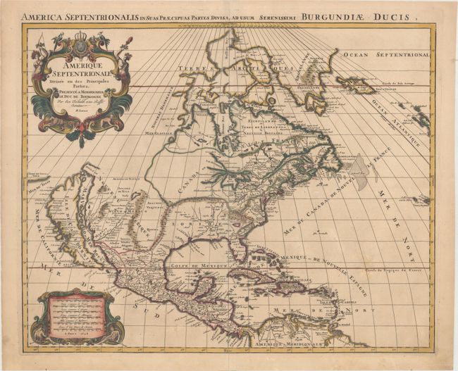
First state of this handsome map showing the island of California with an indented northern coast and the Terre de Iesso Ieco (Japan) just a short distance off its northwestern coast. All five Great Lakes are now shown, with Superior and Michigan open-ended. The Rio del Norte flows incorrectly into the Gulf of California. The lion's share of today's United States is divided between Floride and Nouveau Mexique. The region of present-day South Carolina and Georgia is noted as Floride Francoise. The decorative title cartouche is adorned with the French coat of arms, two Native Americans and tropical birds. The Latin title in upper margin is: "America septentrionalis in suas praecipuas partes divisa, ad usum serenissimi Burgundiae Ducis." Jaillot published a similar map with the same title that is much more commonly found on the market.
References: Burden #700; McLaughlin #113; Wheat (TMW) #74.
Condition: B+
Contemporary outline color in the map that has been partially refreshed, with later color in the cartouches. There is minor soiling and professionally repaired centerfold separations at top and bottom.