Subject: Colonial Eastern North America & West Indies
Period: 1756 (circa)
Publication:
Color: Hand Color
Size:
19.4 x 20.2 inches
49.3 x 51.3 cm
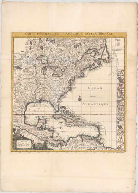
This is the French edition of Popple's key map of 1733, made as an index to his 20-sheet map. This map was initially published separately by Le Rouge in 1742; this edition was made after the Crepy family acquired the plate. The title was changed to reflect the outbreak of the French-Indian War, which occurred in 1756. The map is well-detailed, with excellent representations of topography and waterways, particularly the Mississippi. However, there is a large and spurious lake that is connected to a tributary of the river. The right side of the map is filled with small inset maps of important cities in the Americas, including Boston, New York, Charleston, St. Augustine, Port Royal, Cartagena, and Porto Bello. A decorative cartouche, describing natives and trading occupies the lower left corner.
References: McCorkle #742.2.
Condition: A
Issued folding on watermarked paper with professional repairs to a few tiny holes at fold intersections. The folds have also been professionally reinforced on verso. A minor abrasion in the border at right has also been archivally repaired.