Showing Featured Lots(remove filter)
Filtered by Category:North America(Show All Categories)
Showing results for:Auction 163
Catalog Archive
9 lots
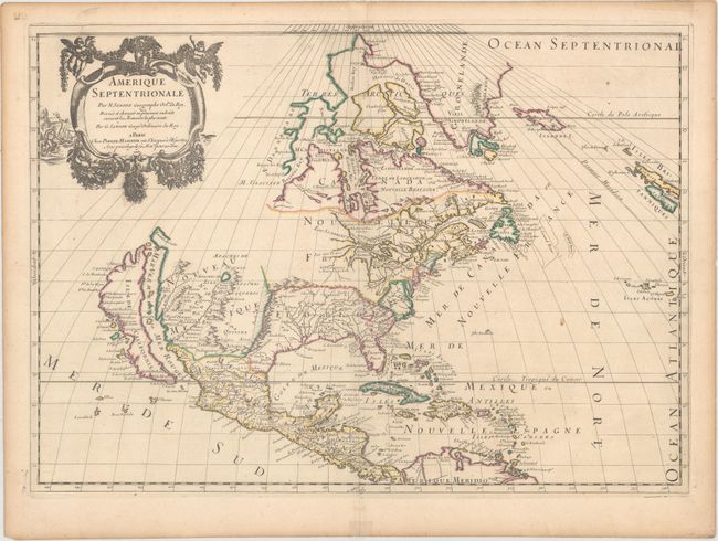
Auction 163, Lot 25
Subject: Colonial North America
Sanson/Mariette
Amerique Septentrionale par N. Sanson..., 1669
Size: 21.9 x 15.6 inches (55.6 x 39.6 cm)
Estimate: $2,400 - $3,000
Important Map for Great Lakes Collectors
Unsold
Closed on 6/14/2017
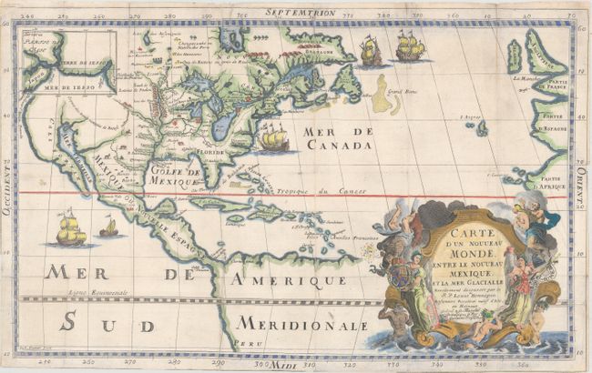
Auction 163, Lot 27
Subject: Colonial North America
Hennepin, Louis de (Fr.)
Carte d'un Nouveau Monde, Entre le Nouveau Mexique, et la Mer Glacialle, 1698
Size: 18.4 x 11.5 inches (46.7 x 29.2 cm)
Estimate: $2,750 - $3,500
Hennepin's Important, Updated Map of North America
Sold for: $1,600
Closed on 6/14/2017
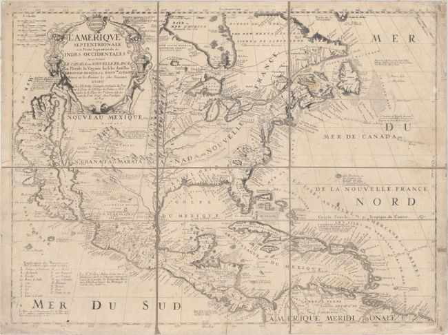
Auction 163, Lot 29
Subject: Colonial North America
Coronelli/Nolin
L'Amerique Septentrionale, ou la Partie Septentrionale des Indes Occidentales ou se Trouve le Canada ou Nouvelle France la Floride la Virginie les Isles Antilles..., 1704
Size: 23.3 x 17.6 inches (59.2 x 44.7 cm)
Estimate: $2,750 - $3,500
Nolin's Spectacular Version of Coronelli's Map of North America
Unsold
Closed on 6/14/2017
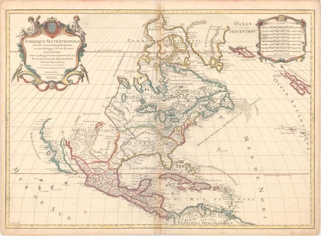
Auction 163, Lot 30
Subject: Colonial North America
Sanson/Jaillot
Amerique Septentrionale Divisee en ses Principales Parties, ou sont Distingues les uns des Autres les Estats..., 1719
Size: 25.3 x 18 inches (64.3 x 45.7 cm)
Estimate: $1,400 - $1,700
Sanson/Jaillot's Map of North America
Unsold
Closed on 6/14/2017
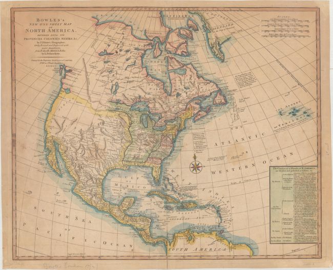
Auction 163, Lot 32
Subject: North America
Palairet/Delarouchette
Bowles's New One-Sheet Map of North America, Divided into It's Provinces, Colonies, States, &c., 1792
Size: 22.8 x 18.6 inches (57.9 x 47.2 cm)
Estimate: $1,500 - $1,800
Rare Map Showing Colonial Possessions and Interesting Geography West of the Mississippi River
Sold for: $650
Closed on 6/14/2017
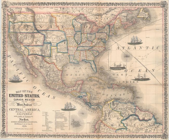
Auction 163, Lot 37
Subject: North America
Ensign, Bridgman & Fanning
Map of the United States, Canada, Mexico and the West Indies with Central America, Showing All the Routes to California with a Table of Distances, 1854
Size: 26 x 21.7 inches (66 x 55.1 cm)
Estimate: $1,800 - $2,100
Decorative Map Published During the California Gold Rush
Sold for: $1,200
Closed on 6/14/2017
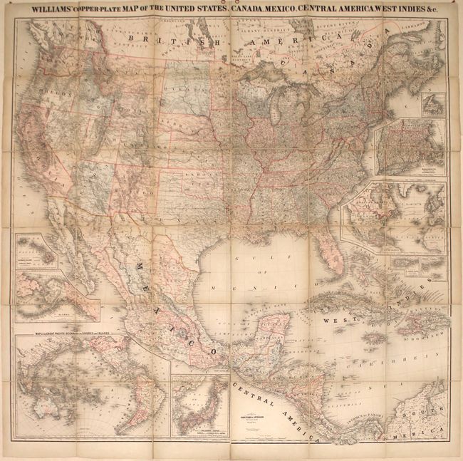
Auction 163, Lot 38
Subject: North America
Williams' Copper-Plate Map of the United States, Canada, Mexico, Central America, West Indies &c., 1876
Size: 63.1 x 61.9 inches (160.3 x 157.2 cm)
Estimate: $1,900 - $2,200
Rare Wall Map of North America
Unsold
Closed on 6/14/2017
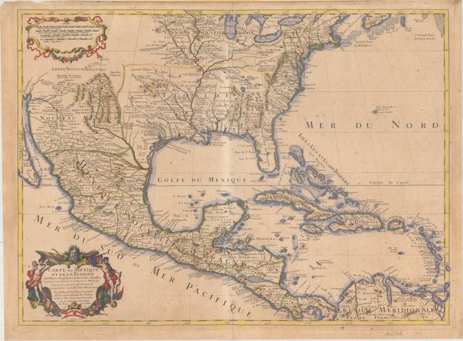
Auction 163, Lot 40
Subject: Colonial Eastern North America & West Indies
Delisle, Guillaume
Carte du Mexique et de la Floride des Terres Angloises et des Isles Antilles du Cours et des Environs de la Riviere de Mississipi..., 1703
Size: 25.6 x 18.7 inches (65 x 47.5 cm)
Estimate: $3,500 - $5,000
Rare First Issue of Landmark in American Cartography - First Printed Map to Accurately Depict the Mouth of the Mississippi River
Sold for: $2,500
Closed on 6/14/2017
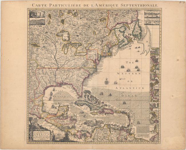
Auction 163, Lot 41
Subject: Colonial Eastern North America & West Indies
Popple/Covens & Mortier
A Map of the British Empire in America with the French, Spanish and Hollandish Settlements Adjacent Thereto by Henry Popple, 1741
Size: 19 x 19.4 inches (48.3 x 49.3 cm)
Estimate: $2,750 - $3,500
Index Sheet of Popple's Map
Sold for: $2,400
Closed on 6/14/2017
9 lots