Showing Featured Lots(remove filter)
Filtered by Category:Europe & Mediterranean(Show All Categories)
Showing results for:Auction 169
Catalog Archive
11 lots
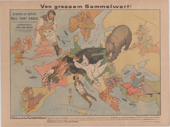
Auction 169, Lot 418
Subject: Europe, World War I
Geographia Map Co
European Revue. Kill That Eagle, 1914
Size: 25.4 x 18 inches (64.5 x 45.7 cm)
Estimate: $2,000 - $2,300
Rare Satirical Map of Europe at Start of World War I
Sold for: $1,500
Closed on 9/12/2018
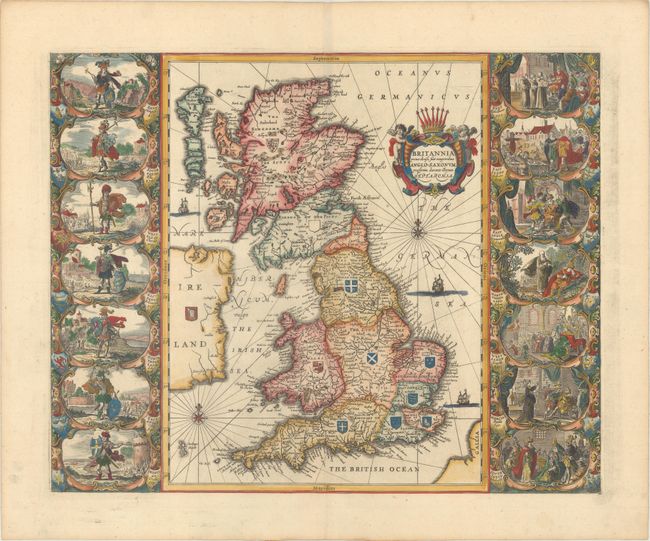
Auction 169, Lot 424
Subject: Britain
Jansson, Jan
Britannia Prout Divisa suit Temporibus Anglo-Saxonum, Praesertim Durante Illorum Heptarchia, 1741
Size: 20.4 x 16.4 inches (51.8 x 41.7 cm)
Estimate: $2,400 - $3,000
Jansson's Splendid Heptarchy Map
Unsold
Closed on 9/12/2018
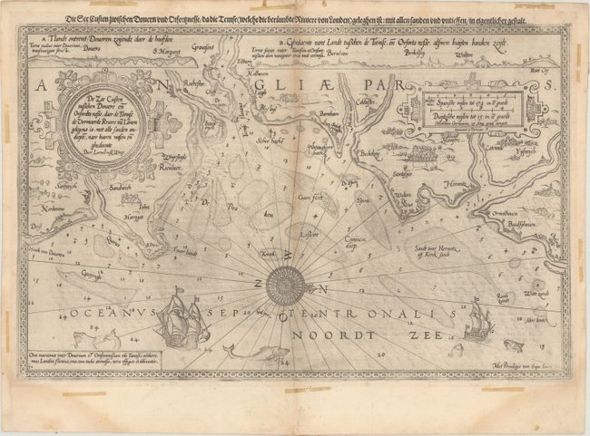
Auction 169, Lot 432
Subject: Southeastern England
Waghenaer, Lucas Jansz
De Zee Custen Tuschen Dovere en Orfordts Nesse, Daer de Teemse de Vermaerde Rivire va Lonen Gelegens is, met Alle Sanden Ondiepte, Naer Haren Wesen en Ghedaente, 1589
Size: 19.9 x 12.8 inches (50.5 x 32.5 cm)
Estimate: $1,000 - $1,300
Rare and Early Sea Chart of the English Coast Near Dover
Sold for: $600
Closed on 9/12/2018
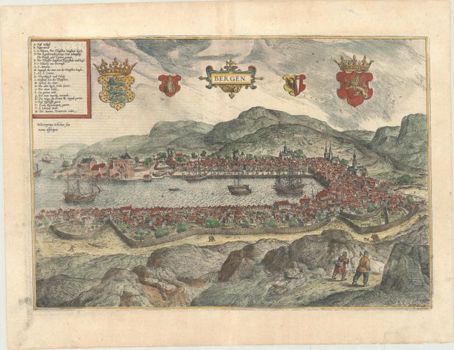
Auction 169, Lot 463
Subject: Bergen, Norway
Braun & Hogenberg
Bergen, 1620
Size: 18.9 x 12.9 inches (48 x 32.8 cm)
Estimate: $1,100 - $1,400
The Only Norwegian City Represented in Braun & Hogenberg's Book of City Views
Sold for: $800
Closed on 9/12/2018
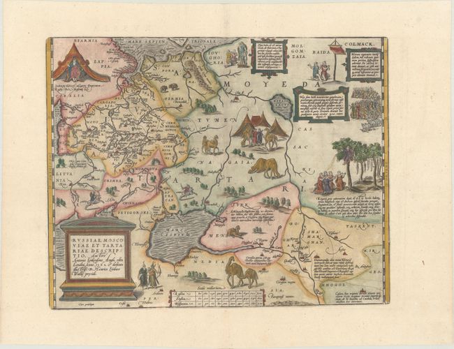
Auction 169, Lot 552
Subject: Russia, Eastern Europe & Central Asia
Ortelius, Abraham
Russiae, Moscoviae et Tartariae Descriptio. Auctore Antonio Ienkensono Anglo..., 1587
Size: 17.6 x 13.9 inches (44.7 x 35.3 cm)
Estimate: $2,000 - $2,300
Ortelius' Map of Russia with a Vignette of Ivan the Terrible
Sold for: $1,800
Closed on 9/12/2018
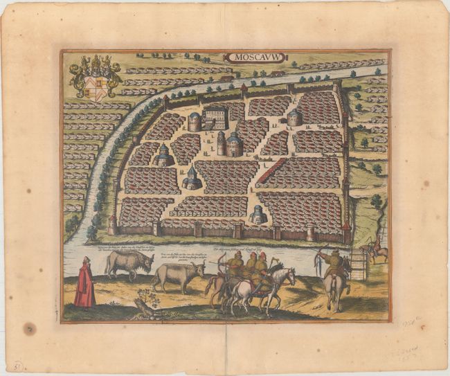
Auction 169, Lot 557
Subject: Moscow, Russia
Jansson, Jan
Moscauw, 1657
Size: 16.6 x 13.7 inches (42.2 x 34.8 cm)
Estimate: $2,300 - $2,750
Rare Jansson Edition of Early Braun & Hogenberg View of Moscow Before the Great Fire
Unsold
Closed on 9/12/2018
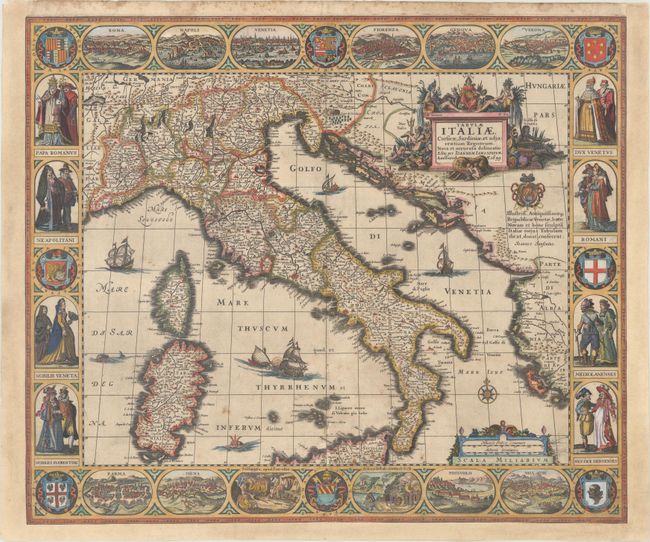
Auction 169, Lot 584
Subject: Italy
Hondius/Jansson
Tabulae Italiae, Corsicae, Sardiniae, et Adjacentium Regnorum. Nova et Accurata Delineatio, 1659
Size: 21.4 x 18.1 inches (54.4 x 46 cm)
Estimate: $5,000 - $6,500
Very Rare Carte-a-Figures Map of Italy
Unsold
Closed on 9/12/2018
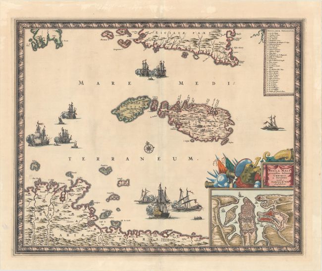
Auction 169, Lot 620
Subject: Malta
Wit, Frederick de
Insula Malta Accuratissime Delineata, Urbibus, et Fortalitiis, 1680
Size: 21.3 x 17.3 inches (54.1 x 43.9 cm)
Estimate: $1,200 - $1,500
One of the Most Decorative 17th Century Maps of Malta
Unsold
Closed on 9/12/2018
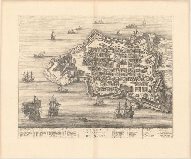
Auction 169, Lot 621
Subject: Valletta, Malta
Mortier, Pierre
Valletta ou Valete Ville Forte, de l'Isle de Malta, 1700
Size: 19.9 x 15.8 inches (50.5 x 40.1 cm)
Estimate: $1,300 - $1,700
Striking Bird's-Eye Plan of Valletta
Unsold
Closed on 9/12/2018
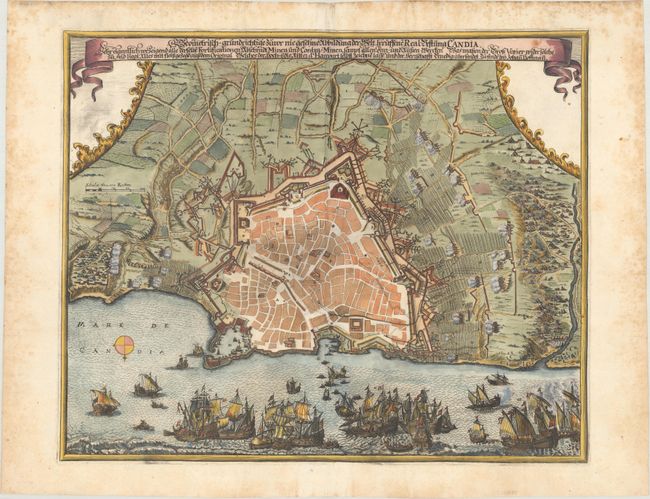
Auction 169, Lot 623
Subject: Candia, Crete
Hoffman, Johannes
Geometrisch-Grundrichtige Zuvor nie Gesehne Abbildung der Welt Beruffene Real-Vestung Candia, 1670
Size: 19.3 x 15.9 inches (49 x 40.4 cm)
Estimate: $1,000 - $1,400
Rare Engraving of the Siege of Candia
Sold for: $650
Closed on 9/12/2018
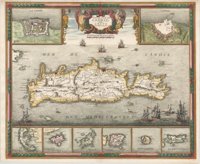
Auction 169, Lot 625
Subject: Crete
Beaulieu, Sebastian de Pontault
Plan de Lisle de Candie Iadis Crete et des Isles Voisines, 1680
Size: 21.1 x 17.6 inches (53.6 x 44.7 cm)
Estimate: $1,000 - $1,400
Beaulieu's Rare Map of Crete After the Siege of Candia
Unsold
Closed on 9/12/2018
11 lots