Subject: Southeastern England
Period: 1589 (circa)
Publication: Spieghel der Zeevaerdt
Color: Black & White
Size:
19.9 x 12.8 inches
50.5 x 32.5 cm
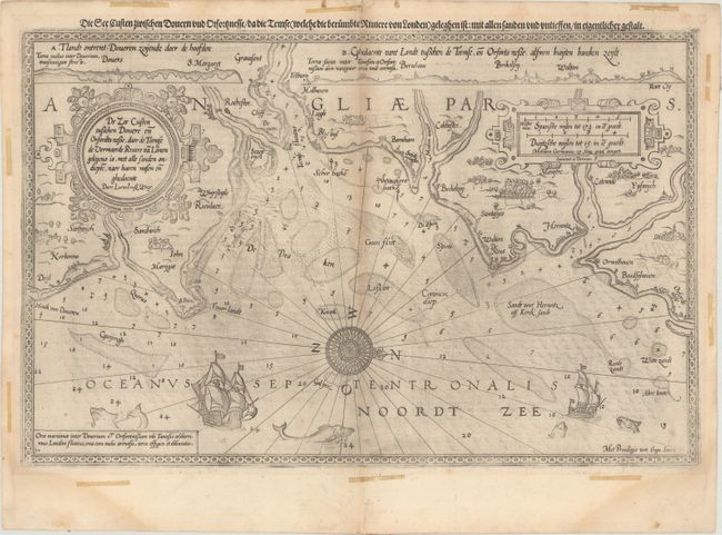
A very early sea chart covering the southern coast of England from Dover to Walton on the Naze and centered on a 32-point compass rose. There is a wealth of detail including soundings, sandbars, towns, and coastal topography with two coastal perspectives included at top. The map is from the Spieghel der Zeevaerdt, the first detailed atlas of charts covering the coastlines of Europe. The map is elaborately embellished with two large strapwork cartouches, extravagant sea monsters, and two sailing ships. Waghenaer's charts are renowned for their fine engraving by the best craftsmen of the period including Theodore de Bry and the Doetecum brothers. This map was engraved by Joannes Doetecum. German text on verso.
References: Shirley (BL Atlases) M.WAG-1a.
Condition: B+
Watermarked paper with light toning along the centerfold, some printer's ink residue, a few minor spots, and a short centerfold separation in top blank margin that has been closed on verso with paper tape. There are remnants of old tape confined to the blank margins on recto.