Subject: Crete
Period: 1680 (circa)
Publication:
Color: Hand Color
Size:
21.1 x 17.6 inches
53.6 x 44.7 cm
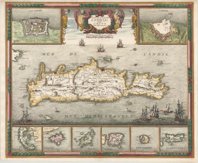
This dramatic map of Crete shows the island following the Siege of Candia, a conflict in which Ottoman forces besieged the Venetian-ruled city until their ultimate victory 21 years later. The map was created by Sebastien de Pontault de Beaulieu, who mapped many of the Mediterranean fortifications in about 1674. Beaulieu's map served as the basis for Frederick de Wit's map published a few years later. The island is filled with good information on roads, towns, and topography. The sea is filled with many war ships representing the epic struggle, and the banner-style title is held aloft by two putti. Flanking the title at top are insets showing the fortifications of the cities of Canea and Candia. At bottom are six additional insets of the islands of Corfu, Zante, Milo, Niesia, Santorini and Scarpanto. The map is surrounded in a lovely, frame-style border.
References: Pastoureau, BEAULIEU XV, II [65]; Zacharakis #135.
Condition: A
An excellent impression on a bright sheet of watermarked paper with a small, professionally repaired chip in the top blank margin and a few minor creases at bottom left.