Catalog Archive
Auction 179, Lot 117

"Carte du Golphe de St. Laurent et Pays Voisins pour Servir a l'Histoire Generale des Voyages", Bellin, Jacques Nicolas

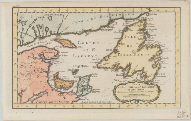
Subject: St. Lawrence Bay, Canada

Period: 1770 (circa)

Publication: Histoire Generale des Voyages

Color: Hand Color

Size:
14.1 x 8.5 inches
35.8 x 21.6 cm
Download High Resolution Image
(or just click on image to launch the Zoom viewer)

This attractive, copper engraved map shows St. Lawrence Bay with Anticosti Island, Prince Edward Island (I. St Jean), Cape Breton Island (Isle Royale), Newfoundland and the adjacent mainland. The map is adorned with a decorative rococo-style cartouche. "Tom. XIX" engraved at top left.

References: cf. Kershaw #591.

Condition: A

A crisp impression on a bright sheet, issued folding with light toning along the edges of the sheet.

Estimate: $120 - $150

Sold for: $90

Closed on 9/16/2020

Archived