Subject: Montreal, Canada
Period: 1870 (dated)
Publication:
Color: Printed Color
Size:
20.3 x 19.3 inches
51.6 x 49 cm
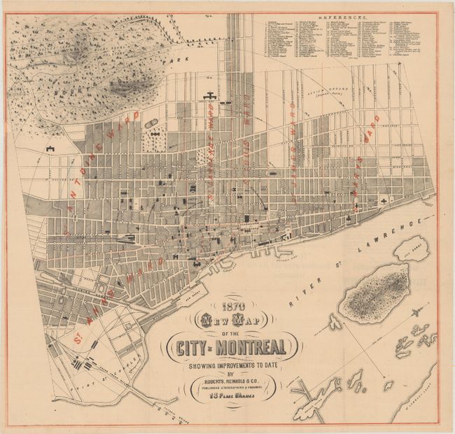
This uncommon plan view of Montreal is by the "publishers lithographers & engravers" Roberts, Reinhold & Co. It locates the city's streets and presents nine wards with red overprinting. A key at top right identifies 91 locations of interest, including churches, colleges, hotels, and burial grounds. Mount Royal Park and Cemetery and Notre Dame des Neiges Cemetery (founded in 1854) are prominently depicted to the west of downtown. Although the map is dated 1870 (and the advertisements on verso, 1872), the inclusion of Mount Royal Park, designed by Central Park co-designer Frederick Law Olmsted starting in 1874 and inaugurated in 1876, suggests a later publication date. North is oriented to top right.
References:
Condition: B+
Issued folding on a slightly toned sheet with small separations at fold intersections. A small chip and associated tears at top left have been repaired on verso with archival materials, with a minor portion of the border replaced in facsimile.