Showing Featured Lots(remove filter)
Filtered by Category:Canada(Show All Categories)
Showing results for:Auction 177
Catalog Archive
7 lots
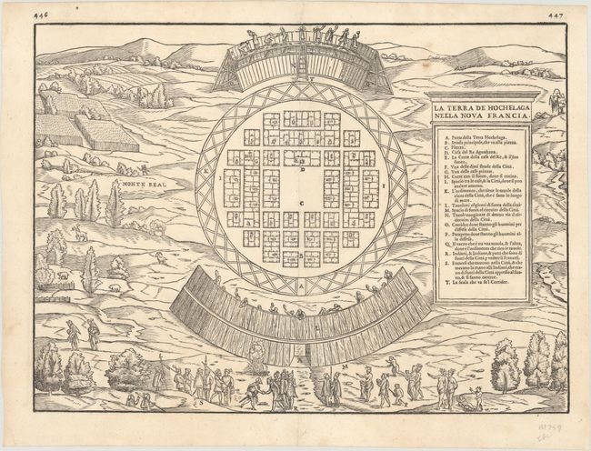
Auction 177, Lot 83
Subject: Montreal, Canada
Gastaldi/Ramusio
La Terra de Hochelaga Nella Nova Francia, 1556
Size: 14.4 x 10.6 inches (36.6 x 26.9 cm)
Estimate: $2,200 - $2,500
The First Published Plan of a Settlement in North America
Sold for: $1,900
Closed on 4/29/2020
Auction 177, Lot 88
Subject: Colonial Eastern United States & Canada
Hennepin, Louis de (Fr.)
Charte Eines sehr Grossen Landes nur Gantz Neulich in dem Mitternachtigen America..., 1698
Size: 16.7 x 14.4 inches (42.4 x 36.6 cm)
Estimate: $2,200 - $2,500
Rare Separately-Issued German Edition of Hennepin's Map of Eastern North America
Sold for: $2,200
Closed on 4/29/2020
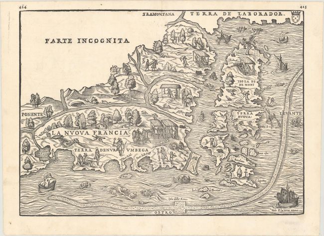
Auction 177, Lot 93
Subject: Northeastern United States & Canada
Gastaldi/Ramusio
La Nuova Francia, 1565
Size: 14.6 x 10.5 inches (37.1 x 26.7 cm)
Estimate: $3,000 - $3,750
The First Printed Map to Focus on New England and New France
Sold for: $3,250
Closed on 4/29/2020

Auction 177, Lot 94
Subject: Colonial Northeastern United States & Canada, Great Lakes
Champlain/Du Val
Le Canada Faict par le Sr de Champlain ou sont la Nouvelle France, la Nouvelle Angleterre, la Nouvelle Holande, la Nouvelle Suede, la Virginie &c..., 1670
Size: 21.4 x 13.8 inches (54.4 x 35.1 cm)
Estimate: $14,000 - $16,000
Very Rare Champlain/Duval Map of New France
Sold for: $10,500
Closed on 4/29/2020
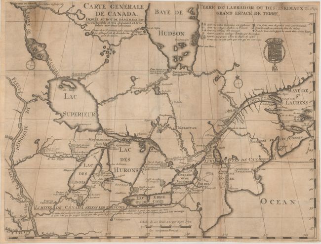
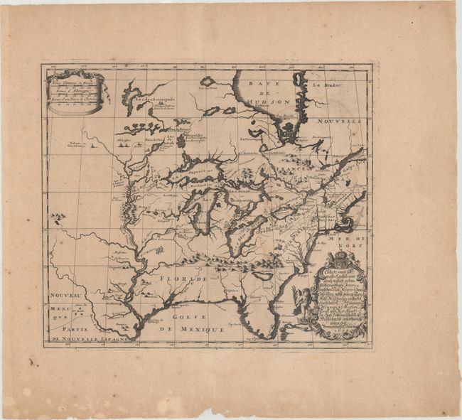
Auction 177, Lot 96
Subject: Colonial Northeastern United States & Canada, Great Lakes
Lahontan, Louis Armand, Baron de
Carte Generale de Canada. Dediee au Roy de Danemark par Son Tres Humble et Tres Obeissant et Tres Fidele Serviteur Lahontan, 1705
Size: 21.5 x 16.4 inches (54.6 x 41.7 cm)
Estimate: $2,200 - $2,500
Lahontan's Map of Canada and the Great Lakes
Sold for: $1,600
Closed on 4/29/2020
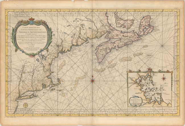
Auction 177, Lot 97
Subject: Colonial Northeastern United States & Canada
Bellin, Jacques Nicolas
Carte Reduite des Costes Orientales de l'Amerique Septentrionale 1re Feuille Contenant l'Isle Royale, l'Accadie, la Baye Francoise, la Nouvelle Angleterre et la Nouvelle Yorc..., 1757
Size: 34.9 x 21.5 inches (88.6 x 54.6 cm)
Estimate: $1,600 - $1,900
Scarce Large-Scale Chart of the Coast of New England
Sold for: $980
Closed on 4/29/2020
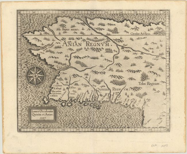
Auction 177, Lot 103
Subject: Alaska & Western Canada
Wytfliet, Cornelis
Limes Occidentis Quivira et Anian, 1597
Size: 11.4 x 9.1 inches (29 x 23.1 cm)
Estimate: $2,000 - $2,300
Early and Imaginary Map of Alaska and the Northwest Passage
Sold for: $1,400
Closed on 4/29/2020
7 lots