Subject: St. Helena
Period: 1815 (dated)
Publication:
Color: Black & White
Size:
12.4 x 9.2 inches
31.5 x 23.4 cm
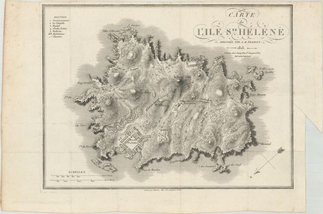
This handsome map depicts the mountainous topography of the island along with a bird's-eye plan of Fort James and a large garden simply called Jardin de la Compagnie. Roads and building are shown throughout the island, and a numbered key at top left identifies the government building, the chapel and a hospital. Engraved by Martin. The island, named after Saint Helena of Constantinople, was first discovered by the Portuguese in 1502. The island changed hands several times between the Portuguese, Dutch and English, until it was colonized by the English East India Company in 1659 and became one of Britain's oldest colonies outside of North America and the Caribbean.
References:
Condition: A
A crisp impression, issued folding, with a binding trim at right and light toning along the edges of the sheet.