Subject: Ancient World
Period: 1651 (dated)
Publication: Newe Landesbeschreibung der zweij Hertzogthumer Schleswig und Holstein…
Color: Hand Color
Size:
21 x 17 inches
53.3 x 43.2 cm
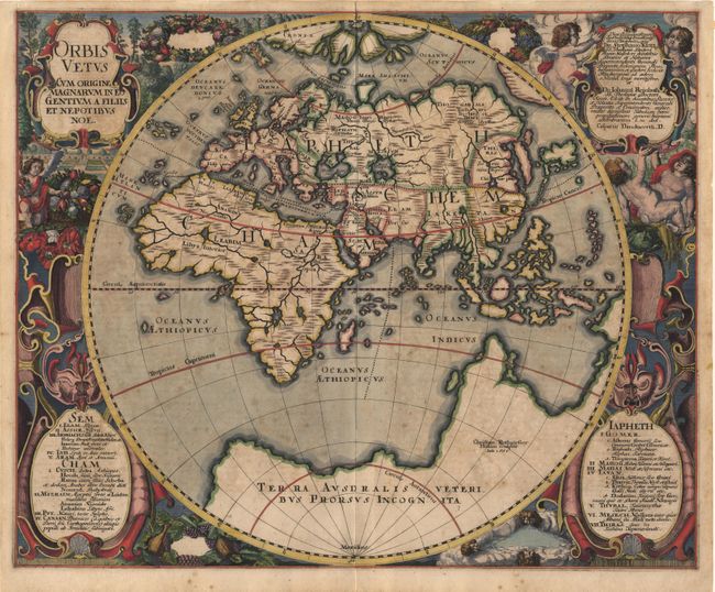
Scarce map of the Eastern Hemisphere from this atlas devoted to the German province of Schleswig-Holstein that was published in collaboration with Johann Meyer in 1652 and again in 1681. This stunning map was beautifully engraved by Christian Rothgiesser with a border of cherubs, fruit, garlands, gargoyles and garden scenes. Four cartouches fill the corners of the map; the two lower ones listing the descendants of Noah. The map presents a classical view of the Old World with a huge Terra Ausdralis Veteribus Prorsus Incognita balancing the rest of the globe. The North Pole is shown as a central landmass and four islands divided by flowing seas. The Asian continent is severely truncated with a 'kite' shaped Japan and the island of Korea. Africa is portrayed in Ptolemaic style. The interior is devoid of place names and distinguished only by major topographical features. A splendid example of this scarce map.
References: Shirley #388.
Condition: A
While there is a bit of light scattered foxing, this is a very good example with superb original color.