Catalog Archive
Auction 98, Lot 26
"Orbis Vetus Cum Origine Magnarum in eo Gentium A Filiis et Nepotibus Noe", Danckwerth, Casper
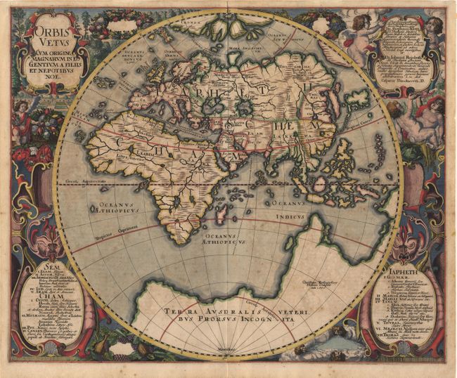
Subject: Ancient World
Period: 1651 (dated)
Publication: Newe Landesbeschreibung der zweij Hertzogthumer Schleswig und Holstein…
Color: Hand Color
Size:
21 x 17 inches
53.3 x 43.2 cm
Download High Resolution Image
(or just click on image to launch the Zoom viewer)
(or just click on image to launch the Zoom viewer)