Subject: India
Period: 1730 (circa)
Publication:
Color: Hand Color
Size:
22.4 x 17.3 inches
56.9 x 43.9 cm
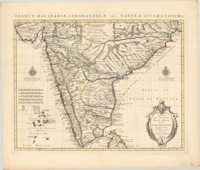
A striking map of southern India showing the Malabar Coast, the Gulf of Cambay and the mouth of the Ganges. It extends to the Lakshadweep Islands, a portion of the Maldives and the northern tip of Sri Lanka. Cities, trade routes and topography are detailed with notes on the Dutch and English colonies along the coast. A pair of deftly engraved compass roses and a decorative cartouche complete the composition. There is an alternate Latin title above the map: "Orarum Malabar Coromandelae, &c. Tabula Accuratissima."
References:
Condition: A
A crisp impression on a bright sheet with contemporary outline color and a bit of minor soiling adjacent to the Laccadive Islands.