Subject: Aegean Sea & Egpyt
Period: 1713 (published)
Publication: Universus Terrarum Orbis
Color: Hand Color
Size:
6.8 x 3.9 inches
17.3 x 9.9 cm
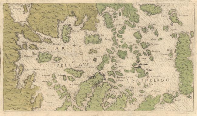
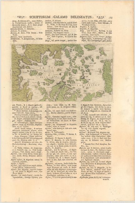
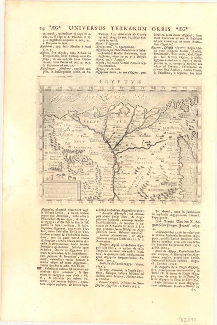
This sheet includes two fascinating small maps. On recto is a hand-colored map (6.8 x 3.9") of the Aegean Sea spanning down to Candia (Crete). Islands are named, and there is simple topographical detail of the mountainous terrain. North is oriented to the left. This plate originally appeared in Rosaccio's Viaggio da Venetia, a Costantinopoli (1598). On verso is an attractive black & white map (6.8 x 5.0") of the Nile valley filled with detail of the pyramids, cities, mountains, towns, and oases. It is engraved in the Italian style with a stippled sea. The plate originally appeared in Magini's Geografia (1596). This sheet comes from Alphonsus Lasor a Varea's Universus Terrarum Orbis. Lasor a Varea, whose real name was Raffaello Savonarola, published his two-volume scriptural and historical dictionary with nearly 500 maps that were taken from old plates by Valegio, Porcacchi, Rosaccio-Franco, and Magini, many of which were more than a century old, and often reworked. On a sheet of Latin text measuring 9.1 x 13.5".
References: Phillips (Atlases) #3475 Vol. I-13 & 14; Shirley (BL Atlases) T.LAS-1a #7 & #8.
Condition: A
Maps are in very good condition. There is minor toning and a small hole in the margins.