Subject: Eastern United States
Period: 1818 (circa)
Publication: A Year's Residence in the United States...
Color: Black & White
Size:
16.4 x 12.6 inches
41.7 x 32 cm
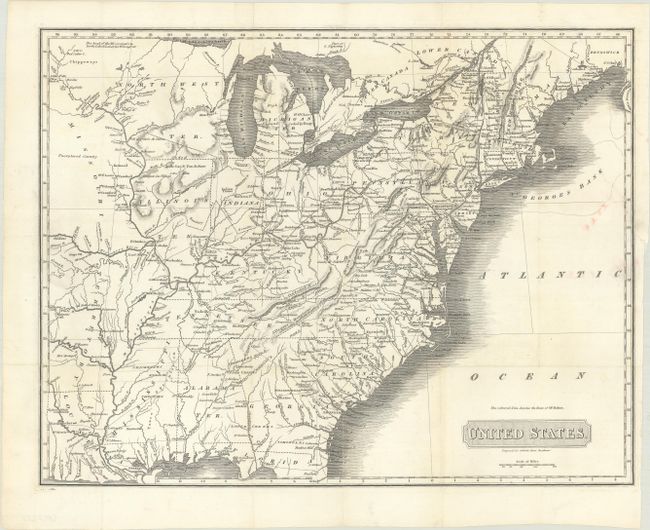
This map was published in Cobbett's A Year's Residence in the United States. It covers the eastern United States to past the 96th meridian, close to the present-day Missouri/Kansas line. The map shows a path from Philadelphia to Illinois Territory, in reference to Thomas Hulme's journey which was covered in his Journal. A huge Missouri Territory occupies all of the west except for Louisiana, and a large Northwest Territory occupies today's Wisconsin, Minnesota, and portions of the Dakotas. A large portion of present-day Iowa is marked "unexplored country" and a dotted line through Illinois and Indiana Territory is labeled "Extended Boundary by Various Treaties."
References: Howes #C-525; Sabin #14021.
Condition: B+
Issued folding, now flat, with some short fold separations and a couple edge tears at left and right that have been closed on verso with archival materials. There is a bit of pink ink in an unengraved area at right.