Subject: Mexico City, Mexico
Period: 1534 (published)
Publication: Isolario
Color: Black & White
Size:
6.4 x 6.4 inches
16.3 x 16.3 cm
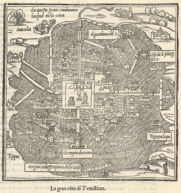
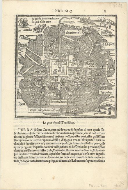
An attractive plan of the city of Tenochtitlan (Mexico City) before Spanish forces destroyed the city. On a full sheet with Italian text below the image and on verso (7.9 x 11.7"). This map was published in Benedetto Bordone's Isolario (which translates as "book of islands"), which was the first atlas covering the entire world based on contemporary information rather than classical geography. It included 112 simple and striking maps scattered through the text, depicting islands throughout the world, with a particular emphasis on islands in the Mediterranean Sea. Bordone first published his Isolario in 1528, with further editions in 1534, 1547, and 1565. This example is from the 1534 edition.
References: Shirley (BL Atlases) T-BORD-1c; cf. Mickwitz & Miekkavaara #27-13.
Condition: A
A dark impression on a clean sheet with one tiny wormhole in the top blank margin.