Catalog Archive
Auction 177, Lot 276
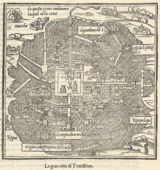
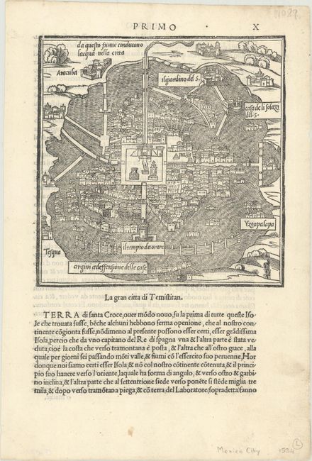
"La Gran Citta di Temistitan", Bordone, Benedetto
1 of 2
Subject: Mexico City, Mexico
Period: 1534 (published)
Publication: Isolario
Color: Black & White
Size:
6.4 x 6.4 inches
16.3 x 16.3 cm
Download High Resolution Image
(or just click on image to launch the Zoom viewer)
(or just click on image to launch the Zoom viewer)