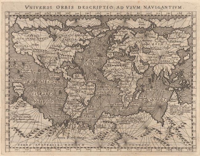
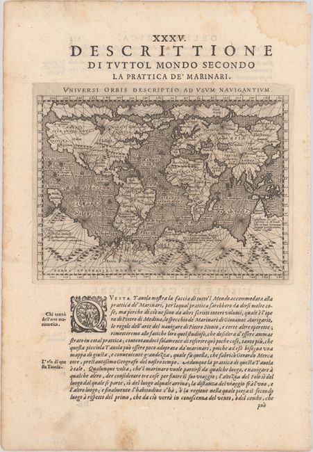
Subject: World
Period: 1598 (published)
Publication: Geografia Cioe Descrittione Universale della Terra...
Color: Black & White
Size:
6.9 x 5 inches
17.5 x 12.7 cm
This small mariner's map is based on one of the most important world maps of the 16th century: Gerard Mercator's multi-sheet map of 1569. The map reflects the belief in wide Arctic sea passages and depicts a huge southern continent, to which Magini has added fanciful ranges of mountains. A fine network of rhumb lines crisscross the map, and the oceans are stipple engraved in the Italian style. Printed on a full sheet of Italian text (8.4 x 12.1"), with the text below the map providing navigational instructions. This map, engraved by Girolamo Porro, is from a Venetian edition of the quarto edition of Ptolemy's Geography that was edited by the distinguished Italian geographer Giovanni Magini.
References: Shirley #196; Mickwitz & Miekkavaara #226 [64].
Condition: A
A crisp impression on watermarked paper with marginal soiling. There are a couple of damp stains in the margins, not affecting the map.