Subject: Oklahoma
Period: 1906 (published)
Publication: Laws, Decisions, and Regulations Affecting the Work of the Commissioner to the Five Civilized Tribes, 1893 to 1906...
Color: Printed Color
Size:
6.1 x 9.4 inches
15.5 x 23.9 cm
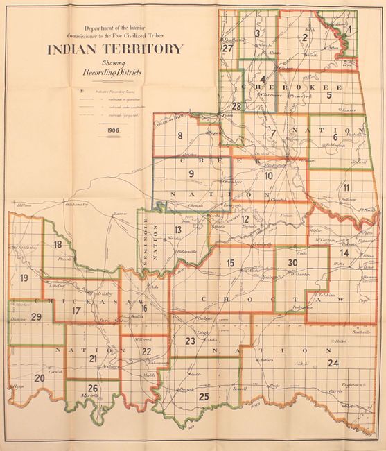
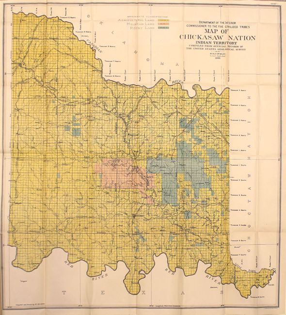
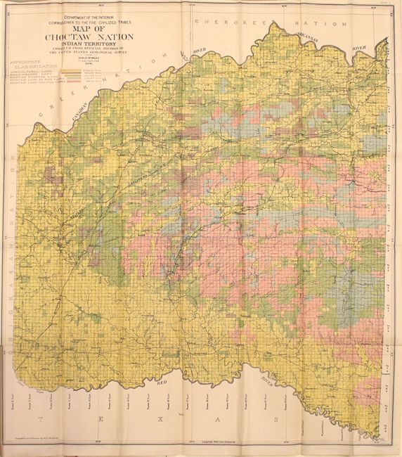
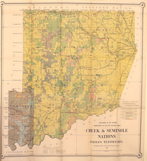
This 250-page report contains five maps related to Indian Territory and the Five "Civilized" Tribes. Four of the maps are tribe specific and are color-coded to show various land classifications including agricultural, mountain and rocky. The map of Indian Territory shows existing and proposed railroads by district. The list of maps includes:
Indian Territory Showing Recording Districts (26.0 x 30.0”)
Map of Chickasaw Nation (30.4 x 33.2”)
Map of Choctaw Nation (32.3 x 36.7”)
Map of Cherokee Nation (25.3 x 34.8”)
Map of Creek & Seminole Nations (23.5 x 25.5”)
Octavo, hardbound in brown cloth with gilt title on spine.
References:
Condition: A
Maps are clean and bright with just a few tiny splits at fold intersections and a few short binding tears. The map of Indian Territory has faint color offsetting. Text is clean and tight. Covers have minor wear with bumped edges.